A series of caches placed along the Original North/South Trail of Land Between the Lakes National Recreation Area. You will be looking for a block "water-proof" box containing a log book and pen near the former NS Trailhead #31 and the Joycetown/Ross Cemetery. There is plenty of room for geocoins and travelbugs. Please return & conceal as found; this is a high muggle area for LBL. This is a relatively moderate-to-easy walk along a seldom used but maintained trail.

The North/South Trail at LBL spans almost the entire length of LBL. The northern portion of the trail consists mainly of single track trails meandering from shoreline to heavily wooded ridges. The southern portion consists mainly of old, double-track roadbeds with some single-track corridors interspersed. The trail meanders over and through heavily wooded ridges, wildlife clearings, and mature bottomland hardwood stands. The N/S Trail intersects many of LBL's designated roads that offer several loop opportunities and access points to hike the trail piece by piece. The N/S Trail is a multiple-use trail. One the northern portion, bicyclists and hikers share the same trail. On the southern portion, horseback riders and hikers share the same trail.
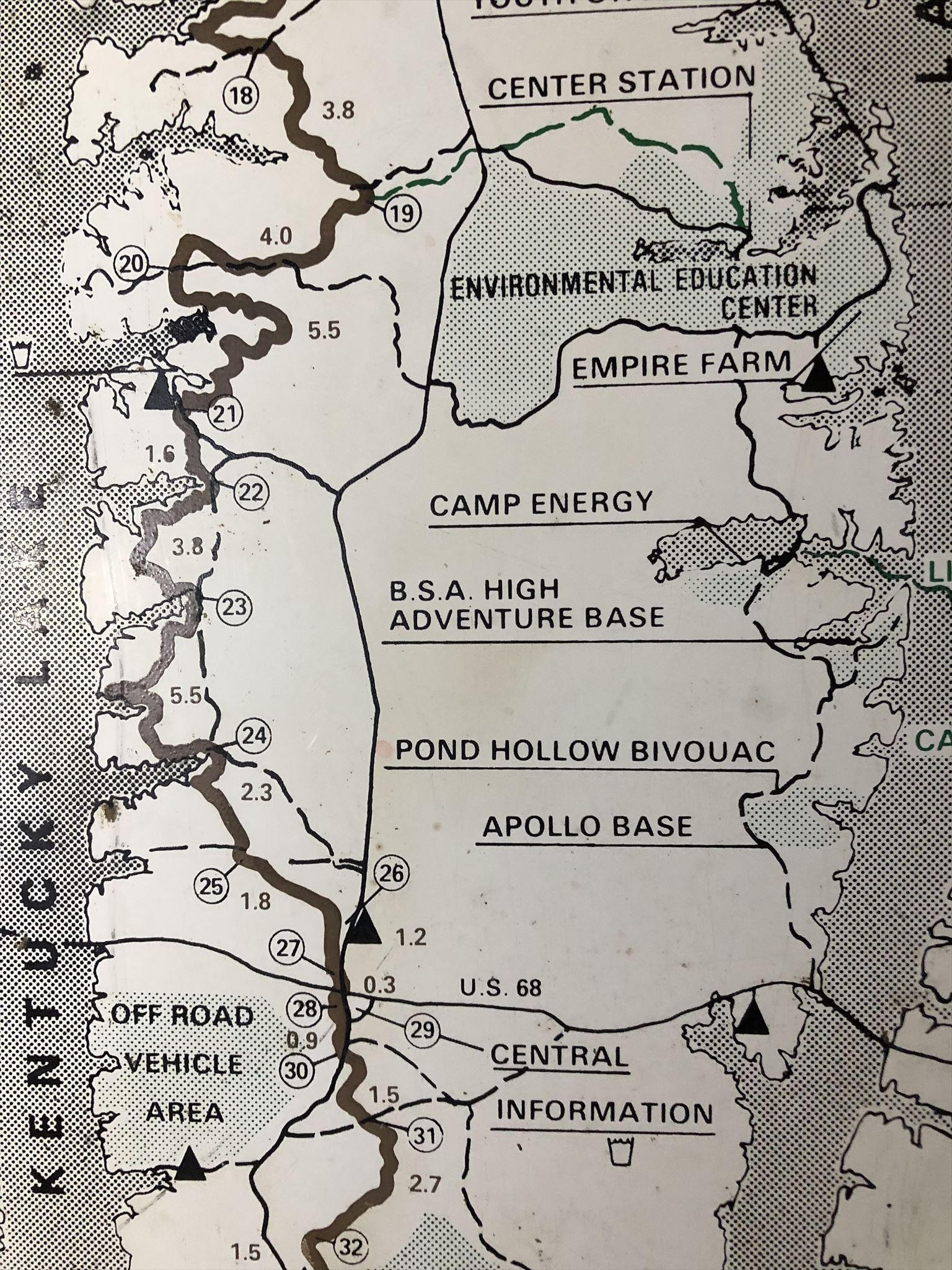
The trail has varied in length since it was established in the early 1970's. Currently, the NS Trail is 58 miles long, and begins/ends at the North and South Welcome Stations, respectively . These caches will be placed along the former N/S Trail which began at the Kentucky Lake Drive Trailhead and ended at the South Welcome Station Trailhead some 65 miles later. Each cache will be near as many of the 50 points on the original map as can be placed within Groundspeak guidelines.
The given coordinates will take you to the Ross cemetery near the former community of Joycetown. On the 1936 USGS map, the cemetery was named Joycetown Cemetery. By the time of the 1950 USGS map, the name had been changes to Ross Cemetery. There are twenty-six marked graves. But only two have names and dates, neither being a "Ross".
Your task:
1) find these two marked headstones and use the dates on them to identify the final coordinates of the geocache container.
Howard Wilson Compton 18AB- 18CD
Jacob Thompson 18E3 - 189F
2) solve for n: F
n = E
3) Final Location: N36° 45.CDN W088° 3.NAB
Checksum: C+D+N=15 N+A+B=8