This is an Earthcache – as such, there is no physical cache. Instead, you will partake in a geology lesson by making observations and answering 4 questions about the three stone boulders at the posted coordinates. Permission for this listing has been granted by the Oregon Ridge Nature Center. No night caching allowed.
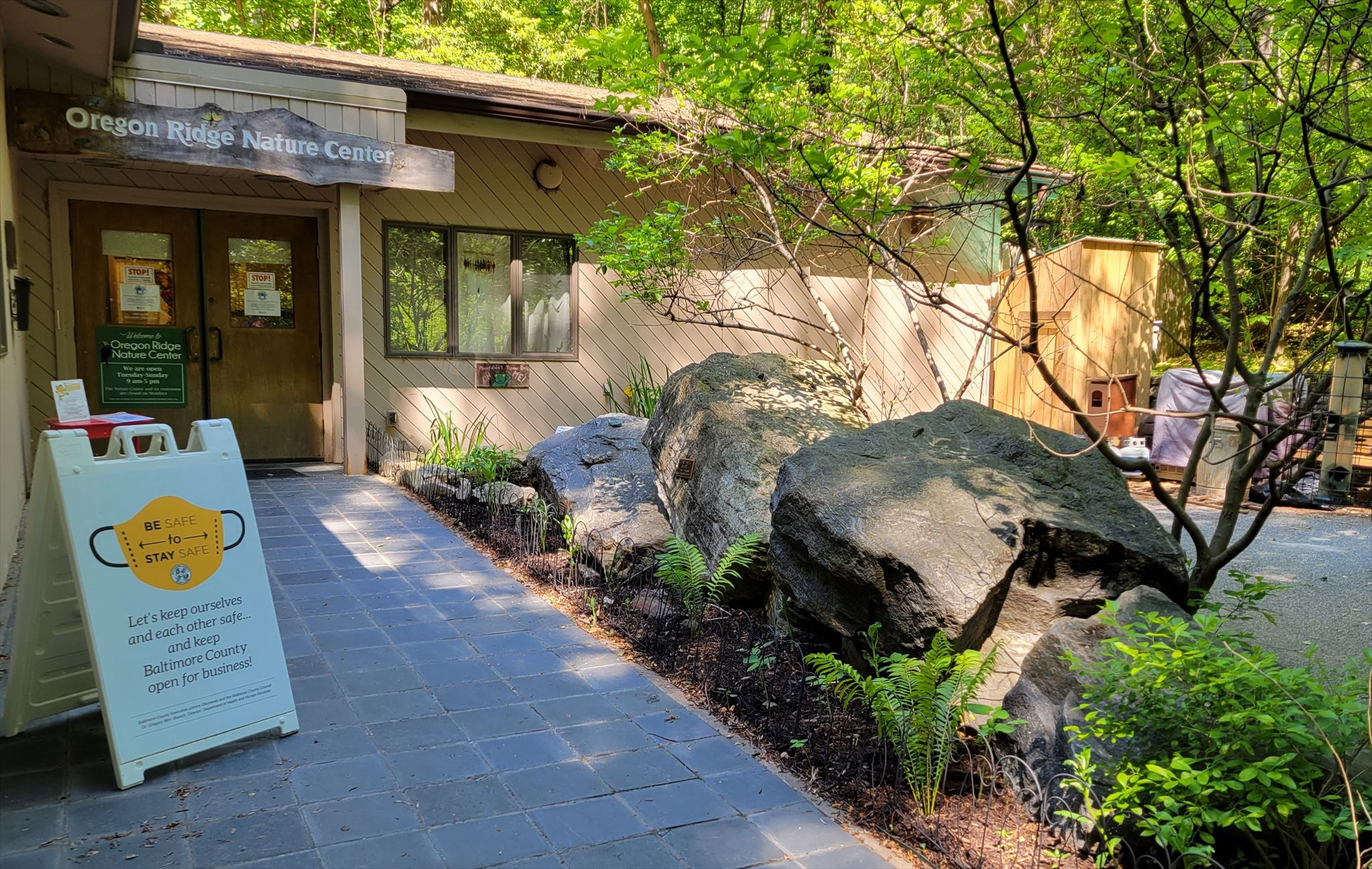
Here in front of the Oregon Ridge Nature Center you will find three prime geological examples of the remnants of continents that collided and sea levels that rose and fell millions of years ago. Most of this park is underlain by the complex rocks of the Piedmont Province. These are diverse igneous and metamorphic rocks that have been folded, faulted, and intruded by magma multiple times during mountain building in the Paleozoic Era. In other words, Oregon Ridge Park has Layers.
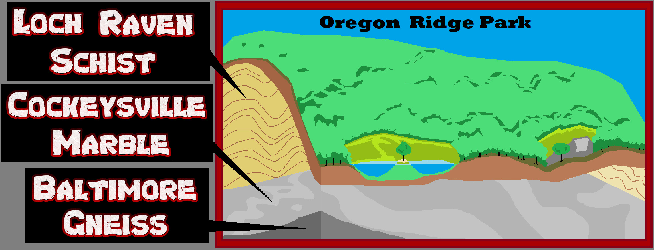
The oldest rock in Oregon Park is the Baltimore Gneiss that lays 2,500 feet below where you are standing. It is a metamorphic rock that was formed by tremendous pressure and heat deep within the earth’s crust when the continents that formed the super continent Rodinia one billion years ago collided. The mountains that formed from that collision are thought to have been taller than today’s Himalayas.
For hundreds of millions of years, the mountains were worn down by wind and water into a flat plain. As the plates moved, loose, sandy material alternated with limestone deposition, each signifying a collision. Ocean Water washed across the plain and formed a warm shallow sea teaming with marine life.
The warm tropical water was shallow enough for waves to move coarse carbonate sand across the seafloor. Constant wave action washed away the smallest particles, whereas the larger fossils were battered and broken. Over time these accumulated debris under pressure solidified into limestone. At the same time the sand and clay of the sea bed squeezed into shale and sandstone, and stacked on top the horizontal limestone layers below.

Six million years ago another period of movement from the separation of the Super Continent Pangea stretched the earth’s crust caused the horizontal layers to be stretched, heated, changed, and then folded into wavy hills of Baltimore county. It was then when the limestone beds metamorphosized and became Cockeysville Marble, and the shale beds metamorphized into Loch Raven Schist.
This rock folding also brought the gneiss to the surface in several large domes in the area, the nearest one is called the Pheonix Dome is just north across Shawan Road.

The wide-open valley between the Oregon Ridge and the Pheonix Dome is mostly of Cockeysville marble that erodes faster than the schist or gneiss. The phoenix Dome is one of 7 large nappes that folded, then fell over. Basically these flipped anticline domes are the opposite of Oregon Ridge Park with Gneiss on top and Loch Raven Schist on the bottom.
LOGGING REQUIREMENTS:
To log this Earthcache: Read the geology lesson above. Answer all four questions posted below. Answers can be sent via e-mail or messenger contacts on my Geocaching profile within a reasonable time. Group answers are fine, but do not post the answers to the questions in your logs.
QUESTION 1. How deep down in the earth below Oregon Ridge Nature Center is the Baltimore Gneiss?
QUESTION 2. Which of these boulders has "potholes" that have formed, which is evidence that this rock was once under flowing water?
QUESTION 3. Look closely at stacked three stones. Which of these three stones shows more signs of weathering and cracking? Why do you think that is?
QUESTION 4. Locate the calcite crystal that has formed in a vug (open space) 6 to 10 inches above the "O" of the cockeysville Marble plaque. Describe the shape and estimate the size of the crystal?
OPTIONAL PHOTO: Posting a photo that readily indicates that you (and anyone else logging the find) are at the location.
 Awesnap has earned GSA's highest level:

REFERENCES
1. Roadside Geology of Maryland, Delaware, and Washington D.C. John means, Mountain Press Publishing Company, 2010
2. Rocks of the Ridge Information Sign, Oregon Ridge Nature Center,
3. Roadside Geology of Maryland, Delaware, and Washington D.C. John means, pages 228-233, Mountain Press Publishing Company, 2010
4. One Of The Supercontinents Is Different From The Others (It’s Rodinia), December 14, 2017,carnegiescience.edu
5. Geological History of MD Explained by Rock Expert, website, broadmead.org