The Hundred of Bremer was proclaimed on 7th August 1851. Government surveyors were sent out to divide the new land into sections for purchase by the pioneer farmers, and to layout the roads of the district. While some effort was made to include any existing infrastructure in the survey, for the most part the sections and roads were laid out in a grid pattern on a map with little regard for any natural obstacles such as rivers and mountains. As a result, some of the surveyed roads were never constructed and many of these unused road corridors are still in existence today.
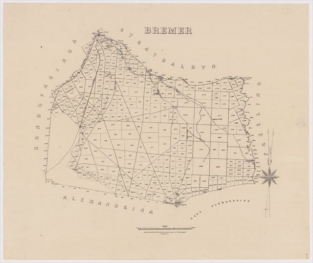
Survey map of the Hundred of Bremer in 1875 (click to enlarge)
This cache is located on a segment of road that never got developed beyond a narrow sandy track. To the north, it's called Pioneer Road and to the south it's called Gun Club Road. This bit in the middle could take either of those names.
This cache can accessed from either north or south but you will probably need a 4WD. Or you could walk the 700m from Echo Park Road which is suitable for all vehicles.