LEDINE - An Intermittent Lake EarthCache
LEDINE - An Intermittent Lake
Please note Use of geocaching.com services is subject to the terms and conditions
in our disclaimer.

LEDINE - presihajoče jezero
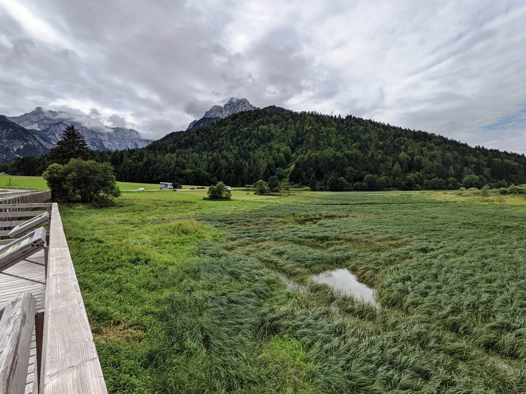
Na vhodu v dolino Planice, ob vasi Rateče, leži presihajoče jezero LEDINE.
Kaj je presihajoče jezero?
Presihajoče jezero je jezero s periodičnim spreminjanjem videza, zlasti vodnih površin ter favne in flore.
Znana presihajoča jezera v Alpah so:
- Cerkniško jezero v južnem delu Cerkniškega polja, primorsko-notranjska regija v Sloveniji,
- Jezero SCHOEDER blizu okrožja Hüttenschlag v St. Johann im Pongau, v avstrijski deželi Salzburg,
- Petelinjsko jezero v porečju Pivke - primorsko-notranjska regija v Sloveniji.
Kaj je posebnost presihajočega jezera Ledine?
Oglejmo si podrobnejši prečni prerez.
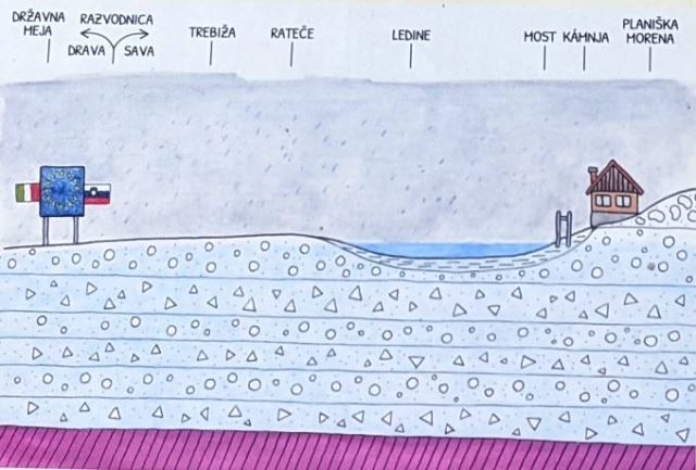
Ostanki Planiške morene tvorijo naravno depresijo. Jezero nima običajnih naravnih dotokov in odtokov. Pregradne plasti so osnova za gramozne plasti. Površinska voda se v teh plasteh preliva in odteka izključno v vzhodni smeri. Jezero se napolni z vodo v jesenskih in spomladanskih mesecih, ko je pade večja količina dežja, v zimskih mesecih pa zamrzne. Jezero izgine v toplih poletnih mesecih, ko za seboj pusti kos bujne trave, z različnimi cvetlicami in različnimi vrstami živali. To se dogaja v normalnem času.
V času močnih padavin se lahko jezero prelije! Takrat voda iz jezera ne odteka samo v podzemnem toku proti vzhodu, v reko Savo, ampak s površinskim vodami tudi proti zahodu v reko Dravo. Vzrok tukaj je Planiška morena, ki tvori prelomnico za vasjo. Tako se jezero izliva v dve reki. Ta poseben pojav se imenuje "vodna bifurkacija" oziroma v latinščini: BIFURCUS.
Spreminjajoča se pokrajina je pravi naravni fenomen, ki ga lahko opazujemo skozi celotno leto.
NALOGE ZA VPIS
Če želite ta EarthCache vpisati kot NAJDEN morate odgovoriti na naslednja vprašanja:
(Oglejte si opisno stran, preberite informativne table in opazujte naravo na naslovnih koordinatah!)
1) Kako se imenujeta dve reki tamkajšnjega porečja?
2) Kako imenujemo pojav, ki je posebnost jezera Ledine (latinsko ime)?
3) Od kod prihaja večina površinske vode?
4) Kolikšno je lahko nihanje vode v podzemnem toku?
5) Na tem mestu opazujte naravo. Opišite vodostaj in stanje jezera med vašim obiskom!
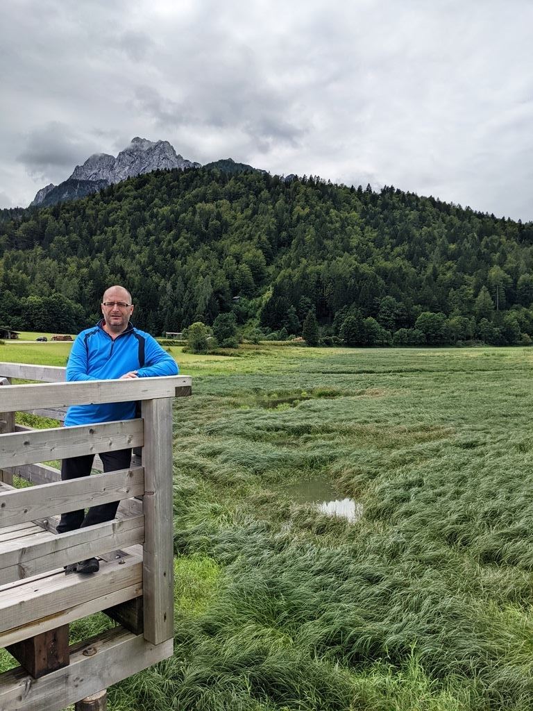
6) Spletnemu vpisu priložite fotografijo vas ali osebnega predmeta, s katerim dokazujete, da ste bili na lokaciji! Ta zahteva je v skladu z EarthCache smernicami od 10. junija 2019 dalje!
Pošljite nam svoje odgovore po pošti: gc[at]dieeddys.de
Prosimo, da v zadevo napišete: "Ledine + vzdevek".
Prosimo, da pri vpisu najdbe ne zapisujete nobenih odgovorov!
Takoj za tem lahko vpišete ta EarthCache kot NAJDEN!
Če bo z odgovori karkoli narobe vas bomo kontaktirali.
Pozor:
Vpisi brez fotografij in odgovorov na vprašanja bodo izbrisani.
Vzorčne fotografije:
Viri:
- informacijske table
- internet
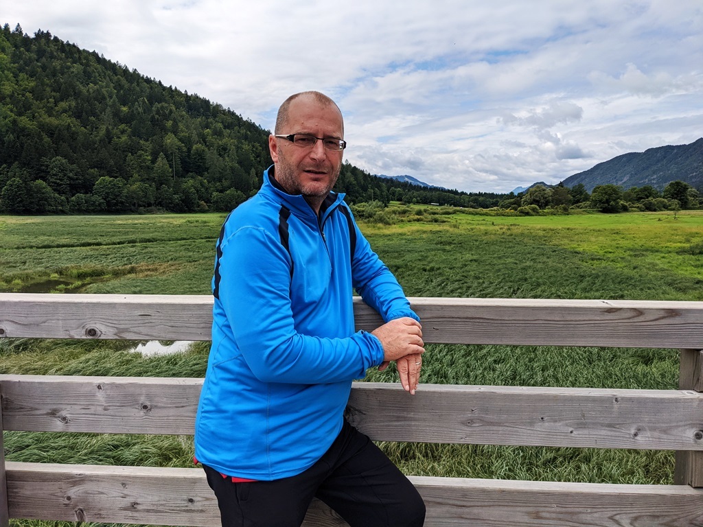
Fotografije na opisni strani je posnel dieeddys 23. avgusta 2021.
Posebna zahvala GeoAwareSI recenzentu za njihovo podporo!

LEDINE - An Intermittent Lake
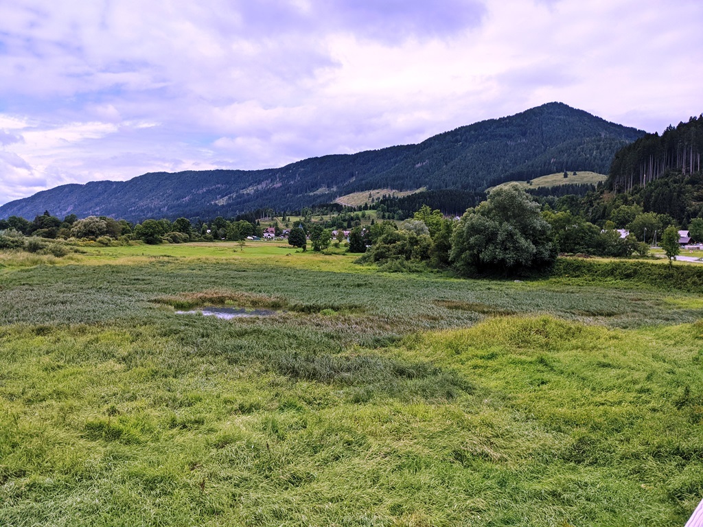
On the entrance of the Planica valley, next to the village of Rateče, there rests the intermittent lake LEDINE.
What is an intermittent lake?
An intermittent lake is a periodic lake with changing appearance, especially water tribes, fauna and flora.
Well-known intermittent lakes in the alps are for example:
- Lake Cerknica in the southern part of the Cerknica Polje, a region in southwestern Slovenia,
- Lake SCHOEDER near Hüttenschlag district of St. Johann im Pongau in the Austrian state of Salzburg,
- Lake Petelinje in the Pivka Basin in the Littoral–Inner Carniola Statistical Region, a region in southwestern Slovenia.
What is specific about Ledine?
Let's take a closer look at the cross section.
Remnants of a Planica moraine form a natural depression. The lake has no ordinary natural inflow and outflow. Barrier layers form the basis for gravel layers. Surface water can seep and run off in these layers and that exclusively in an easterly direction. The lake fills with water in autumn and spring when there is an abundance of rain, while it freezes during the winter months. When summer warms the air, the lake disappears, leaving behind a piece of lush grass with various flowers and different species of animals. That happens in normal years.
However, in years with heavy rainfall the lake can overflow! It flows not only in a underground stream to the east in the river Sava but also above ground to the west in the river Drava. The cause here is the Planica moraine, which forms a watershed behind the village. So the lake drains into two rivers. This specific phenomenon called “water bifurcation”. This is called Latin: BIFURCUS.
It is a true spectacle of nature during the whole calendar year. A changing landscape itself.
LOGGING TASKS
To log this EarthCache as FOUND IT you have to answer the following questions:
(Look at the listing, read the information boards and observe the nature at this point!)
1) What are the names of the two rivers of the watershed there?
2) What phenomenon is the peculiarity of Ledine (Latin name)?
3) Where does most of the surface water come from?
4) How much water fluctuation of the underground stream can be?
5) Observe the nature at this point and describe the water level and the condition of the lake during your visit!
6) Please add an on-site photo of you or a personal item as a proof of visit to your log! This is a logging requirement according to the EarthCache Guidelines from June 10th, 2019!
Send us your answers by mail: gc[at]dieeddys.de
Please write in the subject: "Ledine + Nickname".
Please do not write any answers in the log!
After that you are directly allowed to log this EarthCache as FOUND IT!
We will contact you, if there are any problems.
Attention:
Logs without photo and answering these questions will be deleted.
Responsibility sample photos:
Source references:
- information boards
- internet
The photos in this listing were taken by dieeddys on August, 23rd, 2021.
Special thanks to GeoAwareSI Reviewer for his support!
Enjoy the place and the cache! Happy caching:

You want a souvenir or a banner:

Use this code:
<p><a href="https://coord.info/GC9FAY3" target="_blank" alt="LEDINE - An Intermittent Lake GC9FAY3 by dieeddys" title="LEDINE - An Intermittent Lake GC9FAY3 by dieeddys"><img src="https://s3.amazonaws.com/gs-geo-images/98447af7-4385-4ee8-888f-8f586ecd1e7a.jpg"/></a><p>

Additional Hints
(Decrypt)
Btyrwgr fv bcvfab fgena, cerorevgr vasbezngviar gnoyr va bcnmhwgr anenib an anfybiavu xbbeqvangnu!
Ybbx ng gur yvfgvat, ernq gur vasbezngvba obneqf naq bofreir gur angher ng guvf cbvag!
...
Treasures
You'll collect a digital Treasure from one of these collections when you find and log this geocache:

Loading Treasures