Notice: "Cache seekers assume all risks and responsibilities involved in seeking this earthcache."
Warning: This is an agricultural area where many long-haul trucks full of wheat, corn, onions, potatoes, carrots, sugar beets and other commodities are busy going down the road. Most of us locals are accustomed to these trucks. If you don’t feel safe or comfortable stopping alongside the road or in a pullout to observe the geology, “Don’t Stop”. Don’t let earthcaching control you, but rather you control earthcaching. “Just because it is there, doesn’t mean you have to stop!”
“For your safety, even though the shoulder may be wide enough to stop and make observations, please park in the designated parking pullout and walk to the final. The road does get busy at times. If you feel uncomfortable with the suggested parking location, find a wider spot down the road and walk back.”
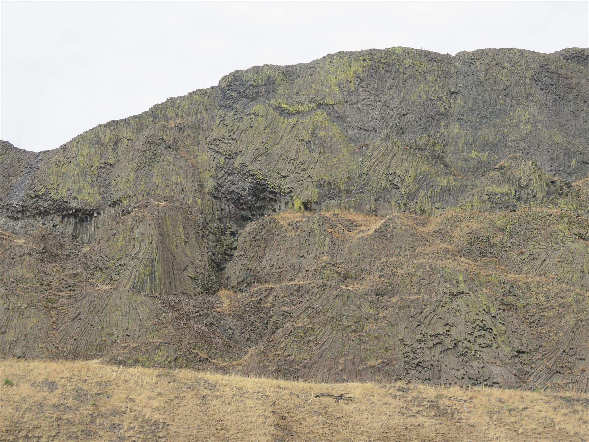
Devils Canyon: Basalt Fan Structure
The fan shaped basalt structure at this location on the west side of Devils Canyon was formed millions of years ago when extruded molten basalt flowed over an unstable or weak subsurface. Unlike most jointed basalt columns of the Columbia Plateau that are virtually vertical, the weight of the solidifying flow in this area buckled and bent from the vertical to various degrees forming fans.

Devils Canyon and Missoula Flood
During the Miocene epoch 10-17 million years ago, the earth opened up and lava poured out over the ground covering 81,000 sq mi to the depth of 2 miles. This basalt layer is called the Columbia River Basalt Group. Devils Canyon exist of several different flows and members: Saddle Mountain flows, Elephant Mountain, Esquatzel, Pomona, Frenchman Spring and Wanapum.
Millions of years later a fault fractured the basalt and created the five-mile-long canyon.
More recent during the Missoula Flood 13-15,000 years ago, water flowed down the Washtucna coulee from Washtucna to Connell. The water over flowed its banks into the Devils Canyon coulee just south of Kahlotus. This flow cleaned out and enlarged the canyon and exposed the basalt fan structure.
To log this Earthcache; Please send a private message to me with answers to the following questions.
1. How was the basalt fans created at this location?
2. Does the basalt fan structure continue on the opposite side of the canyon?
3. What do you think was the weak subsurface structure that could not support the cooling basalt? volcanic ash, alluvial sand, soil, unsolidified basalt, bowl-shape depression, a void, water or something else
Optional:
You may upload a photo to the page of any local wildlife, unique vegetation or geology in the area.
Additional study:
Flood Basalts and Glacier Floods: Roadside Geology of Parts of Walla Walla, Franklin, and Columbia Counties, Washington by Robert J. Carson and Kevin R. Pogue
Devils Canyon- Washington – Glacial Lake Missoula Flood Features
Video: Devils Canyon Coulee