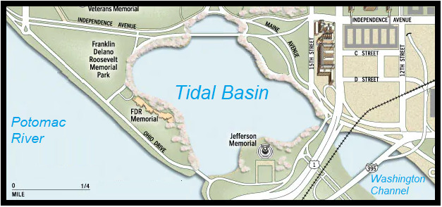
This is an Earthcache – as such, there is no physical cache. Instead after examining the land areas around the 2.1 mile Tidal Basin loop you will answer 6 questions and message me the answers. Permission was granted by for this listing by the National Park Service.
DRAIN THE SWAMP!
The land that you are standing on was created to solve the problems of sedimentation, flooding, and public sanitation here in the District in the late 1800’s.
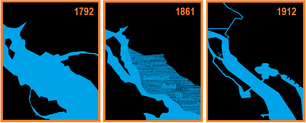
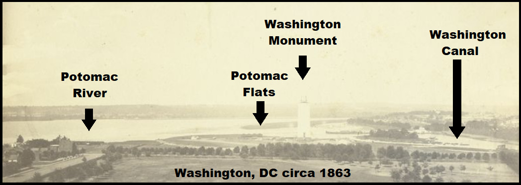
In the image above you can see that the Potomac was wide and clear in 1792. As people moved into the area the landscape changed. Many years of land clearing for agriculture, construction, and mining caused erosion to speed up. Withouth the vegitation, fine-grained soils easily washed into the river during storms and slowly built up along the shores of DC. The result was an increased amount of silt and clay in the water bodies that drain the area and allow boats to freely travel up and down the river. By 1861 this sedimentation built up along the western shore of DC in what was called the Potomac Flats.
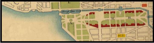
Back in 1862 the Washington Canal cut across the city on what is now Constitution Avenue. City residents used the canal to dump their sewage, which instead of washing west into the Potomac and down river, it instead accumulated into the Potomac Flats. This created a foul smell and breeding ground for disease.
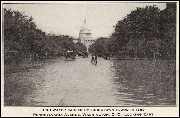
Melting snows caused a huge flood in 1881 where the waters almost reached as far as the US Capitol. This set Congress to direct Peter Conover Hains (whom Hains Point is named for) and the Army Corps of Engineers to fix the problem. Under Hains’ supervision, reclamation of the flats went at a rapid pace through the 1880’s. The largest flood on record in DC struck in 1889 and set work back two years. The C&O Canal was ruined, and more than one million cubic yards of silt filled the recently dredged channels.
This massive project took about three decades to complete. Sediment was slowly dredged from the shipping channels and used as fill in the flats. By 1912 the area that had once been a wetland known as the Potomac Flats had transformed into 620 new acres of land, a land which is currently known as East and West Potomac Park.
HARNESS THE TIDES!
The Tidal Basin is an engineered lake that was built in during this construction to solve DC’s flooding & siltation problems. This system was designed to operate automatically by harnessing the tides of the Potomac River; thus, it uses no motorized controls. Instead, it leverages the power of tides to flush out sediments from the Washington Channel which allows boats to navigate along the DC waterfront safely.
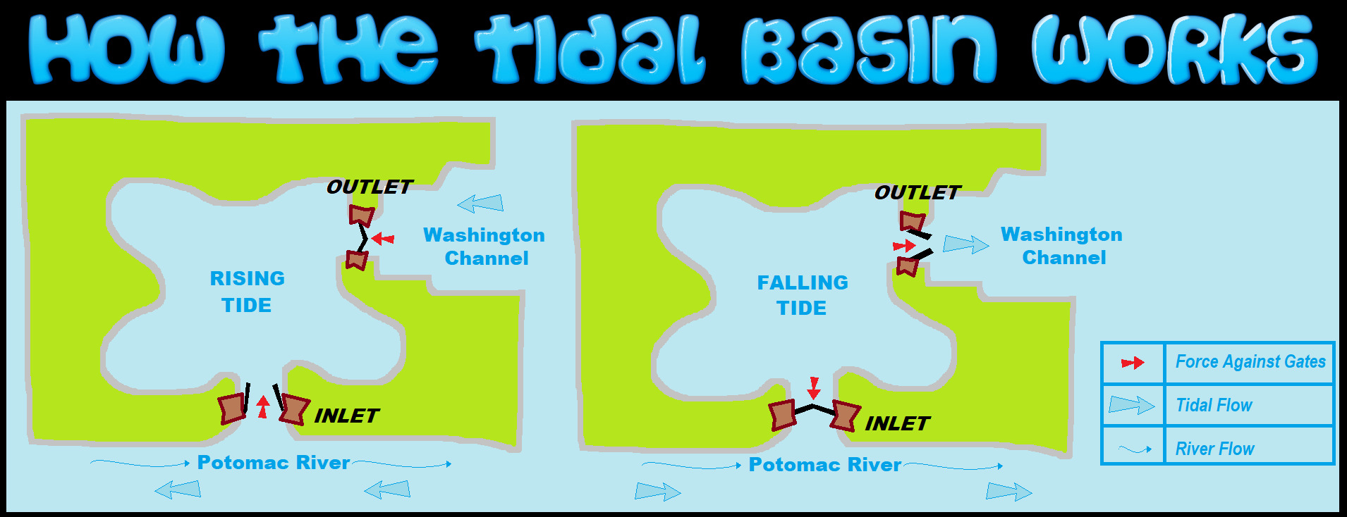
During the flood tide the inlet gates would open to allow water from the Potomac River to enter the Tidal Basin during the rising tide. While the outlet gates close to store incoming water and block the flow of water.
At falling tide, the outflow of water from the basin would exit into the Washington Channel creating a force that would close the inlet gates. The rush of water created going into the channel was designed to sweep leftover sediment away down river.
SINKING
The National Trust for Historic Preservation named the Tidal Basin as one of the United States most endangered historic places in 2019, and scientists have said that rising seas could occasionally place the Jefferson Memorial under several feet of water by 2040.
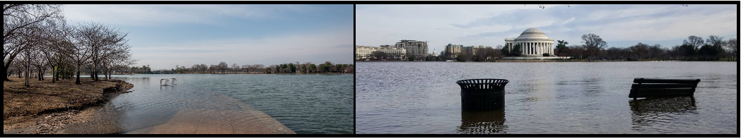
Despite the gate system designed to protect it, the Tidal Basin is sinking due to the silt and water of the Potomac Flats. Twice a day at high tide, rising waters flood the sidewalks surrounding the Tidal Basin. Not only does this impact visitor, but it also impacts infrastructure, and compromises the roots of the cherry trees. Even worse, this flooding is expected to grow more severe in the future due to the sea level rising creating increasingly high tides.

Subsidence is the sinking or settling of the ground surface. It can occur by a handful of processes. Ground subsidence may result from the settlement of native low-density soils, or the caving in of natural or man-made underground voids. Subsidence may occur gradually over many years as sags or depressions form on the ground surface. More infrequent, subsidence may occur abruptly as dangerous ground openings that could swallow any part of a structure that happen to lie at that location or leave a dangerous steep-sided hole.

LOGGING REQUIREMENTS:
To log this Earthcache: Read the geology lesson above. Answer all SIX questions posted below. Answers should be sent to me via e-mail or messenger on my Geocaching profile. Group answers are fine, but the sender must list all the members in your group with the answers. Do not post the answers to the questions in your logs.
QUESTION 1. What was the purpose of reclaiming the land that is now East & West Potomac Park?
QUESTION 2. Did you see any flooding, signs of run off, or any erosion today?
QUESTION 3. What type of subsidence is responsible for the sinking here?
A) Oil/Natural Gas Extraction.
B) Mining.
C) Groundwater related.
QUESTION 4. Describe an area of the Tidal Basin that you saw today that appears to be affected by subsidence more than other parts?
QUESTION 5. Do you see any evidence of mitigation to prevent the areas around the Tidal Basin from flooding or sinking?
QUESTION 6. What else do you think can be done to prevent this area from flooding and sinking?
OPTIONAL PHOTO: Posting a photo that readily indicates that you (and anyone else logging the find) are at the location.

 Awesnap has earned GSA's highest level:

REFERENCES:
1. Tidal Basin, Washington, DC, National Mall and Memorial Parks, website, nps.gov
2. Under Water: The National Mall's Tidal Basin Faces A Rising Threat,Joe Sugarman, Preservation Magazine, Spring 2020, savingplaces.org
3. Rising waters trigger change for DC's Tidal Basin, Whitney Pipkin, Bay Journal, Mar 30, 2021, Newspaper, bayjournal.com
4. Inlet Bridge Ready, Whitney Pipkin, Evening Star, August 4, 1908, Newspaper, newspapers.com
5. The Tidal Basin: an Endangered National Treasure, Trust for the National Mall, May 12, 2020, website, nationalmall.org
6. Landscape Architects Unveil Plans To Save The National Mall's Tidal Basin, Elizabeth Blair, National Public Radio, October 21, 2020, website, npr.org
7. Washington, D.C.'s 19th Century Reclamation Project, Drew Robarge, The Atlantic, March 28, 2011, website, the atlantic.com
8. The ambitious plan to stop the ground from sinking, Amanda Ruggeri, December 1, 2017, BBC News, website, bbc.com