ENGLISH VERSION
CASCADA DE LOS TILOS (ENG)
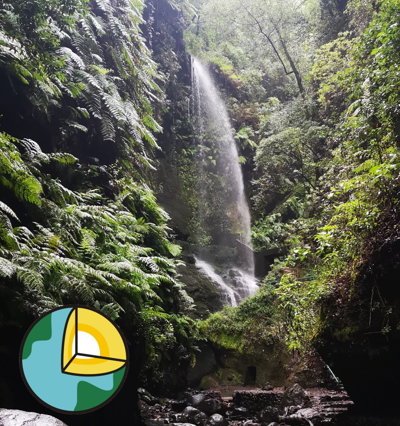
The Cascada de Los Tilos is a waterfall located in the Los Tilos forest, specifically in the Barranco del Agua. A defile where in the past there was a river with more water than now. In the Canary Islands, water is very scarce, for this reason the water is channeled to take advantage of it as you can see in the place. To get to the area of the coordinates of this earthcache, you can do it by the Senderlo La Cascada. The path runs alongside the water channel, passing though two small tunnels and then continues a little further up the ravine to the waterfall. There is very little coverage in the area! Keep in mind.
What is a defile?
A defile is a narrow and not very long gorge between two mountains, or a narrow valley between steep mountains, excavated by the waters of a stream. It often comes from a long process of excavation and erosion produced by the descent of the river.
How is a defile formed?
Due to the steep slope of the river in the upper course, the water moves at a great speed. This makes it have great erosive power (great ability to wear down the ground where it is). It has great strength to drag large stones that act as large hammers or knives sinking the river into its bed. When the river encounters a very high and hard obstacle, like a mountain, step by step, it makes its way, building a slit in the rock called a defile or, in case of doing so in a arid ground, an increasingly wide and deep slit is formed, called a canyon.
The canyons or defiles are the result of millions of years of erosion and sometimes have enormous dimensions such as the Grand Canyon of Colorado (USA) or the Mont-rebei Defile (Iberian Peninsula).
Volcanic zone
Geologically speaking, you should not forget that we are on a volcanic island. We are facing one of the oldest areas of the island of La Palma, as can be seen with the vegetation that gas grown on this volcanic soil. If you have doubts, along the way you can see some basaltic columns on the wlls of the defile.
To register this earthcache, you must go to the coordinates and send us an email (you can send it from our profile) with the answers to the following questions. We will only contact you if there is a problem with any answer.
1.- How do you think the defile of the Cascada de Los Tilos was formed?
A. By the erosion of the rivers banks
B. By the erosion of a plain
C. By the erosion of the river bed
D. By Erosion, the God of destruction
2.- The defiles and canyons are differentiated because...
A. They have formed in different soils
B. Some have been formed by rivers and others not
C. They are found in different places
D. None of the above is correct
3.- Which of the following statements is correct?
A. The defiles and canyons have similar climatic conditions (temperature and humidity) to their surroundings
B. The defiles and canyons have the same climatic conditions as their surroundings
C. The defiles and canyons generally have a different microclimate in their surroundings
D. The defiles and canyons are the main culprits in climate change
4.- Observe the defile of Cascada de Los Tilos where you are. What do the water have to do with it? Reason your answer.
5.- Travertine is a chemical-type limestone sedimentary rock, formed by calcite, aragonite and limonite. It is common to find travertine in hot spring tanks and near waterfalls. Is there travertine in the waterfall? Why?
6.- Observe the rocks in the coordinates, in the middle of the defile. They have yellow/green spots. They are lichens. Are they smooth or rough? Why do you tinck they are like this?
7.- Take a PHOTO with your GPS and/or your nickname with the Cascada de Los Tilos in the background. Remember that photography is obligatory.
If we do not receive the answers, the log will be deleted without notice.
All logs that do not include the photo of the question 7 may be deleted (from the update of the 2019 guidelines, photography may be obligatory to demonstrate that the site has been visited).