How the area formed
Once upon a time, a very long time ago, the area that is now the north-west of Ireland and the area that is now the south-east of Ireland, were on opposite sides of a shrinking ocean known as the Iapetus Ocean. By about 410 million years ago, during the Silurian and Devonian eras these two areas had collided and a great mountain-building phase was in progress. The present-day Slieve Bloom mountains lie along, or are very close to, the 'Iapetus Suture', the notional line that marks where these two areas with very different early geological histories amalgamated to create the area now known as Ireland.
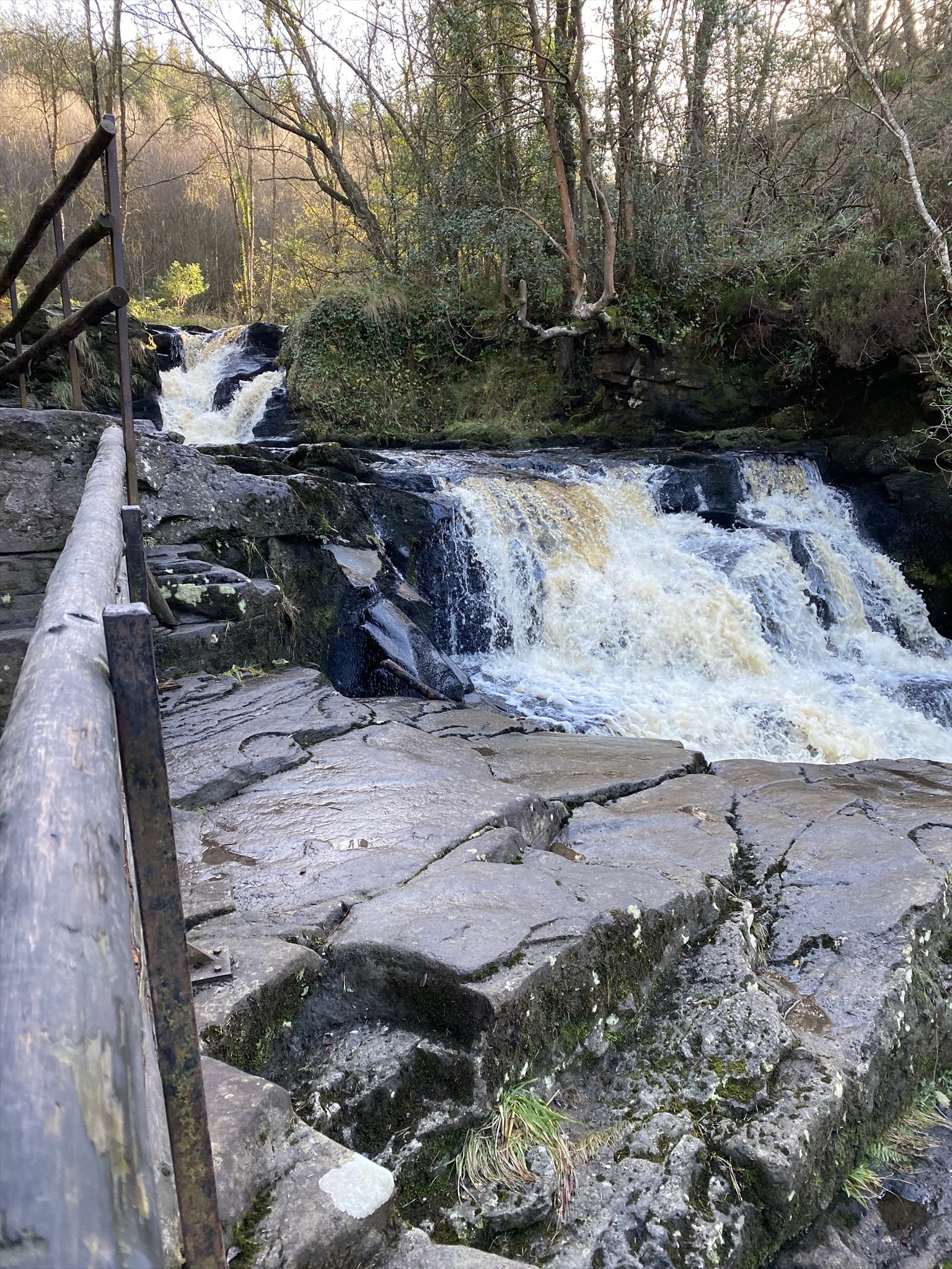
The waterfall
If you stand beside the plunge pool at the foot of the main waterfall you will notice that the lip of the waterfall and the rock at the falls above are of sandstone: but the rock under the waterfall is a much softer, reddish-coloured mudrock. This mudrock is very easily eroded (you can pick it away even with your hand). This is part of the explanation of how the waterfalls here started in the first place.
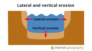
Lateral erosion
Lateral erosion is the process by which a stream sweeps back and forth after initially cutting a way through for itself, and changes a V-shaped channel into a U-shaped one. By this process, a floodplain is created which increases the stream valley’s capacity to carry floodwaters and limit future downcutting.
Vertical erosion
Vertical erosion involves the wearing away and deepening of the river bed. This is mostly by hydraulic action ( the force of fast flowing water) and happens more noticeably during flood conditions. It is most common in the upper course of the river as there is not as much water in the channel so it is shallow and narrow. Once the water has worn away the soft rock and has reached the bedrock it can’t erode a deeper channel as easily
To log a find on this cache
Walk between the posted coords where you can see the erosion, and the waypoint where the waterfall is and
Answer the questions below and send me the answers before you log your find
1. Taking note of the height of the river banks beneath the waterfall, do you think mostly lateral erosion or vertical erosion has happened here? Explain why
2. Do you think your answer to Q1 will continue to happen? Explain why
3. Do you think the formation of the waterfall has anything to do with either type of erosion? Why
4. Take a photo of you or a personal item showing the waterfall in the background, attach this photo to your log