De Meuse-Musel-Kanal oder Ourthe-Kanal (fr: Canal de Meuse et Moselle oder Canal de l'Ourthe) war e Projet, deen 1827 drop an dru war, realiséiert ze ginn, an deen dora bestoung, e schëffbare Kanal tëscht der Meuse an der Musel, queesch duerch d'Ardennen, ze bauen. En hätt haaptsächlech sollen iwwer d'Flëss Ourthe, Klierf a Sauer goen. Déi Belsch Revolutioun an d'Opkomme vun der Eisebunn hunn de Projet zum Echec bruecht.
Quell: Wikipedia
Fir ze beweisen, dat der den Site besicht hott, musst der des 2 Aufgaben erfëllt hunn:
Aufgab 1. Froen.
Um WP1 fannt Der eng Info-Tafel
A = Wéi wäit war den Tunnel schonn an den Bierg gedriwwen, wéi 1830 d’Aarbichten agestallt goufen
Scheck eng Mail mat ärem Nicknum am Betreff un: MeuseMoselA@gmail.com (Beispill: wann A= 1234: MeuseMosel1234@gmail.com ). Wann äer Léisung richteg ass, krëss Du direkt Logerlabnis per Mail.
Aufgab 2. Foto.
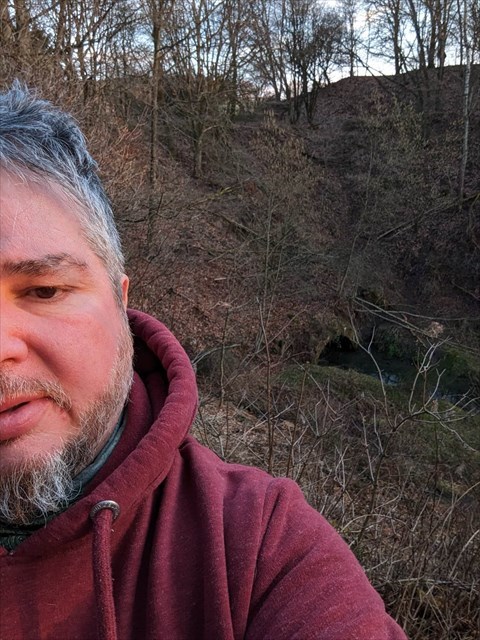
Setzt eng Foto vun Iech (*) oder vun engem perséinlechen Géigestand, mat dem Dier identifizéiert kënnt gi (GPS, Maskottchen, Pabéier mam Nicknum asw.), mat dem Tunnelportal vum Kanal am Hannergrond. (kuckt Beispill).
(*)Äert Gesiicht muss nik obligatoresch op der Foto sënn.
.
Quell: Wikipedia
Le souterrain et le canal de Bernistap, à l’est du village belge de Tavigny (commune d’Houffalize), est un vestige d’un grand projet fluvial entrepris au début du xixe siècle par la Société du Luxembourg avec l'accord et l'appui du roi Guillaume Ier. Il consistait, pour des raisons économiques, à relier par le creusement d’un canal les bassins de la Meuse et de la Moselle, par leurs affluents, l’Ourthe et la Woltz.
Le projet fut suspendu lorsque la Belgique devant indépandante (1830) puis définitivement abandonné quelques années plus tard avec la signature du traité des XXIV articles en 1839 qui consacrait la scission de l'ancien duché de Luxembourg en deux entités : la province de Luxembourg en Belgique et le grand-duché du Luxembourg, État indépendant. Le site de Bernistap est classé comme monument historique en 1988.
Source: Wikipedia
Pour valider votre visite sur place, vous devez satisfaire aux 2 tâches suivantes :
Tableau d’Info au WP1
Tâche 1. Question
A = Combien de mètres, était le souterrain déjà creusé, quand les travailles s’arrêtent en 1830?
Réponse à envoyer à l'adresse e-mail suivante : MeuseMoselA@gmail.com avec votre pseudo geocaching comme sujet de votre courriel (exemple : si A= 1234: MeuseMosel1234@gmail.com). Une adresse correcte obtiendra une confirmation immédiate que vos réponses sont exactes.
Tâche 2. Photo.
Postez une photo de vous (*) ou d'un élément personnel permettant de vous identifier (gps, mascotte, papier avec pseudo,...) avec le tunnel du canal en arrière plan, soyez créativ. (voir exemple).
(*) l'affichage du visage n'est pas obligatoire.
The Bernistap underground and canal, to the east of the Belgian village of Tavigny (municipality of Houffalize), is a remnant of a major river project undertaken at the beginning of the 19th century by the Société du Luxembourg with the agreement and the support of King William I. It consisted, for economic reasons, in linking the basins of the Meuse and the Moselle, by their tributaries, the Ourthe and the Woltz, by digging a canal.
The project was suspended when Belgium had to become independent (1830) then definitively abandoned a few years later with the signing of the Treaty of XXIV Articles in 1839 which established the split of the former Duchy of Luxembourg into two entities: the province of Luxembourg in Belgium and the Grand Duchy of Luxembourg, an independent state. The Bernistap site was classified as a historical monument in 1988.
To claim a credit for your on-site visit, you must do 2 following tasks :
Info at WP1
Task 1. Question.
A = How many Meters had the Channel progressed into the Mountain, at the End of the Project in 1830?
Answers to send to the following email address: MeuseMoselA@gmail.com with your nickname geocaching as subject of your mail (example: if A=1234: MeuseMosel1234@gmail.com). A correct address will get immediate confirmation that your answers are correct.
Task 2. Photo.
Post a photo of yourself (*) or a personal element to identify you (GPS, mascot, paper with nickname,...) with the Entry of the Tunnel in the Background, be creative. (see example).
(*) a face cannot be required.
Virtual Rewards 3.0 - 2022-2023
This Virtual Cache is part of a limited release of Virtuals created between March 1, 2022 and March 1, 2023. Only 4,000 cache owners were given the opportunity to hide a Virtual Cache. Learn more about Virtual Rewards 3.0 on the Geocaching Blog.