Projecto: Geo Estrada N2
Troço: São Brás de Alportel - Faro
Extensão:16 km
|
A Geo Estrada N2 é a maior estrada de Portugal com 738,5 km de extensão. Tem início em Chaves e termina em Faro.
Ao longo desta Geo Estrada, que passa por 11 Distritos e 32 Concelhos, vais encontrar mais de 1500 caches e muitos mais motivos de interesse.
O desafio está lançado...
agora é contigo !
|

|
The Geo Route EN2 is the longest route in Portugal with 738,5 km long. With a start in Chaves and ending in Faro.
Along this Geo Route, crossing 11 States and 32 Counties, you'll find more than 1500 geocaches and many other attractions.
The challenge is ready...
now, is up to you !
|
|
Recomendações
A mais importante é "respeita o código de estrada", principalmente na aproximação às caches. Não pares o teu veículo a ocupar a via. A grande maioria das caches dispõe de local de paragem fora da estrada. Nas raras excepções, existe um a menos de 50m. Não arrisques nem prejudiques o trânsito. Vamos evitar más recordações deste passeio!
Tudo foi preparado para que o percurso seja feito no sentido Norte-Sul, com a maioria das caches colocadas no lado direito. Se fizeres ao contrário vais enfrentar dificuldades desnecessárias.
Caso o GPS não ajude ou a cache se tenha extraviado ou danificado. Este percurso é longo e mantê-lo requer muito esforço, pelo que uma ajuda é sempre bem vinda e o owner agradece. Se for possivel deixa uma cache/logbook de emergência no local para que todos possam continuar a desfrutar deste passeio. Alerta o owner, que irá regularizar logo que possivel.
PARA INFORMAÇÃO ADICIONAL SOBRE ESTE PERCURSO, VISITE (GC9JT4B) |
Recommendations
The most important is "respect the Highway Code", mainly when approaching a geocache. Don't stop your vehicle on the road. Most caches have a stopping spot out of the road. Some rare exceptions may require a short walk within 50m. Do not take any risks and don't cause traffic issues. Let's avoid bad memories from this tour!
This challenge favours travelling on the direction North-South with most of the geocaches located on that right side. Travelling South-North will presents more risk and difficulties.
It could be that your GPS is not helping, or the geocache is missed or damaged. This is a very long tour and requires significant effort to be maintained, so help is always welcomed and owner will appreciate it. If possible leave an emergency container/logbook so that everyone can continue to enjoy this tour. Send an alert to the owner and we'll try to solve the situation soon.
FOR ADDITIONAL INFORMATION ABOUT THIS ROUTE, VISIT (GC9JT4B) |
|
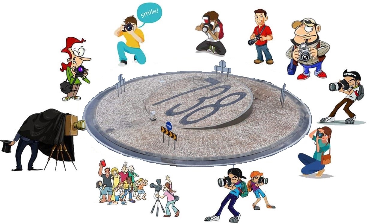
Requisito para reclamar o found:
Anexar ao log uma foto onde seja visivel a rotunda com os números que a identificam "738" juntamente contigo ou com o teu nickname (fotoshop é rejeitado)
Claro que a criatividade é sempre bem vinda e seria engraçado não ser só mais uma foto igual ás demais. Deixo o desafio.
|
Requirement to claim the found:
Attach to your log a photo showing the roundabout with the numbers that identify it "738" together with you or your nickname (photoshop is rejected)
For sure criativity is always welcomed and it would be nice that it is not just another photo like all others. Leave you with the challenge.
|
Virtual Rewards 3.0 - 2022-2023
This Virtual Cache is part of a limited release of Virtuals created between March 1, 2022 and March 1, 2023. Only 4,000 cache owners were given the opportunity to hide a Virtual Cache. Learn more about Virtual Rewards 3.0 on the Geocaching Blog.
ESTA NÃO É A ÚLTIMA CACHE, AINDA HÁ MAIS UMA PARA COMPLETAR
KM 738.500, VAI LÁ.
THIS IS NOT THE LAST CACHE , THERE IS ONE MORE TO COMPLETE
KM 738.500, GO THERE.