Wrekin Hill
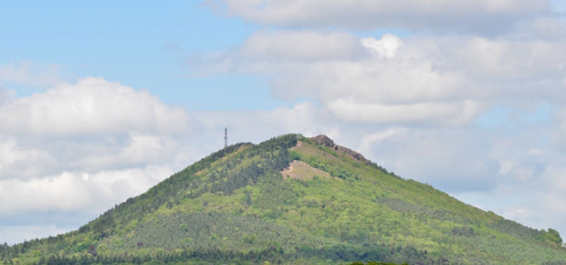
The Wrekin is a hill in east Shropshire, located about five miles (8 km) west of Telford, rising above the Shropshire Plain to a height of 407 metres (1,335 feet) above sea level. It is a prominent and well-known landmark, signalling the entrance to Shropshire for travellers westbound on the M54 motorway. The hill is popular with walkers and tourists and offers good views of Shropshire. It can be seen well into Staffordshire and the Black Country, and even as far as the Beetham Tower in Manchester, Winter Hill in Lancashire, and Cleeve Hill in Gloucestershire.
The earliest mention of the Wrekin occurs in a charter of 855, as entered in a late 11th-century Worcester cartulary, spelled Wreocensetun. Its modern form is thought to have entered modern English via Mercian, and it is likely to have been derived from the early Celtic Wrikon.
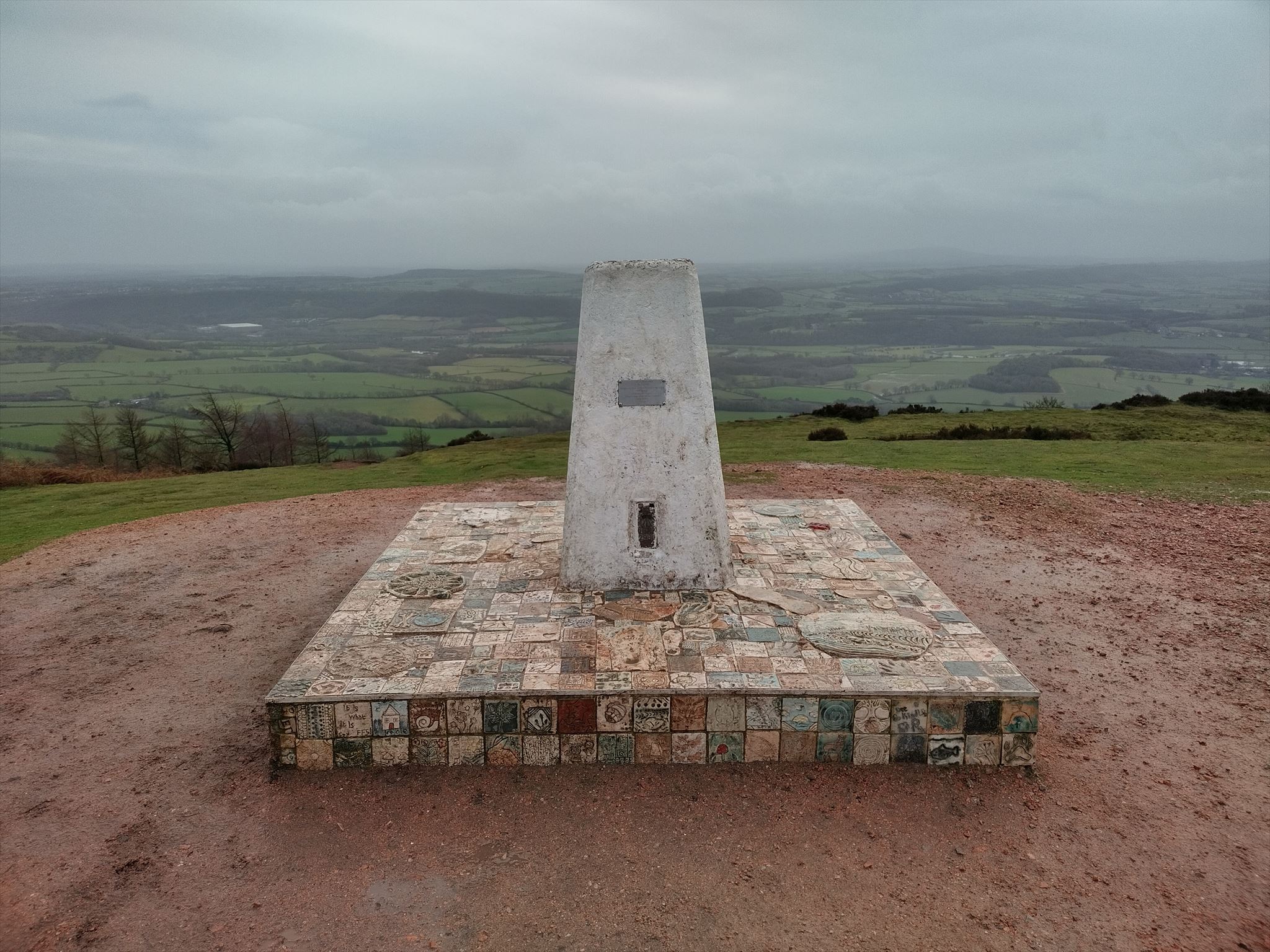
The summit of the Wrekin is home to its trig point, toposcope (viewfinder), and radio tower.
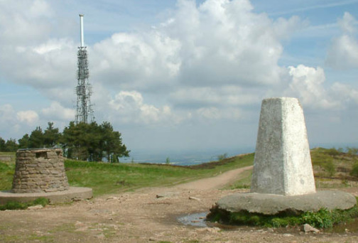
The trig point and toposcope were incorporated into an artwork, The Sky Begins At My Feet, which was designed by the Wellington Arts Collective and unveiled in October 2022 in honour of Queen Elizabeth II. The sculpture is in the stoneware clay tiles laid around the plinths bearing relief portraits of seven local heroes and heroines by artist Sharon Griffin and in a range of decorative tiles designed by the public and various community groups and workshops. A recent addition is the Wrekin transmitting station, used for broadcasting and telecommunications. At the top of the main mast is a beacon, which emits a red pulse of light every few seconds at night. It is known locally as the "Wrekin Beacon", and is visible for many miles around.
Logging requirements
As getting to the top of the hill is challenging enough for some (like me), to claim this cache, all you have to do is post a picture of yourself, your GPS, or anything unique, with THE TRIGPOINT. You can even just point your finger at your favourite mozaic tile if you are shy!
The photo MUST have been taken AFTER the cache was published. Any log failing to meet these requirement will be deleted.
I hope it was an enjoyable walk for everyone, and thank you for visiting this cache!
Virtual Rewards 3.0 - 2022-2023
This Virtual Cache is part of a limited release of Virtuals created between March 1, 2022 and March 1, 2023. Only 4,000 cache owners were given the opportunity to hide a Virtual Cache. Learn more about Virtual Rewards 3.0 on the Geocaching Blog.