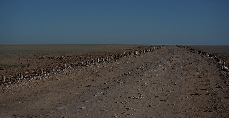
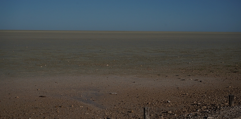
Etosha pan is a large depression locate in a semi arid part of Namibia. It
covers a surface area of 4570 Km2. Today it is an integral part of
Etosha National Park, one of the oldest and largest wildlife parks in the world.
Despite its size and prominence in the area, however, the origin of Etosha pan and the
climatic regime under which it developed has been intensely debated.
Two contrasting, mutually exclusive theories regarding the origin of Etosha pan excist.
The oldest view, dating back to the 1920's assumes Etosha is a dried up lake resulted from
the diversion of the Kunene river to the coast during the late Pilocene/early Pleistocene
(Schwarz 1920; Jaeger 1926; Wellington 1938; Stuart-Williams 1992a; 1992b). The contrasting
view emerged in the 1980's (Rust 1984;1985) and reached prominence in the 1990's. It contents
that Etosha Pan was essentially created by the dominant, North Easterly wind (Buch 1993; 1995
1997; Buch et al 1992).
ETOSHA PAN AS A DEFLATION HOLLOW.
Specifically, the theory of Etosha Pan as an erosional landform assumes that around 5,3 to 3,5
million years ago, a thin layer of sediment cover over the then surface of Etosha pan started to
disintegrate. Soon after, the dominant north-easterly wind eroded and removed the
disintegrated material. Aeolian activity were thought to have been complimented by seasonal
water erosion. Over time, a depression that we call Etosha pan was left behind. The dunes
found today in the western and north-western rim of Etosha Pan are considered as primary
evidence representing part of the removed materials. Sediments at dept of these ridges were
dated to at least 140 Ka and their sedimentation record since then was deemed to reflect
continuous accumulation (Buch et al 1992; Buch&Zoller 1992). As a result,
Buch (1993,1995,1997), among others , concluded that the climatic conditions at Etosha
has been persistently semi-arid as today for the last 1,8 Ma, and that no perennial lake
conditions ever existed in the area since then.
ETOSHA PAN AS A DRIED-UP LAKE.
In contrast, proponents (e.g.Stuart-Williams 1992) of Etosha Pan as a dried-up lake assert
that 3 million years ago Etosha Pan was approximately 82000 km2 in extent with a
depth of 45m. If it existed today it would have been the third largest lake in the world
after the Caspian Sea and Lake Superior.
According to Stuart-Williams that lake, reduced only slightly in depth and extent, persisted
until approximately 35000 years ago, long after the Kunene River was diverted to the coast
around the late Pliocene. The present Etosha Pan is then concidered as a remnant of that
dried-up lake.
To claim this Earth Cache you must answer the following questions.
1) What is the surface area of Etosha Pan ?
2) How deep was the pan according to Stuart-Williams ?
3) Which wind eroded the pan ?
4) The sediments at the dune ridges were dated to when ?
5) Which of the two theories do you find the most likely and why ?
6) Location question - On the main board at GZ, at the bottom find the Namibian crest
with flag, next to the crest are two other signs/plaques, one red the other blue,
what are the abbreviation on the red one ?
7) Take a picture with your GPS visible at GZ OR you can write your name on hand/paper etc and take a picture in front of the info boards.
Send me the answers to the questions by email or message. Any logs without answers will be
deleted. No group finds, each cacher in the group must send their own answers.