Σιδερένια άμμος ⏳ μαγνητίτης στην Κρήτη
Eisensand ⏳ Magnetit auf Kreta
Iron sand ⏳ magnetite on Crete

Στις τελευταίες μου διακοπές στην Κρήτη, περπατώντας στην παραλία, παρατήρησα σκούρες ρίγες στην άμμο, που μου κέντρισαν το ενδιαφέρον. Σε μια μεταγενέστερη αναζήτηση συνάντησα αυτό το φαινόμενο. Η ιδέα για αυτό το Earthcache γεννήθηκε. Ευχαριστώ επίσης την Team N51E06 που με στήριξε στην υλοποίηση της ιδέας.
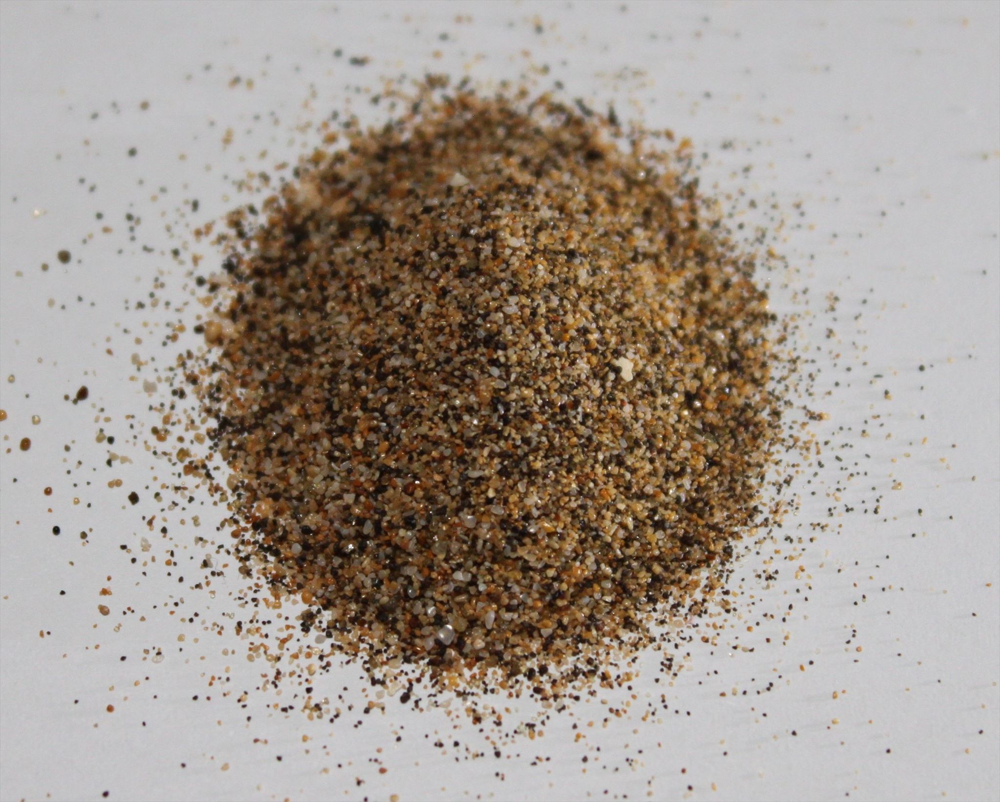
Η Σιδερένια άμμος αναφέρεται στην καθομιλουμένη ως άμμος εμπλουτισμένη με βαριά ορυκτά, η οποία έχει υψηλή αναλογία ορυκτών σιδήρου. Το χρώμα της άμμου είναι σκούρο γκρι ή μαύρο. Το κυρίαρχο ορυκτό σιδήρου στην άμμο είναι ο μαγνητίτης Fe3O4, όπου η περιεκτικότητα σε καθαρό σίδηρο μπορεί να είναι μεταξύ 54% και 60% ανάλογα με την τοποθεσία και την ποιότητα. Επιπλέον, μπορεί επίσης να υπάρχουν και άλλες ανόργανες ενώσεις, όπως π.χ. Β. Οξείδιο τιτανίου(IV) TiO2, οξείδιο βαναδίου(III) V2O3, οξείδιο μαγνησίου και άλλα.

Μετά το αλουμίνιο, ο σίδηρος είναι το πιο κοινό μέταλλο στον φλοιό της γης. Λόγω της ηφαιστειακής δραστηριότητας, μπορεί να μεταφερθεί σε σχετικά μεγάλες ποσότητες από τις βαθύτερες περιοχές του φλοιού ή από τον άνω μανδύα στην επιφάνεια, όπου γίνεται μέρος του βράχου της λάβας με τη μορφή ορυκτών σιδήρου. Εκατομμύρια χρόνια πριν, σε διάφορα μέρη του κόσμου σχηματίστηκαν περιοχές σιδηροφόρων πετρωμάτων και στη συνέχεια διαβρώθηκαν για μεγάλα χρονικά διαστήματα.
Πηγή: https://de.wikipedia.org/wiki/Eisensand
Η ιστορία του σχηματισμού της Κρήτης συνδέεται στενά με τις τεκτονικές διεργασίες μεταξύ της ευρωπαϊκής και της αφρικανικής ηπείρου, όταν η τεράστια θάλασσα της Θέτυς ήταν ακόμα εκεί κατά τη διάρκεια του Μεσοζωικού πριν από περισσότερα από 150 εκατομμύρια χρόνια. Στην Τριτογενή Εποχή, μεγάλες αναδιπλούμενες οροσειρές χαράχτηκαν σε όλο τον πλανήτη λόγω της παρασύρσεως μεταξύ τους των τεράστιων ηπειρωτικών πλακών που επιπλέουν στο παχύρρευστο μάγμα του μανδύα της Γης. Η θαλάσσια περιοχή της Θήτυς μειώθηκε επίσης όταν η αφρικανική ηπειρωτική πλάκα πλησίασε την ευρασιατική πλάκα στα βόρεια και υψώθηκαν αρκετές οροσειρές.
Η διαδικασία, η οποία διήρκεσε αρκετά εκατομμύρια χρόνια, οδήγησε στις ευρωπαϊκές Άλπεις, τη Διναρική οροσειρά και, στην επέκτασή της, την ελληνική οροσειρά στην ηπειρωτική Ελλάδα, καθώς και τη νησιωτική σειρά του Νοτίου Αιγαίου, ο κύριος σύνδεσμος των οποίων μεταξύ η Πελοπόννησος και η Ανατολία είναι το νησί της Κρήτης.
Αυτό το ορεινό τόξο, που σχηματίστηκε με τα Επτάνησα, την Πελοπόννησο, την Κρήτη, την Κάρπαθο και τη Ρόδο μέχρι τα όρη Κάρια στη Μικρά Ασία στην πλάκα του Αιγαίου, ήταν το αποτέλεσμα της σκληρότερης μάζας των Κυκλάδων, που είχε ήδη σχηματιστεί στον Παλαιοζωικό, από η οποία διάβρωση και καθίζηση στις αρχές του Τεταρτογενούς σχηματίστηκαν και τα νησιά των Κυκλάδων και η αφρικανική πλάκα τους εμπόδισε να παρασυρθούν περαιτέρω. Αυτό είχε ως αποτέλεσμα τη δημιουργία της Ελληνικής Τάφρου βάθους σχεδόν 5000 μέτρων μεταξύ της Κρήτης και της αφρικανικής ακτής στη ζώνη καταβύθισης, όπου η αφρικανική ηπειρωτική πλάκα τώρα πιέζεται κάτω από την πλάκα του Αιγαίου.
Αυτή η καταβύθιση δεν έχει ακόμη ολοκληρωθεί, καθώς η Αφρική και η Ευρώπη εξακολουθούν να παρασύρονται η μία προς την άλλη κατά περίπου 4 εκατοστά το χρόνο, γεγονός που μπορεί να προκαλέσει μεμονωμένους σεισμούς στην περιοχή. Ο μεγαλύτερος μέχρι τότε σεισμός της σύγχρονης εποχής το έτος 438 μ.Χ. Λόγω μιας τεκτονικής αναταραχής στη ζώνη καταβύθισης, το νησί της Κρήτης κατέβηκε κατά 4 μέτρα κάτω από την επιφάνεια της θάλασσας στην ανατολική πλευρά και ανυψώθηκε έως και 8,5 μέτρα στη δυτική πλευρά, όπως φαίνεται ακόμη σήμερα στους βράχους της Γραμβούσας. χερσόνησος στην παλιά ακτογραμμή. Ως εκ τούτου, τον 5ο αιώνα εγκαταλείφθηκε το λιμάνι των Φαλάσαρνας που δεν ήταν πλέον αξιοποιήσιμο και ορισμένες αρχαίες λιμενικές τοποθεσίες στην ανατολική Κρήτη βυθίστηκαν στη θάλασσα.
Πηγή: https://www.cretadeluxe.com/de/info_klima.htm
Τα Περβόλια, τα Μισίρια και ο Πλατανιάς (ή Πλατανές) είναι τρία συνεχόμενα προάστια του Ρεθύμνου που βρίσκονται 3-5 χλμ δυτικά της πόλης. Ήταν ξεχωριστοί οικισμοί που ενσωματώθηκαν στον αστικό ιστό του Ρεθύμνου λόγω οικιστικής ανάπτυξης.
Η Μισίρια πήρε το όνομά της από την αραβική λέξη Misr, που είναι προάστιο του Καΐρου με πολύ εύφορο έδαφος. Ομοίως, η περιοχή ονομάζεται Μισίρια λόγω της εύφορης γης που εξακολουθεί να παράγει πολλά λαχανικά.
Μπροστά από το προάστιο απλώνεται μια μεγάλη αμμουδιά, η οποία αποτελεί προέκταση της τεράστιας παραλίας που ξεκινάει κοντά στο λιμάνι του Ρεθύμνου και εκτείνεται ανατολικά για 13χλμ. Είναι πολύ καλά οργανωμένο με πολλές επιλογές για φαγητό, ποτό και διαμονή. Όπως σε όλα τα σημεία της τεράστιας παραλίας, έτσι και εδώ η θαλάσσια χελώνα Caretta caretta γεννά αυγά. Οι χελώνες κινδυνεύουν με εξαφάνιση, αλλά ο Ρεθεμνιώτικος Κόλπος είναι ένα από τα τρία πιο σημαντικά μέρη για το είδος στην Ελλάδα, έχοντας περισσότερες από 400 φωλιές κάθε χρόνο.
Πηγή: ⭐ Tourist-Info für die Insel Kreta ⛵, Griechenland ⭐ - Misiria Strand cretanbeaches.com
Η σιδερένια άμμος βρίσκεται σχεδόν παντού στον κόσμο. Ωστόσο, σπάνια βρίσκεται σε οικονομικά σημαντικές και εξορυκτικές ποσότητες (π.χ. στη Χιλή, τη Γουατεμάλα, την Ινδονησία, τον Καναδά, την Ιαπωνία και τη Νέα Ζηλανδία). Οι μικρές αλλά βαριές πέτρες ή κόκκοι σκορπίστηκαν κατά μήκος των ακτών από τον άνεμο, τα κύματα και τις παλίρροιες. Λόγω του μεγαλύτερου ειδικού βάρους τους (5,2 g/cm3) από την κανονική (χαλαζιακή) άμμο (2,65 g/cm3), εναποτέθηκαν σε συμπυκνωμένη μορφή.
Μπορείτε να φιλτράρετε τη μαγνητική άμμο;
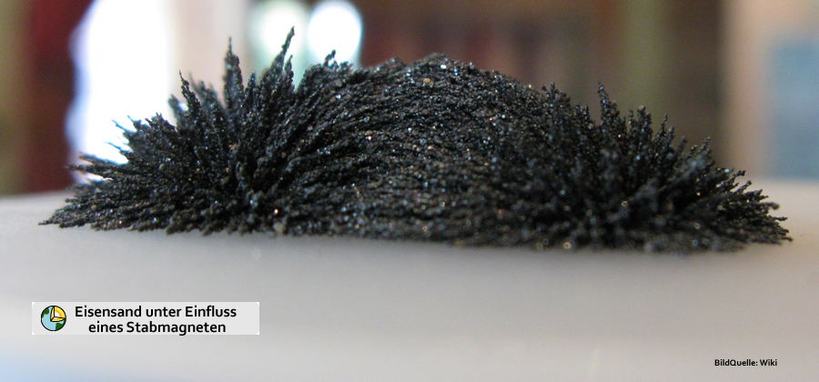
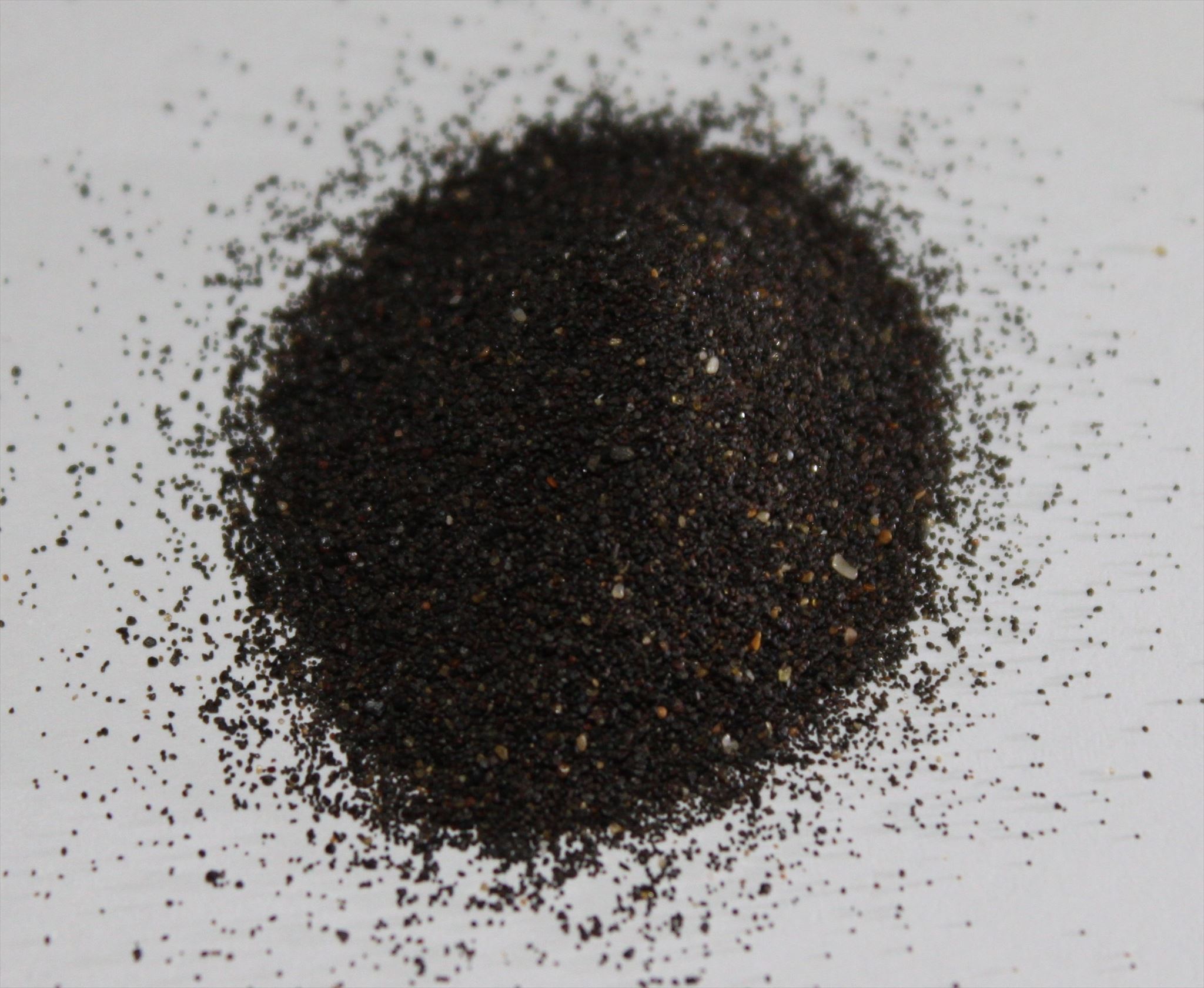
Ναι, ακόμα και πολύ εύκολο. Το μόνο που χρειάζεστε είναι ένα φύλλο χαρτιού, ένας μαγνήτης και ένα μικρό δοχείο. Κρατήστε το φύλλο χαρτιού πάνω από ένα σημείο ξηρής (!!) άμμου και πλησιάστε το αργά με τον μαγνήτη. Τώρα μετακινήστε τη λεπίδα μπρος-πίσω λίγο πάνω από την άμμο. Στη συνέχεια, κρατάτε το φύλλο πάνω από ένα δοχείο και αφαιρείτε τον μαγνήτη. Το ορυκτό πέφτει τώρα στο δοχείο χωρίς να αφήνει κανένα υπόλειμμα στον μαγνήτη σας.
Για να καταγράψετε αυτήν τη γήινη κρυφή μνήμη,
τώρα πηγαίνετε στην «Παραλία Μισίρια». Οι συντεταγμένες της καταχώρισης βρίσκονται στη μέση της παραλίας και είναι άσχετες για την απάντηση στις ερωτήσεις. Κατά μήκος της παραλίας μπορείτε να κάνετε μια ωραία βόλτα τόσο στην άμπωτη όσο και στην παλίρροια. Είναι καλύτερο να το κάνετε αυτό στην άμπωτη λίγο πριν ξαναμπεί η παλίρροια. Για τα πειράματα χρειάζεστε μόνο έναν μαγνήτη, ένα κομμάτι χαρτί και πιθανώς ένα μικρό βαζάκι/μια μικρή πλαστική σακούλα για μετέπειτα πρόβες στο σπίτι. Στη συνέχεια, κάντε τις τρεις παρακάτω εργασίες. Δεν χρειάζεται να είστε γεωλόγος για αυτό - η κατανόησή σας και οι παρατηρήσεις σας στο χώρο είναι απολύτως επαρκείς. Η τρίτη εργασία μπορεί να απαντηθεί με λίγη εργασία χωρίς πολύ κόπο.
-
Αναζητήστε σκοτεινά σημεία στην περιοχή όπου τα κύματα αγκαλιάζουν απαλά την άμμο. Τώρα φιλτράρετε την άμμο όπως περιγράφεται παραπάνω και κοιτάξτε το δείγμα. Μπορείτε να εντοπίσετε διαφορετικά χρώματα;
-
Ρίξτε μια πιο προσεκτική ματιά στο τμήμα της παραλίας. Υπάρχουν μέρη όπου συγκεντρώνεται η σιδερένια άμμος; Εάν ναι, πώς το εξηγείτε αυτό;
-
Όταν επιστρέψετε στο σπίτι, πάρτε μια καλή ψηφιακή ζυγαριά κουζίνας και ζυγίστε μια ποσότητα από το δείγμα που φέρατε μαζί σας (~20 γραμμάρια πρέπει να είναι αρκετά· αυτό αντιστοιχεί σε 1-2 κουταλιές της σούπας άμμο· οι αριθμοί είναι τόσο σημαντικοί που η μικρή ποσότητα είναι επαρκής για το πείραμα). Τώρα πραγματοποιήστε ένα "φιλτράρισμα" όπως περιγράφεται παραπάνω! Για να επιτύχετε το πιο ακριβές αποτέλεσμα, θα πρέπει να επαναλάβετε το φιλτράρισμα 2-3 φορές. Μόλις το φιλτράρισμα δεν παρέχει πλέον ορυκτά, μπορείτε να μεταβείτε στο τελευταίο μέρος της εργασίας.
Τώρα ζυγίστε την υπόλοιπη φιλτραρισμένη άμμο. Ποιο ήταν το ποσοστό μαγνητίτη στο δείγμα σας; Παρακαλούμε επισυνάψτε φωτογραφίες του δείγματός σας και τα φιλτραρισμένα μέρη στο αρχείο καταγραφής!

Photos: andi_ilvese
-
Μεταβείτε στο "WP1 - Misiria Beach" και τραβήξτε μια φωτογραφία του εαυτού σας ή ένα προσωπικό αντικείμενο με φόντο το "Amrai Dam Canal". Σύμφωνα με τις οδηγίες της 10ης Ιουνίου 2019, αυτή είναι μια αποδεκτή κατάσταση καταγραφής (https://www.gc-reviewer.de/fotobeweis-bei-earthcaches-wieder-zuallowed/ και https://www.geosociety.org/ GSA/Education_Careers/ Field_Experiences/EarthCache/GSA/fieldexp/EarthCache/guidelines/home.aspx). Τα αρχεία καταγραφής στα οποία δεν επισυνάπτεται η φωτογραφία θα διαγραφούν μετά από 14 ημέρες χωρίς σχόλια.
Στείλτε μου τις απαντήσεις σας από τις εργασίες μέσω ταχυδρομείου ή κέντρου μηνυμάτων και, στη συνέχεια, μπορείτε να καταγράψετε αμέσως το Earthcache. Δεν χρειάζεται να περιμένετε να κυκλοφορήσει το αρχείο καταγραφής από την πλευρά μου! Θα ελέγξω τις απαντήσεις και τις λύσεις που αποστέλλονται για να βεβαιωθώ ότι είναι σωστές και θα επικοινωνήσω μαζί σας εάν είναι απαραίτητο.
Παρακαλώ σημειώστε :
|
Οι αρχές σε άλλες ευρωπαϊκές χώρες διακοπών είναι λιγότερο σκληρές. Για παράδειγμα, οι ταξιδιώτες μπορούν να πάρουν μαζί τους πέτρες από την Ισλανδία ή την Ελλάδα, υπό την προϋπόθεση ότι δεν πρόκειται για συγκεκριμένα ορυκτά, φυσικά μνημεία ή αρχαίες ή αρχαιολογικά σημαντικές πέτρες. Σε αυτές τις περιπτώσεις, απαγορεύεται και εδώ η αφαίρεση. Οι παραθεριστές μπορούν επίσης να πάρουν μαζί τους άμμο από αυτές τις χώρες, καθώς αυτό δεν απαγορεύεται.
|
Πηγή: https://www.bussgeld-info.de/sand-mitnehmen-verboten/#tabelle

Bei meinem vergangenen Urlaub auf Kreta sind mir bei einem Strandspaziergang dunkle Streifen im Sand aufgefallen, die mein Interesse geweckt haben. Bei einer anschließenden Recherche stieß ich auf dieses Phänomen. Die Idee für diesen Earthcache war entstanden. Vielen Dank auch an Team N51E06, die mich bei der Umsetzung der Idee unterstützt haben.
Als Eisensand bezeichnet man umgangssprachlich einen mit Schwermineralien angereicherten Sand, der einen hohen Anteil an Eisenmineralien aufweist. Die Farbe des Sandes ist dunkelgrau oder schwärzlich. Das im Sand vorherrschende Eisenmineral ist Magnetit Fe3O4, wobei der reine Eisenanteil je nach Fundort und Qualität zwischen 54 % und 60 % liegen kann. Zusätzlich können auch noch andere Mineralverbindungen vorhanden sein, wie z. B. Titan(IV)-oxid TiO2, Vanadium(III)-oxid V2O3, Magnesiumoxid und weitere.
Eisen ist nach Aluminium das häufigste Metall in der Erdkruste. Durch vulkanische Aktivität kann es aus den tieferen Bereichen der Kruste oder aus dem oberen Mantel in relativ großen Mengen an die Erdoberfläche transportiert werden, wo es in Form von Eisenmineralen Bestandteil des Lavagesteins wird. An verschiedenen Stellen der Erde sind so vor vielen Millionen Jahren Gebiete mit eisenhaltigem Gestein entstanden und anschließend über lange Zeiträume erodiert.
Quelle: https://de.wikipedia.org/wiki/Eisensand
Die Entstehungsgeschichte Kretas hängt eng mit den tektonischen Vorgängen zwischen dem europäischen und dem afrikanischen Kontinent zusammen, als dort während des Mesozoikums vor über 150 Millionen Jahren noch das riesige Meer Thetys lag. Im Erdzeitalter des Tertiärs wurden auf dem ganzen Planeten durch das Gegeneinanderdriften der riesigen Kontinentalplatten, die auf dem zähflüssigen Magma des Erdmantels schwimmen, grosse Faltengebirgszüge herausgehoben. So verkleinerte sich auch die Meeresfläche der Thetys, als sich die afrikanische Kontinentalplatte nach Norden der eurasischen Platte näherte und es dabei zur Aufwerfung mehrerer Gebirgszüge kam.
Der mehrere Millionen Jahre dauernde Prozess sorgte bis vor 2 Millionen Jahren für die Entstehung der europäischen Alpen, des Dinarischen Gebirgsbogens und in seiner Verlängerung der Hellenischen Bergkette auf dem griechischen Festland, sowie des Südägäischen Inselbogens, dessen Hauptglied zwischen dem Peloponnes und Anatolien die Insel Kreta ist.
Dieser Gebirgsbogen, der sich mit den Ionischen Inseln, dem Peloponnes, Kreta, Karpathos und Rhodos bis zum Karischen Gebirge in Kleinasien auf der Ägäischen Platte bildete, war das Ergebnis der härteren, bereits im Erdaltertum entstandenen Kykladenmasse, aus der sich durch Erosion und Absenkung am Anfang des Quartärs auch die Kykladen-Inseln bildeten und die die afrikanische Platte am Weiterdriften hinderte. Dadurch entstand an der Subduktionszone, wo sich die afrikanische Kontinentalplatte jetzt unter die Ägäische Platte schob, auch der fast 5000 Meter tiefe Hellenische Graben zwischen Kreta und der afrikanischen Küste.
Diese Subduktion ist noch nicht abgeschlossen, da auch heute noch Afrika und Europa etwa 4 cm im Jahr aufeinander zu driften und dadurch in der Region vereinzelte Erdbeben verursachen können. So hatte das bisher größte Erdbeben der Neuzeit im Jahre 438 n.Chr. durch eine tektonische Aufwerfung an der Subduktionszone die Insel Kreta an der Ostseite um 4 Meter unter den Meeresspiegel abgesenkt und an der Westseite um bis zu 8,5 Meter angehoben, wie man heute noch an den Felsen der Halbinsel Gramvoussa an der alten Uferlinie erkennen kann. Deshalb wurde auch im 5. Jahrhundert der nun nicht mehr nutzbare Hafen von Falassarna aufgegeben und einige antike Hafenstandorte im Osten Kretas versanken im Meer.
Quelle: https://www.cretadeluxe.com/de/info_klima.htm
Pervolia, Misiria und Platanias (oder Platanes) sind drei aufeinanderfolgende Vororten von Rethymnon, befindet sich 3-5 km westlich der Stadt sind. Sie waren getrennte Siedlungen, die in das Stadtgefüge von Rethymnon, aufgrund der Wohnbebauung aufgenommen wurden.
Misiria hat ihren Namen von dem arabischen Wort Misr erhalten, der mit sehr fruchtbarem Boden ein Vorort von Kairo ist. In ähnlicher Weise wird die Region Misiria genannt, wegen des fruchtbaren Landes, das noch viel Gemüse produziert.
Vor der Vorstadt erstreckt sich ein langer Sandstrand, der eine Erweiterung des riesigen Strandes ist, der in der Nähe des Hafens von Rethymno beginnt und sich nach Osten für 13 km erstreckt. Er ist sehr gut organisiert, mit einer Fülle von Möglichkeiten für Essen, Trinken und Unterkunft. Wie in allen Teilen des riesigen Strandes, legt die Meeresschildkröte Caretta Caretta hier Eier. Die Schildkröten sind vom Aussterben bedroht, aber der Rethymno Golf ist eine der drei wichtigsten Orte für die Arten in Griechenland, mehr als 400 Nester hat er jedes Jahr.
Quelle:⭐ Tourist-Info für die Insel Kreta ⛵, Griechenland ⭐ - Misiria Strand cretanbeaches.com
Eisensand kommt fast überall auf der Welt vor. Doch wirtschaftlich bedeutsame und abbaubare Mengen findet man ihn jedoch nur selten (z.B. in Chile, Guatemala, Indonesien, Kanada, Japan und Neuseeland). Die kleinen, aber schweren Steine oder Körner wurden durch Wind, Wellen und Gezeiten an den Küsten verteilt. Aufgrund ihres größeren spezifischen Gewichtes (5,2 g/cm3), als des normalen (Quarz-)Sandes (2,65 g/cm3), lagerten sie sich konzentriert ab.
Kann man magnetischen Sand filtern?
Ja, sogar sehr einfach. Du benötigst dafür nur ein Blatt Papier, einen Magneten und ein kleines Gefäß. Halte das Blatt Papier über eine Stelle mit trockenem (!!) Sand und nähere Dich langsam mit dem Magneten. Jetzt bewegst Du das Blatt ein wenig über dem Sand hin und her. Danach hältst Du das Blatt über ein Gefäß und entfernst den Magneten. Das Mineral fällt nun in das Gefäß, ohne dass Reste an Deinem Magneten verbleiben.
Um diesen Earthcache zu loggen
Begib Dich nun zum „Misiria Beach“. Die Listingkoordinaten liegen mitten auf dem Strand und sind für die Beantwortung der Fragen unerheblich. Entlang dem Strand kann man sowohl bei Ebbe als auch bei Flut schön spazieren gehen. Am Besten machst Du dies bei Ebbe kurz bevor die Flut wieder einsetzt. Für die Experimente benötigst Du lediglich einen Magneten, ein Stück Papier und evtl. ein kleines Döschen/eine kleine Plastiktüte für spätere Proben zuhause. Befasse Dich dann mit den unten stehenden drei Aufgaben. Du musst hierfür kein Geologe sein – Deine Auffassungsgabe und Beobachtungen vor Ort sind völlig ausreichend. Aufgabe drei kann mit ein wenig Hausarbeit ohne große Probleme beantwortet werden.
-
Suche nach dunklen Stellen in dem Bereich, wo die Wellen sanft den Sand umspülen. Führe nun wie oben beschrieben eine Filterung des Sandes durch und betrachte die Probe. Kannst Du unterschiedliche Farben erkennen?
-
Betrachte Dir den Strandabschnitt etwas genauer. Gibt es Stellen, wo der Eisensand konzentriert vorhanden ist? Wenn ja, wie erklärst Du Dir das?
-
Zuhause angekommen nimm eine gute digitale Küchenwaage und wiege eine Menge Deiner mitgebrachten Probe ab (~20 Gramm sollten ausreichen; das entspricht 1-2 Suppenlöffel mit Sand; die Zahlen sind so signifikant, dass für den Versuch die kleine Menge ausreicht). Führe nun eine „Filterung“ wie oben beschrieben durch! Um ein möglichst genaues Ergebnis zu erzielen, solltest Du die Filterung 2-3 mal wiederholen. Sobald Deine Filterung kein Mineral mehr liefert, kannst Du zum letzten Teil der Aufgabe gehen.
Wiege nun den verbliebenen gefilterten Sand ab. Wie hoch war der Prozentsatz an Magnetit in Deiner Probe? Füge bitte dem Log Bilder Deiner Probe sowie den gefilterten Teilen bei!
Photos: andi_ilvese
-
Begib Dich zum "WP1 - Misiria Beach" und mache ein Foto von Dir oder einem persönlichen Gegenstand mit dem "Amrai Dam Canal" im Hintergrund. Gemäß Guidelines vom 10. Juni 2019 ist diese eine akzeptable Logbedingung (https://www.gc-reviewer.de/fotobeweis-bei-earthcaches-wieder-zugelassen/ und https://www.geosociety.org/GSA/Education_Careers/Field_Experiences/EarthCache/GSA/fieldexp/EarthCache/guidelines/home.aspx). Logs, bei denen das Foto nicht angehängt ist, werden nach einer Frist von 14 Tagen kommentarlos gelöscht.
Deine Antworten zu den Aufgaben schicke mir bitte per Mail oder Message-Center und danach darfst Du den Earthcache sofort loggen. Du musst auf keine Logfreigabe von meiner Seite warten! Ich werde die zugesandten Antworten und Lösungen auf ihre Richtigkeit prüfen und mich ggf. bei Dir melden.
Bitte beachtet unbedingt :
|
Weniger hart gehen Behörden in anderen europäischen Urlaubsländern vor. So dürfen Reisende Steine aus Island oder Griechenland mitnehmen, sofern es sich nicht um bestimmte Mineralien, Naturdenkmäler oder antike bzw. archäologisch bedeutsame Steine handelt. In diesen Fällen ist das Mitnehmen auch hier untersagt. Urlauber können aus diesen Ländern zudem Sand mitnehmen, denn verboten ist dies nicht.
|
Quelle: https://www.bussgeld-info.de/sand-mitnehmen-verboten/#tabelle

During my previous vacation on Crete, I noticed dark streaks in the sand while walking on the beach, which piqued my interest. During a subsequent research, I came across this phenomenon. The idea for this earth cache was born. Many thanks also to Team N51E06 who have supported the implementation of the idea.
Iron sand is colloquially a sand enriched with heavy minerals that has a high proportion of iron minerals. The color of the sand is dark gray or blackish. The predominant iron mineral in the sand is magnetite Fe3O4, whereby the pure iron content can be between 54% and 60% depending on the location and quality. In addition, other mineral compounds can also be present, such as. B. titanium (IV) oxide TiO2, vanadium (III) oxide V2O3, magnesium oxide and others.
After aluminum, iron is the most common metal in the earth's crust. Due to volcanic activity, it can be transported in relatively large quantities from the deeper areas of the crust or from the upper mantle to the earth's surface, where it becomes part of the lava rock in the form of iron minerals. Millions of years ago, areas with ferrous rock were created in different parts of the world and then eroded over long periods of time.
Source: https://de.wikipedia.org/wiki/Eisensand
The history of the formation of Crete is closely related to the tectonic processes between the European and African continents, when the huge sea of Thetys was still there during the Mesozoic more than 150 million years ago. In the Tertiary Era, large fold mountain ranges were carved out across the planet by the drifting against each other of the huge continental plates that float on the viscous magma of the Earth's mantle. The sea area of the Thetys also decreased when the African continental plate approached the Eurasian plate to the north and several mountain ranges were raised.
The process, which lasted several million years, gave rise to the European Alps, the Dinaric mountain range and, in its extension, the Hellenic mountain range on the Greek mainland, as well as the South Aegean island range, the main link of which between the Peloponnese and Anatolia is the island of Crete .
This mountain arc, which formed with the Ionian Islands, the Peloponnese, Crete, Karpathos and Rhodes up to the Carian Mountains in Asia Minor on the Aegean Plate, was the result of the harder Cyclades mass, which had already formed in the Palaeozoic, from which erosion and subsidence on the At the beginning of the Quaternary, the Cyclades islands also formed and the African plate prevented them from drifting further. This resulted in the almost 5000 meter deep Hellenic Trench between Crete and the African coast at the subduction zone, where the African continental plate now pushed under the Aegean plate.
This subduction is not yet complete, since Africa and Europe are still drifting towards each other by about 4 cm a year, which can cause isolated earthquakes in the region. The hitherto largest earthquake of modern times in the year 438 AD. Due to a tectonic upheaval at the subduction zone, the island of Crete was lowered by 4 meters below sea level on the east side and raised by up to 8.5 meters on the west side, as can still be seen today on the rocks of the Gramvoussa peninsula on the old shoreline. Therefore, in the 5th century, the port of Falassarna, which was no longer usable, was abandoned and some ancient port locations in eastern Crete sank into the sea.
Source: https://www.cretadeluxe.com/de/info_klima.htm
Pervolia, Misiria and Platanias (or Platanes) are three consecutive suburbs of Rethymnon that are located 3-5km west of the town. They were separate settlements incorporated into the urban fabric of Rethymnon due to residential development.
Misiria got its name from the Arabic word Misr, which is a suburb of Cairo with very fertile soil. Similarly, the region is called Misiria because of the fertile land that still produces many vegetables.
In front of the suburb stretches a long sandy beach, which is an extension of the huge beach that starts near the port of Rethymno and stretches east for 13km. It is very well organized with plenty of options for food, drink and accommodation. As in all parts of the huge beach, the sea turtle Caretta caretta lays eggs here. The turtles are in danger of extinction, but the Rethymno Gulf is one of the three most important places for the species in Greece, having more than 400 nests every year.
Source:⭐ Tourist-Info für die Insel Kreta ⛵, Griechenland ⭐ - Misiria Strand cretanbeaches.com
Iron sand occurs almost everywhere in the world. However, it is only rarely found in economically significant and degradable quantities (e.g. in Chile, Guatemala, Indonesia, Canada, Japan and New Zealand). The small but heavy stones or grains were distributed along the coasts by wind, waves and tides. Due to their higher specific weight (5,2 g/cm3) than normal (quartz) sand (2,65 g/cm3), they were concentrated.
Can you filter magnetic sand?
Yes, even very simple. All you need is a sheet of paper, a magnet and a small vessel. Hold the sheet of paper over a spot with dry (!!) sand and slowly approach it with the magnet. Now move the leaf back and forth a little over the sand. Then you hold the sheet over a vessel and remove the magnet. The mineral now falls into the vessel without any residue remaining on your magnet.
To log this earth cache,
now go to "Misiria Beach". The listing coordinates are in the middle of the beach and are irrelevant for answering the questions. Along the beach you can go for a nice walk at low tide as well as at high tide. It is best to do this at low tide just before the tide comes in again. For the experiments you only need a magnet, a piece of paper and possibly a small jar/a small plastic bag for later rehearsals at home. Then do the three tasks below. You don't have to be a geologist for this - your comprehension and observations on site are completely sufficient. Task three can be answered with a little homework without much trouble.
-
Look for dark spots in the area where the waves gently wash the sand. Now filter the sand as described above and look at the sample. Can you see different colors?
-
Take a closer look at the beach section. Are there places where the iron sand is concentrated? If so, how do you explain it to yourself?
-
When you arrive at home, take a good digital kitchen scale and weigh a lot of the sample you brought with you (~ 20 grams should be enough; this corresponds to 1-2 soup spoons with sand; the numbers are so significant that the small amount is sufficient for the experiment). Now carry out a "filtering" as described above! In order to achieve the most accurate result possible, you should repeat the filtering 2-3 times. Once your filtering is no longer supplying mineral, you can move on to the last part of the task.
Now weigh the remaining filtered sand. What was the percentage of magnetite in your sample? Please add pictures of your sample as well as the filtered parts to the log!

Photos: andi_ilvese
-
Go to "WP1 - Misiria Beach" and take a picture of yourself or a personal item with the "Amrai Dam Canal" in the background. According to the guidelines of June 10, 2019, this is an acceptable log condition (https://www.gc-reviewer.de/fotobeweis-bei-earthcaches-wieder-zugelassen/ and https://www.geosociety.org/GSA/Education_Careers/Field_Experiences/EarthCache/GSA/fieldexp/EarthCache/guidelines/home.aspx). Logs in which the photo is not attached will be deleted without comment after a period of 14 days.
Please send me your answers from the tasks by email or message center and then you can log the Earthcache immediately. You don't have to wait for a log release from my side! I will check the sent answers and solutions for their correctness and get in touch with you if necessary.
Please note :
|
Authorities in other European holiday countries are less harsh. For example, travelers are allowed to take stones from Iceland or Greece with them, provided they are not specific minerals, natural monuments or ancient or archaeologically significant stones. In these cases, taking away is also prohibited here. Holidaymakers can also take sand with them from these countries, as this is not prohibited.
|
Source: https://www.bussgeld-info.de/sand-mitnehmen-verboten/#tabelle