
Great River Bluffs State Park is located in southeast Minnesota overlooking the Mississippi River. The park preserves steep-sided bluffs rising 500 feet above the river and the narrow valleys between them, which support rare and fragile plant communities. It is also known for its oak-hickory woods, pine plantations and goat prairies (sometimes referred to as hill prairies). Two of the bluffs have received further protection under the Minnesota Scientific and Natural Areas program, which are known as King's and Queen's Bluff Scientific and Natural Area.
This region is underlaid by sedimentary rock layers that were deposited approximately 500 million years ago when this was a shallow sea. The lower, older rock is sandstone which is overlain by more recent dolomite ( a type of sedimentary rock). A deep channel was carved into this stone by the ancient Mississippi River, which roughly 10,000 years ago was greatly swollen in size due to all the water from glaciers to the north which were melting. This led to the softer sandstone eroding more easily and undercutting the dolomite. This led the rock to fracture and left behind cliffs. Side streams that flowed into the Mississippi River eroded gullies and created a series of bluffs that were capped with erosion resistant dolomite. It is also worth mentioning that this is located in the Driftless Area of the Midwest. The Driftless Area was never covered by ice during the last ice age and lacks the characteristic glacial deposits known as drift. Its landscape is characterized by steep hills, forested ridges, deeply carved river valleys, and karst geology with spring-fed waterfalls and cold-water trout streams. The ecology (flora and fauna) in the Driftless Area are more closely related to those of the Great Lakes region and New England than those of the broader Midwest and central Plains regions.
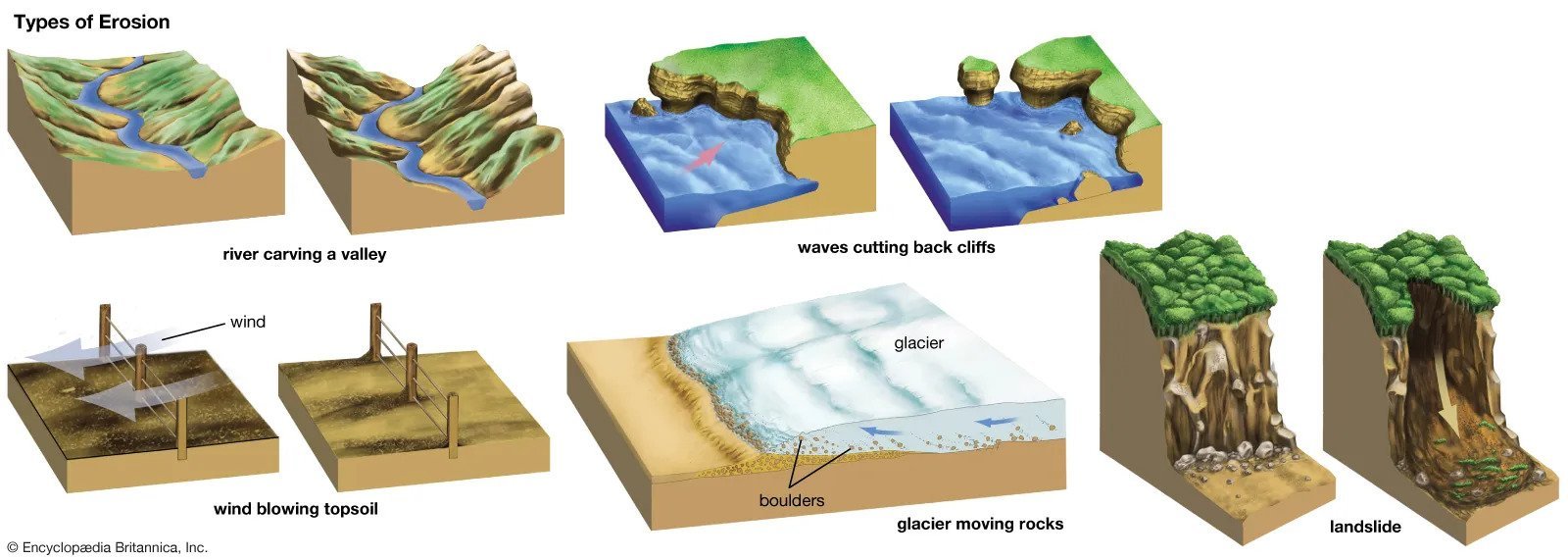
Erosion is defined as the geological process in which earthen materials are worn away and transported by natural forces such as wind or water. Valley erosion (sometimes referred to as stream erosion) occurs with continued water flow. The erosion is downward which deepends the valley, and headward, which extends the valley into the hillside, creating head cuts and steep banks. In the earliest stage of stream erosion, the erosive activity is dominantly vertical, the valleys have a typical V-shaped cross-section and the stream gradient is relatively steep. When some base level is reached, the erosive activity switches to lateral erosion, which widens the valley floor and creates a narrow floodplain.
Logging Requirements:
- Describe the valley that you see in front of you. What signs of erosion can you see, if any? Do you think valley erosion or lateral erosion is the most dominant force now?
- What evidence can you see in front of you that supports that this was once a plateau?
- By how many feet has the debris from the erosion and valley formation raised the floor of the Mississippi River valley?
- Upload a photo taken at the Orchard Overlook. You don't have to be in the photo though it is strongly encouraged.