Mount King George: The Highest Peak of the Royal Group
This small lock and lock container is located on the 3,413m summit of Mount King George. Mount King George is the highest mountain in the Royal Group, which is an area of 8 towering peaks in the Height of the Rockies Provincial Park. King George, a prominent 11,000' peak and one of the highest mountains in the Southern Canadian Rockies, towers 200 m over the next highest Royal peak. A journey to the summit of this mountain offers a little bit of everything: a river crossing, a (for now) decent trail through the bush, a beautiful bivy spot, stunning hiking up a glaciated alpine valley, some scree slogging, exposed scrambling on loose rock, snow climbing, ice climbing and glacier travel!
An adventure to the summit of Mount King George is a serious undertaking for experienced climbers and mountaineers only. The now "standard" route to the summit follows up the South Face, which is an alpine climb with mandatory snow and glacial ice climbing up to 40 degrees on a crevassed glacier. This geocache is an extreme challenge which requires mandatory glacier travel, snow & ice climbing, scrambling on steep terrain, mountaineering experience and all associated equipment including the mandatory use of ice axes and crampons.
Mount King George:
About the Mountain
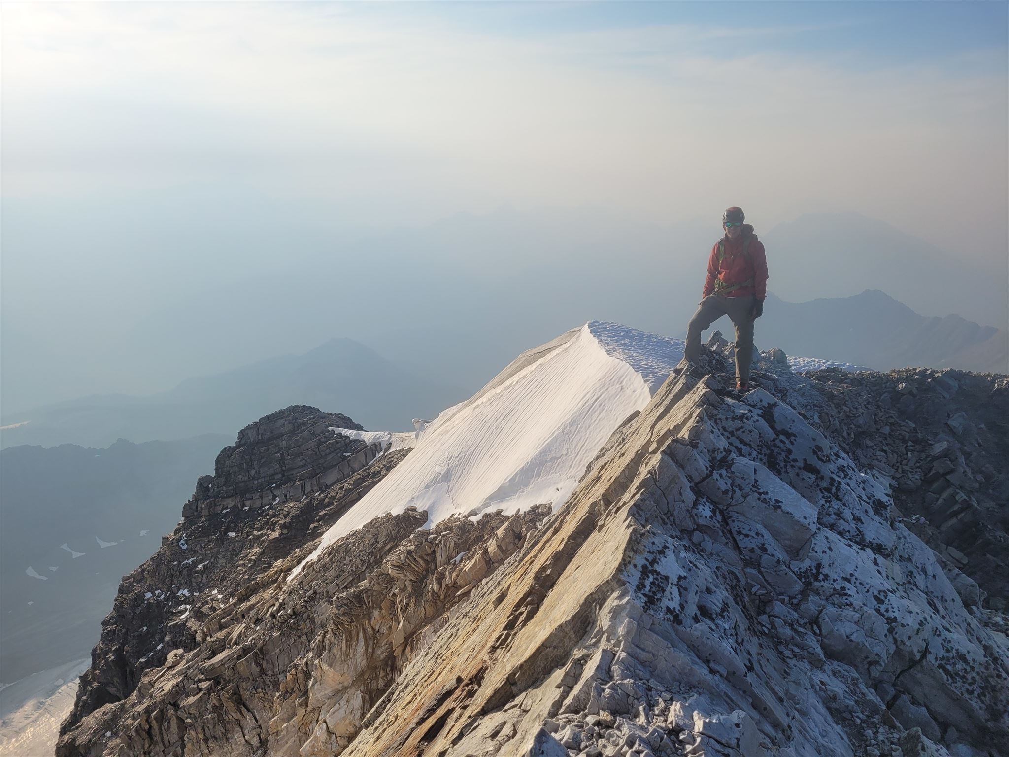
On the Summit of Mount King George:
Naming: The AB/BC Boundary Commission named the Royal Group for eight immediate members of the British Royal Family after World War I. The family head was King George V.
Climbing Season: July-September
Difficulty: PD+, 4th class (difficult) scrambling, snow/ice climbing up to 40 degrees, glacier travel
Trip Time: 2-3 days, overnighting at the bivy site. Approach: 5-8 h, Climb: 7-11 h, Deproach: 4-6 h, 16-25 h total travel time.
Total Distance and Elevation Gain: 30km, 2500 m gain. Approach: 10.5 km, 1000 m gain, Climb: 9 km, 1250 m gain, Deproach: 10.5 km, 250 m gain.
First Ascent: August 10, 1919 by Val Fynn with Rudolph Aemmer as guide
Second Ascent: 1970 (over 50 years later!!) by Gerry Brown, William Hurst and John Carter
The Approach
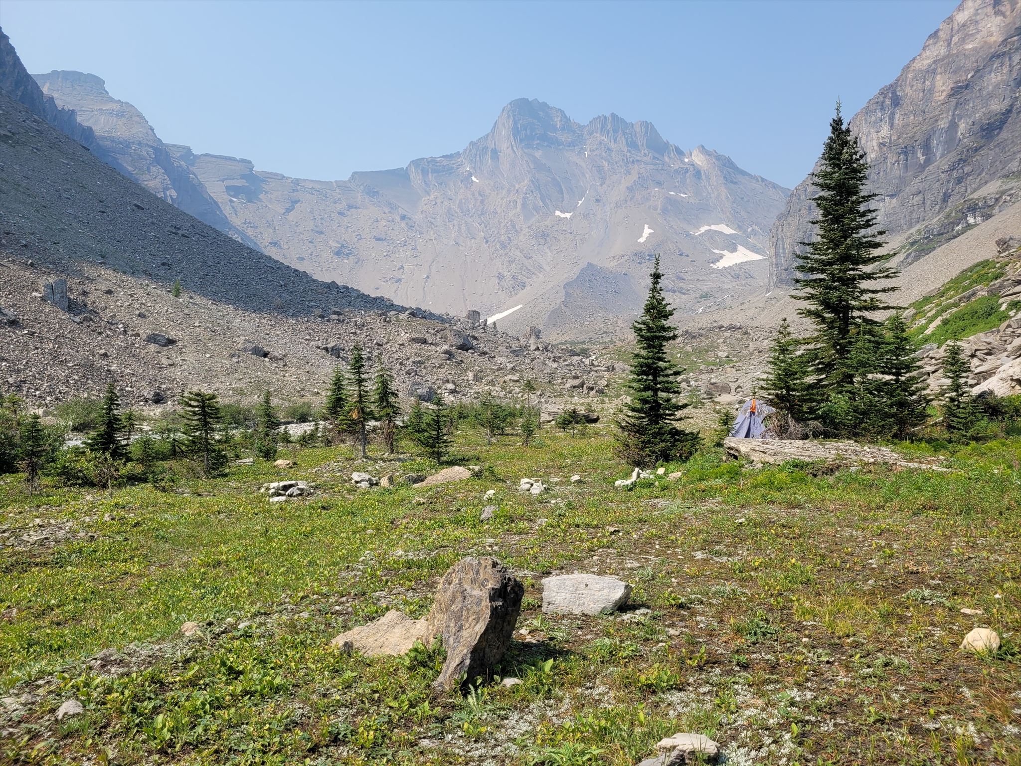
The Beautiful Bivy Site
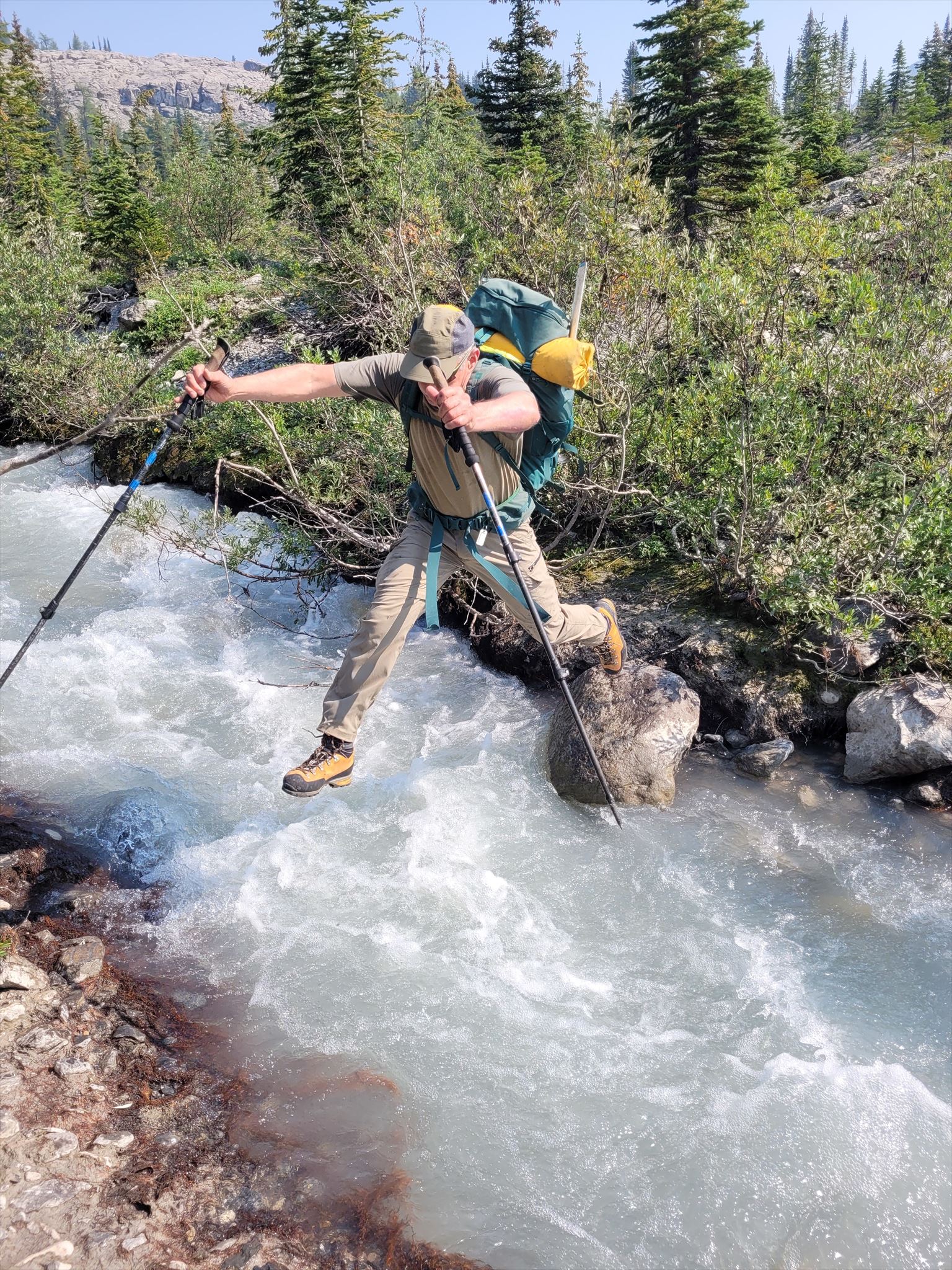
The approach to Mount King George may very well be just as difficult as the climb itself! Speaking from experience, the approach has turned me around on this mountain in the past. With a challenging river crossing through the sometimes raging Palliser River and possible deadfall littering the lower trail near Fynn Creek, it can be a very demanding approach.
That said, in the late summer, the Palliser River crossing is no more than knee deep at the provided fording waypoint. Even better, a kind soul who goes by Foresty Forest spent 3 days with a chainsaw in Aug 2022 cleaning the approach trail of ALL deadfall! For the most part, the lower approach is now a pleasant cleared trail through the otherwise impenetrable bush! Don't expect it to stay like that forever!
Pick up a cairned, flagged and chopped trail at the parking coordinates, follow down to the river, ford the Palliser, hike through the cutblock for 300m and you will arrive at the trailhead proper. Here, the trail parallels Fynn Creek for several kilometers. Further back, the trail turns right and heads through a hellish section of bush. If you're lucky, the trail will be beautifully cleared as a path of heaven! Higher up, the trail steepens as the bush is left behind. Head up the trail then turn left and traverse to climb up another ridge. The trail continues above a cliff then starts traversing left. Cross over the King George Glacier outflow creek at a point of your choosing (not simple!), then continue along the moraines aiming for the valley behind. You will have to drop some elevation and head left to dodge a steep cliff, then pick up a good trail on the left side of the cliff. This trail hikes steeply upwards for 15-20 more minutes to treeline and the beautiful bivy spot!
Hopping the King George Glacier Outflow Creek on Approach:
The Routes
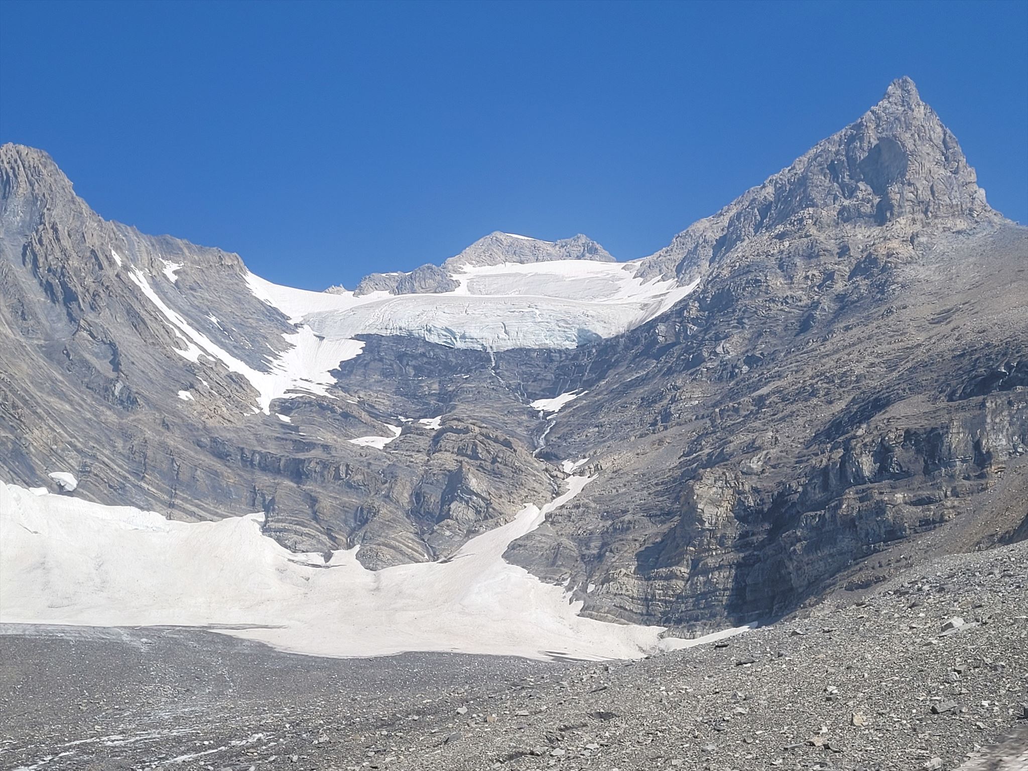
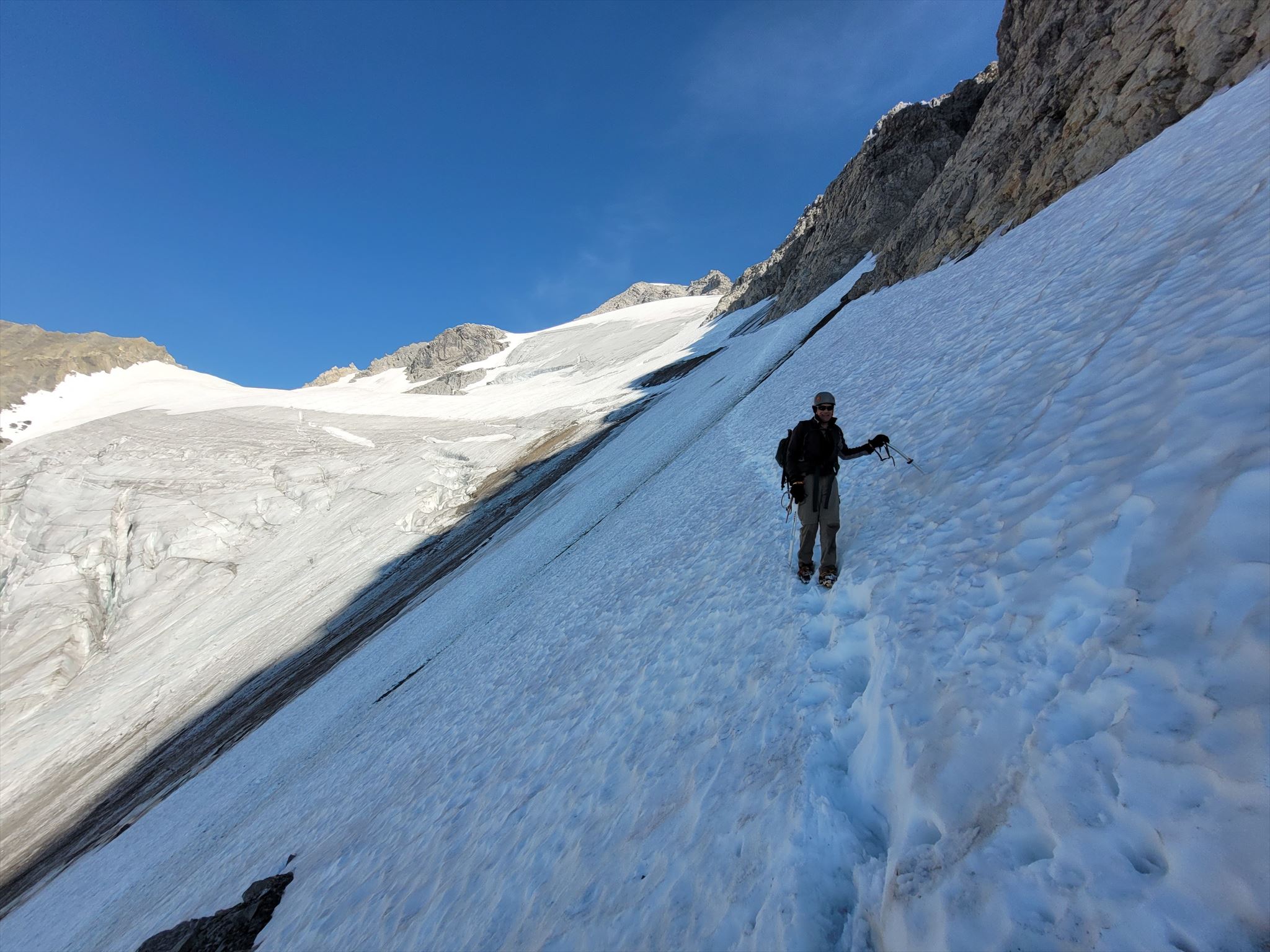
Snow and Ice Climbing on the South Face:
Standard Route: The South Face
Required Gear: Crampons, 2 ice axes, helmet. Recommended to bring a short rope, ice screws, harness and cord for abalakovs if you are not comfortable soloing exposed ice and snow.
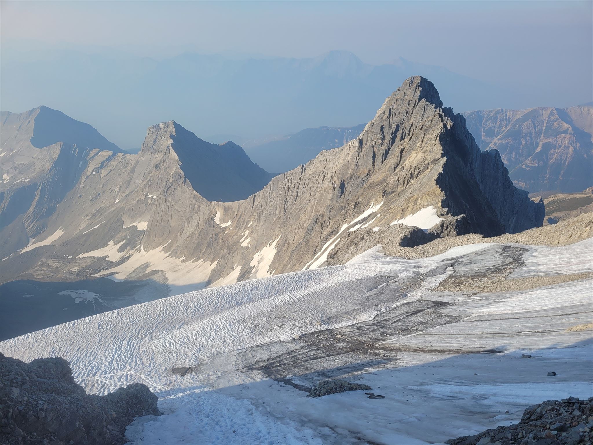
These days, the South Face is by far the most popular route to the summit of Mount King George. The route follows up a stunning glaciated valley to the west of Mount Princess Mary. Although the scrambling and climbing is by no means of great quality, the route has a huge aesthetic appeal when staring up from the valley bottom as it looks simply impossible from below.
From the bivy site beside the glacial runoff creek at treeline, begin by hiking up the moraines to the west of Mount Princess Mary towards the head of the valley. Around the bend, Mount King George will appear. The South Face looks incredibly intimidating from here, but perhaps you will still be hiking by headlamp at this point. Further up the moraine, you will want to take a right turn to head up steeply towards the Princess Mary - King George Col. Some of the gullies offer reasonably firm rock, otherwise there are some loose scree ramps as well.
At the col, the towering outlier of King George looms above you. Aim for this outlier. This is the most tedious part of the route as it's 300 m vertical gain on very loose scree (great on descent!). Eventually you will reach the steep rock at the outlier. Carefully scramble up loose 4th class rock to a cairned ledge, which provides access around the imposing cliffs. Traverse across the ledge following cairns and aiming for the South Glacier.
Arriving at the glacier, it's time to equip your crampons and ice axes! In early season the route is likely mostly snow, but in late summer it could be partially or fully ice. In early September 2022, we had a mix of snow and ice up to 40 degrees on the South Face. In early October 2022, a friend encountered 100% ice with no snow on the south glacier - very challenging conditions! Note that there are significant crevasses on the glacier and snow bridges can be weak in the late summer. Climb up and left on snow and ice to the summit block of King George. A final steep snow/ice section leads to a now melted out couloir, which offers 3rd/4th class scrambling to the summit. Congratulations, you are at the summit! Descend the same way you came up.
Some other routes on Mount King George include:
Northeast Ridge: Low 5th. The route taken by the first ascensionists in 1919.
West Ridge: Low 5th. Probably inaccessible these days due to the rapidly receding glacier.
Southeast Ridge: 5.3. The former "standard" route, the chutes are now said to be slimy and wet.
East Face: 70 degree ice. Several difficult routes exist for high-level mountaineers.
Safety Blurb
The terrain to reach the summit of Mount King George is very technically challenging, requiring a significant approach through the bush, mandatory glacier travel, scrambling on loose and very exposed 4th class terrain, mandatory snow and ice climbing, a significant rockfall hazard, significant crevasse hazard, and 2-3 days all at high elevations deep in the backcountry of the Canadian Rockies. This is probably one of the most difficult geocaches in Canada. Do not underestimate the challenge of this summit. You must be trained in and have experience with glacier travel, crevasse rescue, self arrest techniques, snow and ice climbing, scrambling in the Canadian Rockies (loose rock) and general backcountry travel. You must also come prepared with all the required mountaineering equipment and at least one similarly skilled and equipped partner. Crampons and an ice axe are mandatory, I recommend bringing 2 ice axes. A rope and ice screws are probably a good idea to bring if you expect a significant amount of ice. There are many places in which a fall on the rock, snow or ice would be fatal. The rockfall and crevasse hazards are also very high. If you are not 100% confident in your skills or abilities, hire a mountain guide.
Note: Without the hint and spoiler photo, this geocache may be extremely difficult to find in adverse conditions. If the mountain is not completely snow free, the geocache is likely impossible to find. Plus your ascent will be very challenging and hazardous in snowy conditions. Bring copies or have access to the spoiler photo to aid in your search. Note: the geocache is not the summit register.
Mount King George is a fantastic adventure! The journey from the banks of the Palliser River to the summit is a very worthy campaign for experienced mountaineers who have all the necessary skills and equipment to travel through the various terrain. The varied nature of the route provides an interesting challenge, as every hour you will be doing something different. Have fun & stay safe!