Theodore Roosevelt National Park is located in the badlands in western North Dakota. It honors U.S. President Theodore Roosevelt, who first came to the North Dakota badlands to hunt bison in September 1883 and he fell in love with the rugged lifestyle of the West. Roosevelt invested in ranching and spent two years living in this area. His adventures in "the strenuous life" outdoors and the loss of his cattle during the winter from 1886 to 1887 helped influence his pursuit of conservation when he served as President from 1901 to 1909.
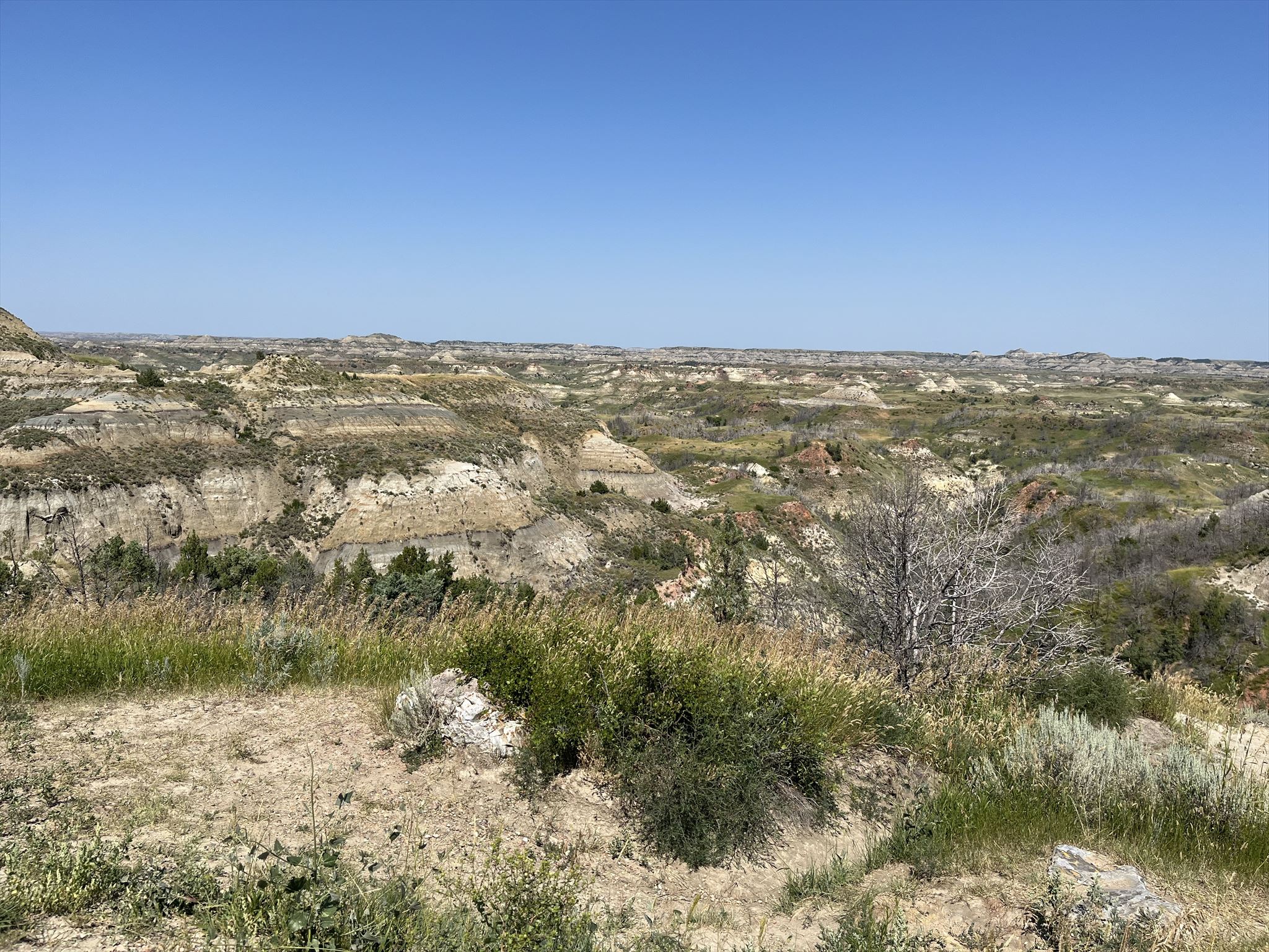
To the Lakota, this land is mako sick which means bad land or bad earth. The French fur trappers called it les mauves terres a traverser which means the bad lands to cross. From this overlook, you'll be able to understand exactly how this place earned its name. The oldest layers in the Little Missouri badlands were formed about 65 million years ago when the Rocky Mountains were being uplifted. Sediments such as sand, silt, and mud were eroded and carried off the eastern slopes by ancient rivers and deposited here in layers. The main rock formation you see in front of you is bentonite which erodes easily. When this clay is unprotected by more durable formations, erosion produces a pattern of irregular gullies known as “badlands”. Different features such as domes (formation in shape of a dome), ravines (deep narrow gorges with steep sides), plateaus (areas of relatively high level ground), tunnels, and arches can be found in badlands.
This area contains coal beds which can be ignited by lightning strikes and prairie fires and they can burn for many years. When a coal bed burns, the overlying sediments are baked into a hard natural brick that geologists call clinker, though it is known locally as scoria. The red color of the rock comes from the oxidation of iron released from the coal as it burns. The burning lends both color to the badlands and helps to shape them. These hardened rocks are more resistant to erosion than the unbaked rocks nearby. Over time, erosion has worn down the less resistant rocks, leaving behind a jumble of knobs, ridges, and buttes topped with durable red scoria caps.
Please remain on the trail at all times to hep preserve the site for future generations to enjoy.
Logging Requirements:
- Describe the badlands in front of you. What type of formations appear to be most common in these badlands (domes, ravines, plateaus, tunnels, or arches)? Why do you think this is the case?
- From the overlook, observe a scoria cap. How is it similar and how is it different from the rest of the badlands? Estimate the thickness. What can this tell us about the intensity of the fire?
- Estimate the proportion of the formations in front of you that contain scoria caps. Are they more of less common than you would have expected and why do you think this is the case?
- Upload a photo taken at the Badlands Overlook. You do not need to be in the photo though it is strongly encouraged.