Notice: "Cache seekers assume all risks and responsibilities involved in seeking this earthcache." “Just because it is there, doesn’t mean you have to seek the cache!” Don’t let earthcaching control you, but rather you control earthcaching.
Attention:
Please read the entire earthcache description before attempting.
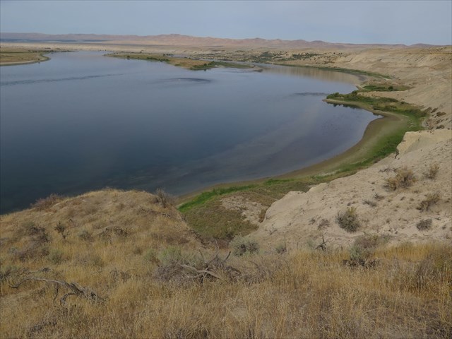
White Bluffs: Hanford Reach National Monument
The White Bluffs of Hanford is an ancient geological story as well as a recent one. From the Columbia River Basalt Group floods that laid down lava basalt some 13,000 feet deep and over a 10 million years period to the present drifting sand dunes, landslides and erosion that changes its topography.
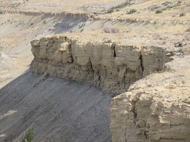
Waypoint 1: Ringold Formation
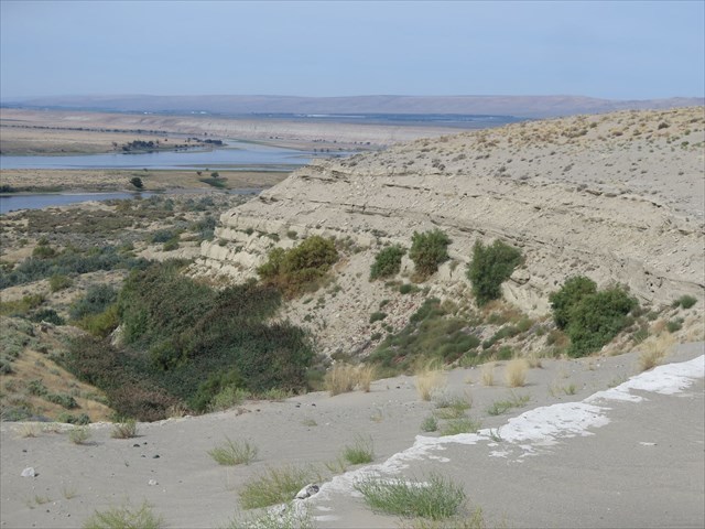
Stop for a moment at waypoint one and view the Ringold Formation. The formation was created between 3 and 8 million years ago after the lava floods ended. The formation is some 500 feet deep with 300 feet above the river level and another 200 feet below. The ancient Columbia and Salmon-Clearwater River deposited slack-water sand, gravel and cobblers over the lava basalt. As the rivers slowed and meandered, the area became a large lake system. Annually the lake and floodplain laid down layers of sand, slit, and clay above the pale gravels.
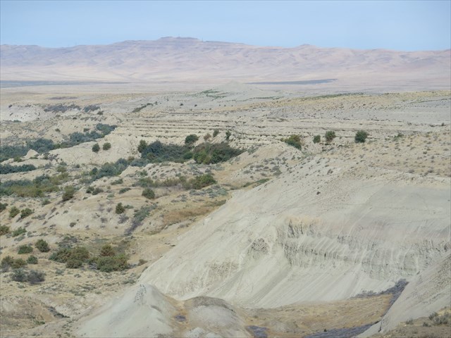
Waypoint 2: Landslide
Observe the Crown (the top of the slide that is left intact), the Scarp (the steep drop off from the crown), the Hummocks ( the flowing mounds in the middle of the slide) and down to the toe (the end of the slide and debris pile). These slides were caused by prolonged rainfall and water saturation into the lake deposits of clay and silt. The increased weight over the sand and gravel of the river deposits created instability in the ground and a slide occurs at the weakest layer due to gravity.
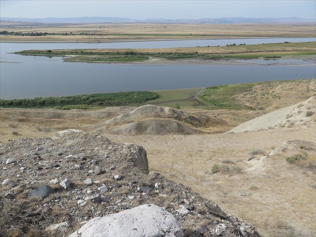
Waypoint 3: Erratics and Hummocks
As you traverse the trail, the texture of the trail surface changes from clay, to sand, to pieces of mixed granite and basalt gravel. At waypoint 3, small pieces of broken granite up to boulders size granite from northern Idaho maybe observed. These granite specimens are small erratics floated down and dropped by icebergs during the great Missoula floods 13-15,000 years ago. Also here, standing on the crown of a landslide is a couple of nice hummocks in view.
Waypoint 4: Lake Lewis Rhythmites
At waypoint 4 are more rhythmites, but these rhythmites are different from the earlier floodplain sediment layers at waypoint 1. The Missoula floods at the end of the last ice age created temporary Lake Lewis because of the bottleneck drainage through the Wallula Gap. The lake would fill and drain with each flood. Lake Lewis settled out layer upon layer of ancient sediments. Each layer is separated in time by wind-blown alluvial sands. Before the Missoula floods, the ancient Salmon-Clearwater River may have cut a channel through the Ringold formation from the east to the Columbia River then abandoned after the river changed it course to where the current Snake River flows. Alternatively, the channel may have been washed out with the initial Missoula Flood. The sediments from the lake filled the channel as seen today with rhythmites.
Final: Sand Dunes
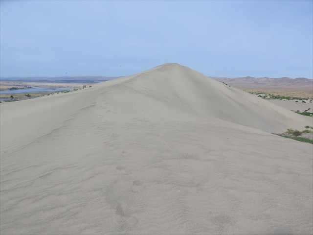
The landslides, as seen from the trail, have loosened the lake and river sediments. Over time the dry loose sands are picked up by the southwest prevailing wind and the material is deposited on top of the bluff. They are several hundred feet high. There are ripples on the dunes. The ripples have oscillations or regular variations that produce a waveform in the sand structure. These wavelength (crest to crest of the waveform) depends on the velocity (speed) of the wind and the weight of the material being moved. Notice the wavelengths are different from the east side and the west side of the dune due to wind velocity.
To log this Earthcache, please send a private message to me with the answers to the following questions.
1. How was the Ringold formation created?
2. Why is there a difference in the structure of the rhythmites at waypoint 1 and 4?
3. Why does the trail change in texture as you hike to the sand dunes?
4. At the finial, observe how the ripples on the dunes are different from the west side to the east side. Measure the wavelength of each side. That is to say, measure the distance from wave crest to wave crest of the waveform on the west side and then on the east side. Which side has a greater period and by how much?
Optional: You may upload a photo to the page of any local wildlife, unique vegetation or geology in the area.
Regulations - Provisions and Precautions - Safeguards
The White Bluffs: Hanford Reach National Monument earthcache is located on federal land and operated by US Fish and Wildlife Service. It is through their generosity that earthcachers are allowed access to the monument.
The final/virtual is located 2 miles from the parking area. The around trip may take over 2 hours. There is no need to leave the trail to make any observations. Before hiking White Bluff to the sand dunes, be aware of possible coyotes, snakes and ticks in the area. Never hike alone, bring water, wear proper clothing and hiking shoes. The hike is overland with an increase elevation of 400 feet. The trail is on the edge of some steep and possibly unstable slopes. Stay clear of cliffs and dropoffs.
The monument requires hikers to stay on the main trail. Don’t take any unimproved side trails to overlooks or unauthorized viewpoints. Don’t climb on any formations. Hikers may be injured by going off trail because of the steep hillside drop offs, cliffs or other unforeseen hazards. Leave rocks, vegetation and other artifacts in place where they may be enjoyed by others. Pets are leashed. “Motorized vehicles, horses, and bicycles are prohibited on the trail, as well as smoking, hunting, and fires.”
Earthcachers may find the quick elevation change and sand on the trail difficult to transverse. Trail etiquette requires all hikers respect the trail, keep everyone safe and protected on the trail. Leave no trace. Do additional research before embarking.
Directions: To access White Bluffs: Hanford Reach National Monument
1. Drive east from the Vernita Bridge on Washington County Road 24.
2. Turn south at the Small "White Bluff Area" sign onto the gravel road.
3. Turn west toward the Boat Launch on the paved road.
4. Park at the suggested parking coordiunate. There is no trailhead sign. Hike the well traveled trail north from parking lot.
Additional study and sources:
Video: The White Bluffs at Hanford Reach - Columbia River Free Flowing Stretch
Ringold Formation of Pleistocene age in type loclaity, the White Bluffs, Washington
The late Cenozoic evolution of the Columbia River system in the Columbia River flood basalt province