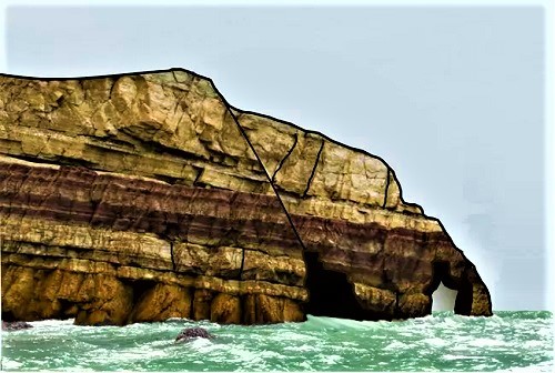
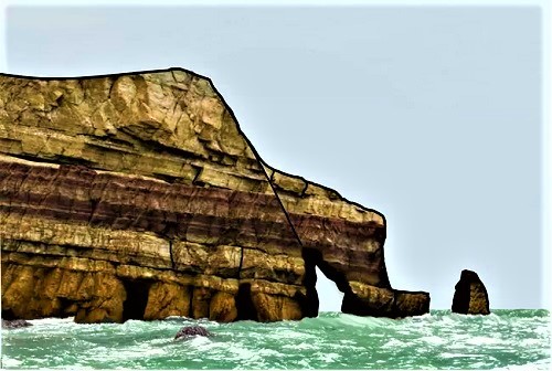
Tens of sea caves and other coastal karst landforms are to be found along the limestone coast of the Maltese Islands. Most of the sea caves develop around the present-day sea level, such as Blue Grotto, which is one of the widest and most spectacular sea cave on the islands. The Blue Grotto karst system is composed by partially submerged chambers, sea arches, gorges and small-scale landforms, such as coastal notches, and speleothems. Such landforms developed at the northwestern side of Wied Babu, in a half a kilometer wide bay near Żurrieq. This chapter presents the results of a detailed geomorphological survey of these coastal and karst landforms and discusses the origin and development of the studied landforms. The close relation with the sea level suggests that the system is partly related to former enlargement of dissolutionally widened karst voids and partly related to present-day marine processes, such as waves, and subaerial processes, including rock collapse. Although most of the species recorded from the environs of Filfla are common elsewhere around the Maltese Islands, in general, the recorded biotopes exhibit high species richness values, which is indicative of a low degree of anthropogenic pressure being exerted on the site.
Origin of sea caves:
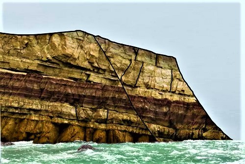
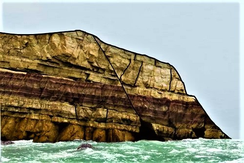
Sea caves or littoral caves are formed primarily from erosion caused by waves. They can be formed along the ocean coast and lakeshores where water impacts bedrock. Most sea caves are formed along weaknesses in the rock, such as faults, fractures, or bedding/foliation planes and can occur in nearly every type of rock.
1)Bedrock with fractures and large fault.
2) Caves develop as waves erode the faults and fractures near the edge of the water.
3) With continuing erosion, the cave becomes open at both ends forming a natural bridge or arch.
4) Arch roof collapse leaves behind a sea stack and further erosion turns another cave into an arch.
Coastal Erosional Features
As erosion progresses, the cave can become open at both ends to form a natural bridge or arch. When the arch roof collapses, it leaves behind a sea stack, no longer connected to the mainland above mean high tide. Caves and arches will continue to form as waves erode more of the bedrock.
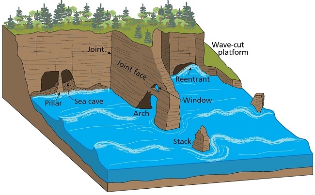
Illustration of coastal erosional features. Sea caves are erosional features that form in high energy tidal environments. Waves and the sediments they carry exploit and enlarge weak zones such as joints, faults, dikes, veins, and layers of soft rock in otherwise erosion resistant rock.
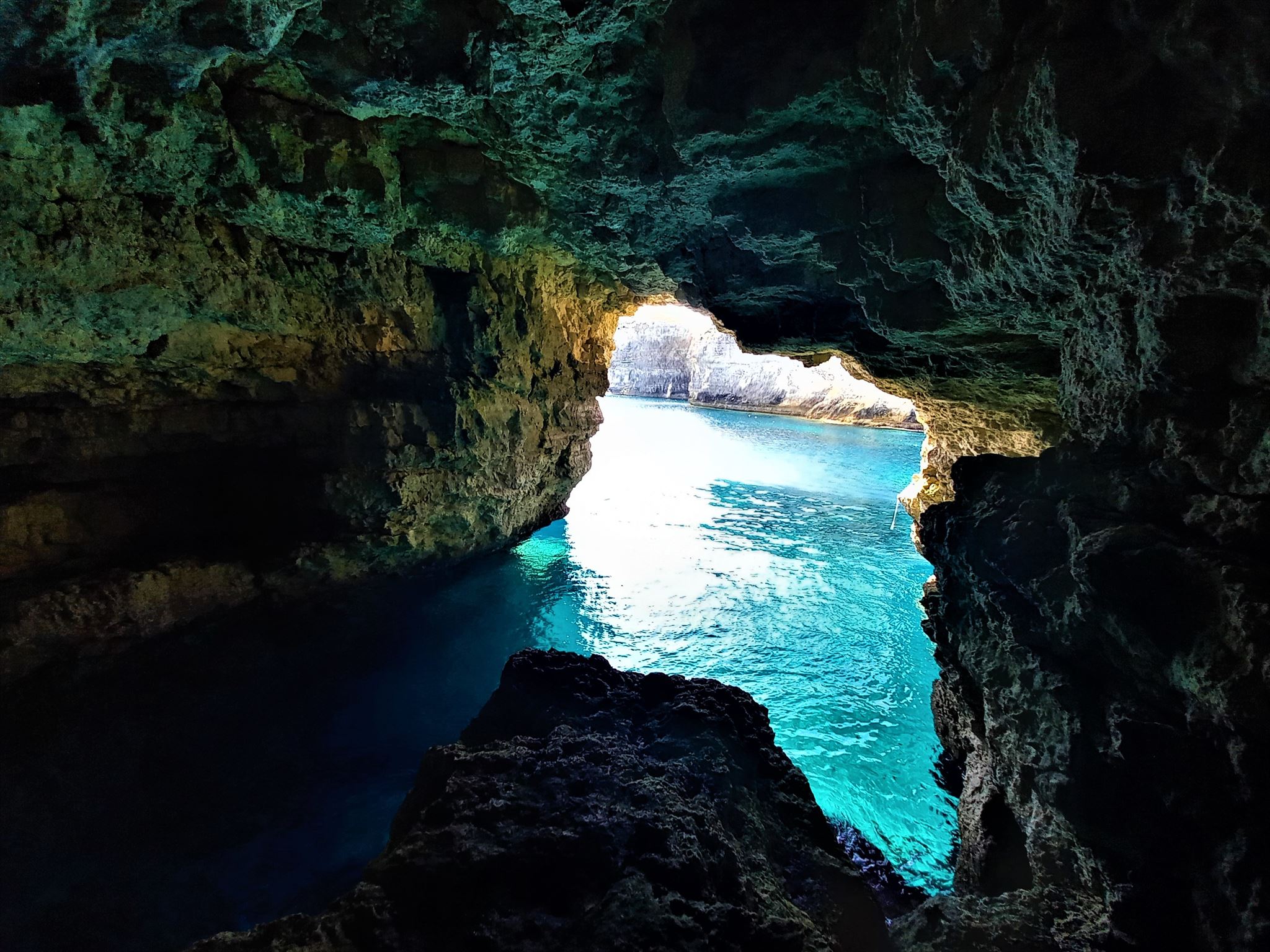
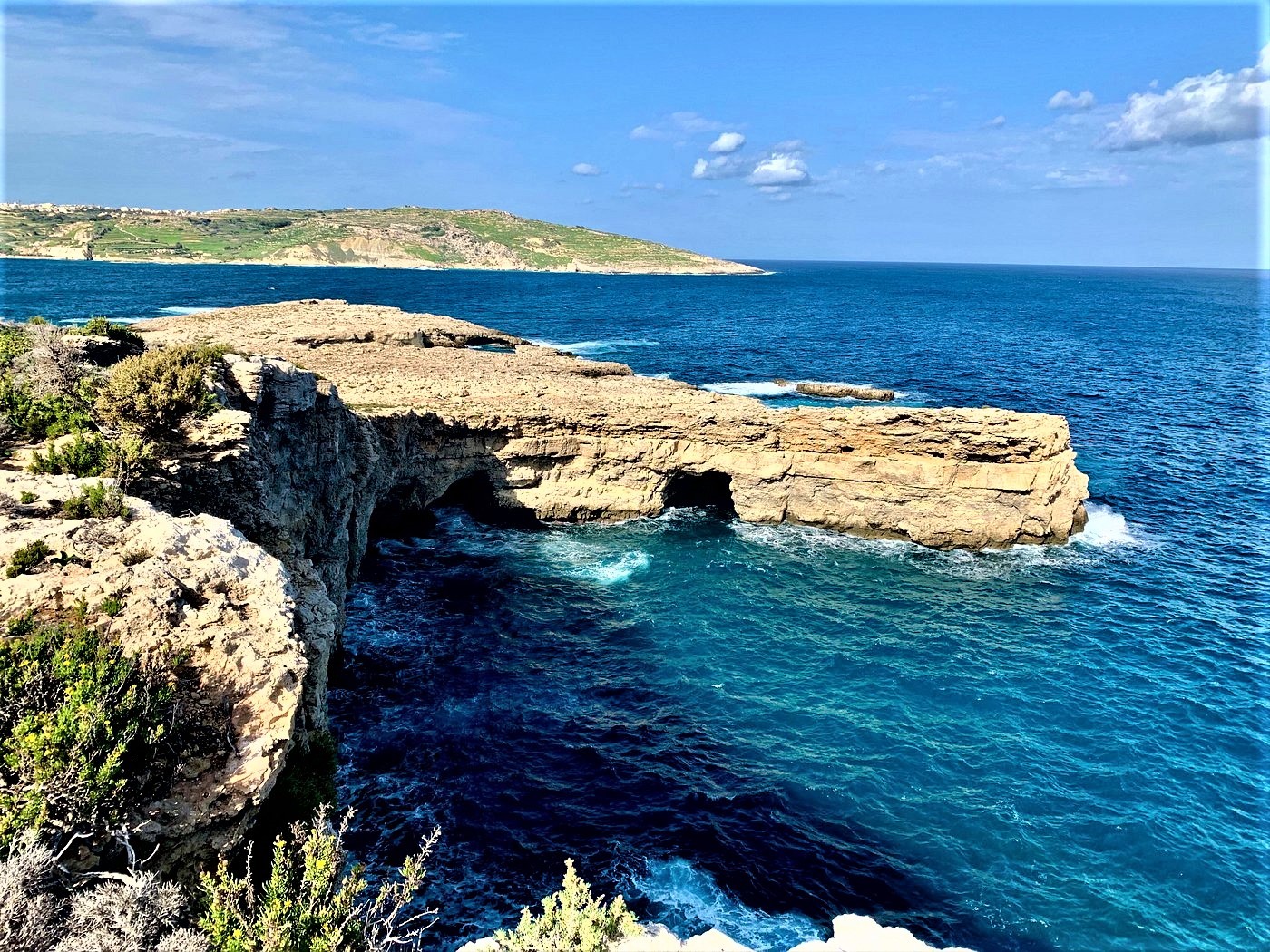
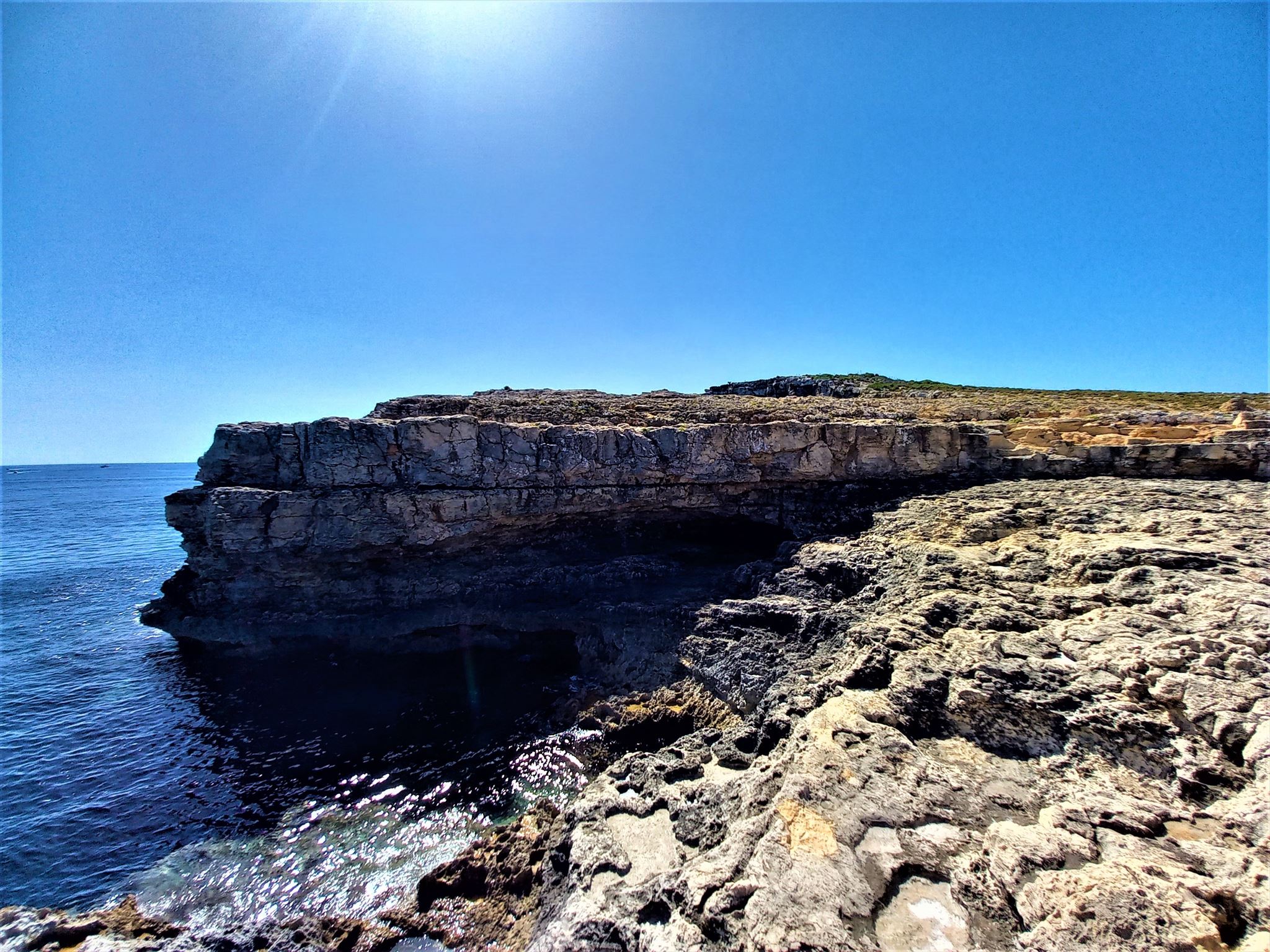
Santa Maria Caves is a shallow cave system located on the north-eastern coast of Comino Island near Santa Maria Bay, one of the most fascinating cave systems in the world. There are over ten caves and each of them has its own individual beauty. Some are completely submerged, where more experienced divers can dive and others only half, where snorkelers can dive. The caves are not deeper than 8 m, and they provide a view of the light zone through openings, crevices and cracks in the ceiling throughout the dive. In order to dive here, you need a certificate entitling you to dive at a depth of 18 m.

Conditions required for logging:
To log this cache you need to visit specific place – cave on coastline of Comino island on the coords of Earth cache, answers the following questions and reply me to an email in my profile.:
- Observe the surrounding of the cave and tell me how the cave was formed?
- What is the colour of the karst in front of the cave and in the cave? Are they different? What is it caused by?
- What is the width and height of the cave entrance?
- Measure the altitude at the entrance to the cave?
- Does the cave have an opening hole on the other side? If yes, is it under water or above water?
- Can you see other cave from Santa Maria caves system from this place?
- Please post a photo of yourself, or GPS with sea cave.
Feel free to log this cache. You do not need to wait for permission to log. If your answers are not correct, incomplete, I will contact you by e-mail. But if your e-mail is not coming to me within 3 days from your log, I will delete your log without notice

Kundizzjonijiet meħtieġa għall-illoggjar:
Biex tilloggja din il-cache trid iżżur post speċifiku – grotta fuq il-kosta tal-gżira Kemmuna fuq il-koordinati tal-cache tad-Dinja, twieġeb il-mistoqsijiet li ġejjin u rrispondini għal email fil-profil tiegħi.:
- Osserva l-madwar tal-grotta u għidli kif ġie ffurmat l-għar?
- X'inhu l-kulur tal-karst quddiem l-għar u fl-għar? Huma differenti? X'inhu kkawżat minn?
- X'inhu l-wisa 'u l-għoli tad-daħla tal-grotta?
- Kejjel l-altitudni fid-daħla tal-grotta?
- Il-grotta għandha toqba li tiftaħ fuq in-naħa l-oħra? Jekk iva, huwa taħt l-ilma jew fuq l-ilma?
- Tista' tara għar ieħor minn sistema ta' għerien ta' Santa Marija minn dan il-post?
- Żid mal-ġurnal ritratt tiegħek mal-għar tal-baħar
Ħossok liberu li tilloggja din il-cache. M'għandekx bżonn tistenna l-permess biex tilloggja. Jekk it-tweġibiet tiegħek mhumiex korretti, mhux kompluti, nikkuntattjak bl-e-mail. Imma jekk l-e-mail tiegħek ma tiġix għandi fi żmien 3 ijiem mill-log tiegħek, se nħassar il-log tiegħek mingħajr avviż.
