Theodore Roosevelt National Park is located in the badlands in western North Dakota. It honors U.S. President Theodore Roosevelt, who first came to the North Dakota badlands to hunt bison in September 1883 and he fell in love with the rugged lifestyle of the West. Roosevelt invested in ranching and spent two years living in this area. His adventures in "the strenuous life" outdoors and the loss of his cattle during the winter from 1886 to 1887 helped influence his pursuit of conservation when he served as President from 1901 to 1909.
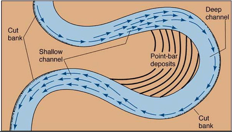
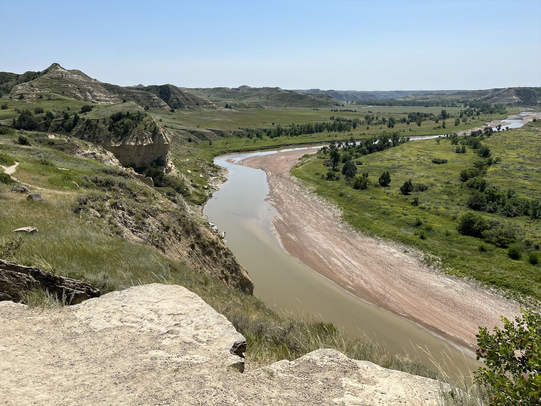
The listed coordinates will bring you to the Wind Canyon Overlook, which overlooks the Little Missouri River. Cut banks and point bars are two features that can often be seen along meandering rivers. Both processes occur in pairs. As rivers flow, they erode soil and create banks. You may sometimes hear cut banks being referred to as river cliffs, and are banks that are nearly vertical. Cut banks are found on the outside bend of a river and are caused by the moving water of the river wearing away the earth. In contrast, point bars are located on the inside bend of the river. As the river curves around the bend in the river, the water slows down and sediment is dropped to the river bed. The sediment deposits build up over time and form a point bar. You may be wondering why cut banks are always on the outside bends of rivers while point bars are on the inside bend. The reason has to do with where the maximum velocity, which is located on the outside of the bend, while the lowest velocity will be found at the inside of the bend. This can also cause a river to move sideways or form oxbow lakes (formed when river becomes more curvy until the river ultimately loops back onto itself and then flows along the straighter path and forms a cutoff).
Logging Requirements:
- From the overlook, describe the point bar and estimate its width.
- Looking at the outside bend of the river, describe the cut banks. Do you see any vegetation? How do you think this influences the formation of cut banks?
- If you compare both banks of the river (the side you are standing on versus the side directly across), they look completely different. Why do you think this is the case?
- Do you think an oxbow lake will eventually form here, why or why not?
- Upload a photo taken at the Wind Canyon Overlook. You do not need to be in the photo, though it is strongly encouraged.