Introduction
I have visited the Chobe NP with the safari tour and also with other events, but I was little disappointed, there is no relevant geocache (traditional, EC, virtual) to easily find or solve. Because I am geology enthusiast, I would like to invite you for this easy earth cache, which introduce you some geological facts, so typical for this part of Africa.
Geology of Chobe area
The main area, which Chobe national park belongs to is so called the Ganzi-Chobe belt. This belt defines a linear zone of volcano-sedimentary rocks that form inliers through the Kalahari Desert of western and northern Botswana. Geological investigations along the Ghanzi Ridge have revealed a sequence composed of a basal bimodal volcanic suite with minor intercalated sedimentary rocks, termed the Kgwebe Formation, and an upper siliciclastic sedimentary unit with subordinate carbonates, called the Ghanzi Group. To the northeast in the Chobe District, basal volcanics informally termed the Goha Hills Formation are overlain by carbonate-bearing siliciclastics assigned to the Chinamba Hills Formation.
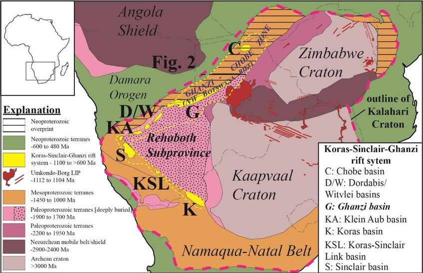
Geochemical analysis and field relations of the Kgwebe Formation volcanics indicate that the sequences were accumulated in a continental rift basin. Rifting was initiated by extensional tectonics associated with a continental collision along the Namaqua-Natal Belt. The Kgwebe Formation volcanics started to accumulate during Mesoproterozoic times (1,1 miliard years ago). The depositional basin developed from fluvial and lacustrine systems during the accumulation of the Kgwebe Formation, into an extended shallow marine basin that accommodated the Kuke, Ngwako Pan, D'kar, and Mamuno Formations of the Ghanzi Group.
Pedological conditions (soils)
As already written above, the bedrocks of African savanna soils are mostly igneous and sedimentary, but metamorphosed rocks can also occur and they are created from ignaeous or sedimentary rocks by the influence of high pressures, extremly high temperatures and time. During the genesion of soils, tropical weathering and soil-forming processes take place and are important for the soil creation. The upper horizon of the soil has a low humus content due to the rapid decomposition of nutrients. In addition to other pedogenetic processes, the process of fertilizing, so called ferritization and feralitization takes place.
The main condition for the ferritization and feralitization is a tropical or subtropical climate with a long dry period, when the soil dries out for the most part of its depth. The fertilizing process releases a large amount of Fe2O3, which often creates concretions. The best developed ferratic soils are formed in places, where rainfall does not exceed 1000 mm and the dry period lasts up to eight months here. In dry savannas, red-brown soil and reddish-brown soil are developed from ferratic soils.
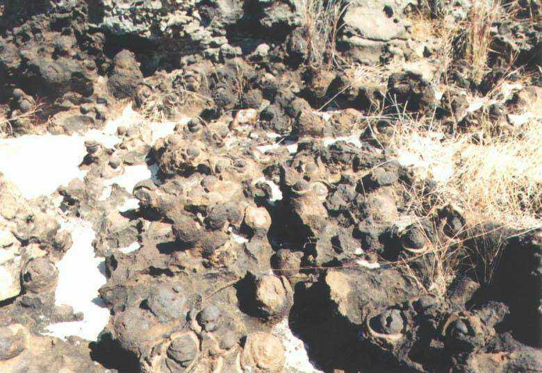
Lateritic weathering
So-called lateritic weathering is typical for this part of Africa. Soils are formed by feralitization - laterization in a constantly humid climate with the presence of equatorial, tropical and subtropical forests. Feralitic soils have a large amount of free Fe2O3 and Al2O3, which is accumulated here as a result of the strong relation of silicic acid. The most of the substances are dissolved, such as quartz, sodium, potassium, magnesium, calcium, etc. and in the end, only the residue that does not dissolve remain, and it consists mainly of iron and aluminum oxides and this is called laterite
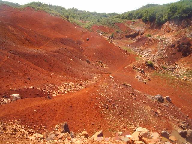
This type of soils are the oldest and deepest soils on Earth. They are very intensively weathered and their depth reaches from 2 to 20 meters, in some cases even more. The top of this soils has a low humus content (around 1% to 3%) because organic material is rapidly decomposed and consumed by lush vegetation.
We can find two types of feralitic soils in the savannas:
1.The first type is the typical red laterite soil of the savannah. It is formed in a hot tropical climate with a significant rainy and dry season. The annual amount of precipitation ranges from 1000 to 1500 mm. The determining pedogenetic process is feralitization, which takes place during the rainy season. During the dry season, the grass dries up and the surface heats up above 50°C. This creates numerous hard iron-manganese concretions 1-2 mm in size. These red laterized soils acquire a "pseudo-sandy" character. The amount of plant material is considerable and it is rapidly mineralized. Therefore, there is only 2-3% humus in the upper part of the soil. Red laterite savanna soils cover vast areas of Africa. They are relatively fertile, but so far they are used by primitive agriculture or not at all. With proper cultivation and fertilization, they would provide high yields of agricultural crops.
2.The second type of feralitic savanna soils are laterites, more recently referred to as
plinthine. This type of soil has a red or yellowish color and strongly dries out (dehydrates) noticeably. A horizon with high iron and aluminum content can harden into a compact conglomerate. This creates easily-disruptible soil crusts and hard-to-disrupt hard armor. Their color depends on the chemical composition of the soil. A high ferrum content colors the soil to red and purple, light red and pink soils are rich in the element aluminum. The presence of silicates is evidenced by a gray or beige coloration.
* * * * * * * * * * * *
Your tasks are:
1) Visit Chobe national park and try to notice rocks and soils conditions around.
2) According to listing and your observations in the national park, what colors of soils did you find, and why are they colored so?
3) What do you think, what type of ferralitic soils, the Chobe soils are? The red latheritic soil (1.) or plinthine (2.)? Why?
4) At the GZ what is your altitude according to your GPS? Is it too high or to low for conditions of latherite soils genesion? Why?
5) Mandatory task - At the GZ, there is a big black stone board with description of the Chobe national park history (there is a rhinoceros symbol above). Please post a photo here and add it to your log. It is a proof for me, that you have been here.
6) Voluntary task - Please post a photos of your adventure in national park Chobe and add it to your log. I will love too see it.
* * * * * * * * * * * *
Your right answers send me via message center or email through my profile, than you can log your visit. If your answers aren't correct, I will give you an echo. Please respect a rule - 1 log = 1 email with answers. In that case i will be uncompromising, who will log without sending answers, he will be deleted. It is a proof for me, that you were there and do something for a point. And please no retrespective logs from your sofa!
* * * * * * * * * * * *