This cache looks at the Strike and Dip that can be seen in the Canyon Walk near Bright, a beautiful, dog friendly walk.
To measure and describe the geometry of geological layers, geologists apply the concepts of Strike and Dip.
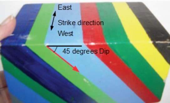
Strike refers to the line formed by the intersection of a horizontal plane and an inclined surface. This line is called a strike line, and the direction the line points in (either direction, as a line points in two opposite directions) is the strike angle.
Dip is the angle between that horizontal plane and the inclined surface (such as a geological contact between tilted layers) measured perpendicular to the strike line down to the inclined surface.
The following will help understand these concepts better.
Sedimentary rocks, under the influence of gravity, will deposit in horizontal layers
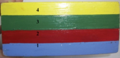
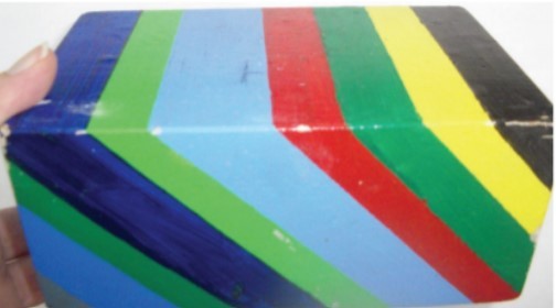
Once sedimentary rocks are subjected to tectonic forces, they may be folded, tipped on edge, chopped up by faults, or even overturned.
Dip refers to the downward angle at which the tilted beds now lie. A dip of 90 degrees is vertical/straight down.
Strike is more complicated. This is the direction the beds point when looking along the layer and is always a compass direction exactly 90 degrees to the direction of the dip.
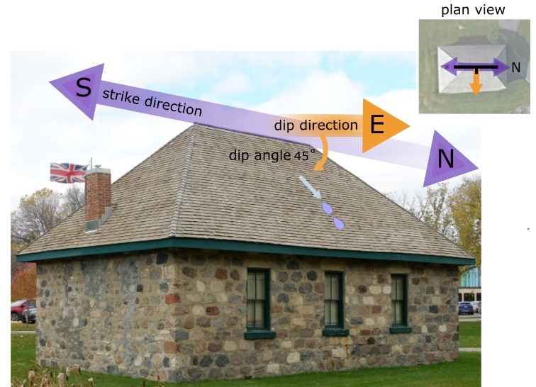
The sloping roof on a one side of a house can be used to demonstrate Strike and Dip. The ridge line of the roof defines the Strike of the roof and runs in a North / South direction. The roof Dips away at a 45% angle down.
Now on to this Cache
The Ovens river cuts deeply into the bedrock here forming a canyon. At GZ, you can see ribbons of rock, and the steeply dipping bedrock bars exposed as you look up the river. Near GZ along the walking trail, there are also numerous tail races. These are deep, narrow slots cut into the bedrock at right angles to the river. These were cut by hand by the early gold miners to allow tailings (treated earth and gravel) to be washed away from their workings.
Logging requirements.
The cache can be logged at the same time as the answers to the following questions are submitted by separate email to us (no need to wait for a confirmation email first however, answers must be sent within 10 days or your log may be deleted).
1. Looking at the exposed bedrock bars near GZ (as seen both along the river as well as inside the tail races) what is the rough dip angle of the bedrock (remember, vertically straight down would be 90 degrees).
2. What is the general Strike Direction of these bedrock bars?
3. Post a (non spoiler) picture in your log of a team member or something representing your team, in front of or inside one of the tail races through the bedrock near GZ.
Source LibreTexts Geosciences