This elaborate multi cache covers the middle section of Israel National Trail, starting at Tel Aviv and ending in Jerusalem mountains.
In order to find the cache you need to visit all stages of the multi. There are 50 stages overall.
Don't be alarmed by the magnitude of the trail and the task. Take your time. You can walk the Israel National Trail in successive days as a one long trip like some people do (4-7 days of trekking depending on your pace and if you skipped the gaps), or break the trail into daily sections, or even do a short hike each time.
Or just use this multi as a road map to walking trails in central Israel. And more importantly, enjoy the trail, enjoy nature and the sites - i hope this quest will enrich you as much as it did to me.
Some stages can be park & grab. Others may be bike & grab for cyclists. And there are stages with higher terrain and significant hike.
Although there are many stages, they are usually grouped into the more attractive parts of the trail. While there are sometimes even 10km gaps in between the groups. So you don't really have to walk the entire length of the trail if you don't want to.
Difficulty and terrain are based both on accumulative effort and on the more challenging mountain parts.
Estimated distance: Minus the sections that were skipped (unless you insist on walking all the bends of middle Yarkon) - i roughtly estimate the trekking at 50km+
Estimated elevation change: 5 mountain ridges difficult climbs/descents, but don't underestimate the hills, probably 1500-1700 meters.
The majority of stages are virtual, you find the clue on a sign / memorial / other more unique objects.
Part of the stages are marked as virtual here, but you need to find a physical traditional cache i hid on the trail. In that cache you find the value needed written down at the top of the logsheet. These specific caches are published at the same time as the multi. These physical caches can serve as an incentive to do part of the trail, and vice versa. While doing the multi, you will find many new caches.
Public transport: This multi cache is easily doable with public transportation. Although few exit points require lengthy walking to bus stations.
Key stations can be found at - Baptist village on route 40 or Yarkon interchange, entrance to Elad, Mitzpe Modiin (Ben Shemen), Ishpro Center south of road 431, Latrun junction, Mesilat Zion on road 38 (There is a bicycle trail along 38 to walk towards station), Beit Meir, Tsuba on 395 (cache is still there if you consider a piece of paper a cache), Sataf junction, Hadassah Ein Kerem hospital (there is a path along the road towards Ein Sarig).
Posted coordinates are at Yarkon estuary, Israel National Trail going from this point eastward. The eastern most stages nearly reach Jerusalem near Hadassah Ein Kerem hospital.
Final location can be anywhere between posted coordinates and the eastern most stage, even beyond, or not near the trail at all. Basically it can be anywhere :)
FTF: The first to pass successfully through all stages, get a green light in checker, and find this great multi cache - will find unregistered tb, will get a special recognition here (along with STF and TTF), and will always be able to say they were the first to complete the Israel National Trail multi-cache of central Israel.
Banner: Anyone who successfully completes the multi, can put a special logo on their profile page.
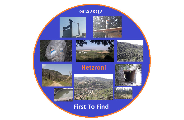
Congratulations to hetzroni who completed the great multi in 18 days -
The multi:
(Note - when there are signs in multiple languages, read the English part, like in A1)
(Tip - take photos of signs/clues - also of nearby ones if there is doubt which sign, so that later i can relate better if there are issues)
(March 2025 update - Since officially the trail in D section was relocated, adding new options for D1-D4 in new locations on the new trail)
Posted coordinates - A1: See photo A1, read the right sign. The first year mentioned - 19??=A1 (two digits)
A2: The first century mentioned. A2=?th
B1: Walk on the pedestrian bridge over the river, find the series of bird drawings in black. Find bird in photo B1. B1=its position if you start counting from right end.
B2: On Ayalon bridge there are paintings of people. B2=Number of people wearing glasses (including on top of head)
B3: find the object. B3=First number mentioned in the explanation plaque.
B4: Right beyond the park, where the dirt road starts, turn right and find the religious eruv pole (marks TLV border) with trail mark. B4=Number of pole as written on sticker.
C1: The first number mentioned in the sign
C2: What is the right-most forbidden activity in the sign?
Camping=C2=1 Fishing=C2=2 Fire=C2=3 Loud noise=C2=4
Bathing=C2=5 Littering=C2=6 Loose dogs=C2=7
C3: What is the bottom-right forbidden activity in the sign?
Camping=C3=1 Smoking=C3=2 Fire=C3=3 Loud noise=C3=4
Drinking wine=C3=5 Littering=C3=6 BBQ=C3=7
C4: The first number mentioned in the sign (not the pillbox sign but on the other side of the trail)
D1: First number mentioned in the sign.
D5: (new trail option for D1) Find GCB4VW5
D2: See photo D2, Find the cement pole and the poem at the bottom. D2=Number of letters in the last line.
D6: (new trail option for D2) Find GCB4W14
D7: (new trail option for D2) Find GCB4W4X
D3: Find the memorial plaque. D3=Number of letters in the 2nd line.
D8: (new trail option for D3) Find GCB4XD8
D9: (new trail option for D3) Find GCB4XE6
D4: Find the blue face graffiti at the beginning of tunnel (east side, south wall). What is the color of his shirt?
Red=D4=1 Black=D4=2 Purple=D4=3 Green=D4=4
White=D4=5 Silver=D4=6 White=D4=7
Da: (new trail option for D4) There are two signs with opening hours. D1=larger hour number - smaller hour number - 2
E1: Find the memorial plaque a little off the trail. E1=Higher number-lower number (age).
E2: Go to the trail info station. E2=Distance to next sign.
E3: Find GCA8T4P
E4: Fine the memorial plaque a little off the trail. There is a bible verse of Isaiah, chapter 41. E4=Number of verse in the chapter.
E5: Find the panoramic sign. It shows names of places within the panoramic view. E5=Total number of letters in the first and second places starting from the right.
F1: Find the unique memorial with 7 art pieces. F1=Number of soldiers in left art piece.
F2: Walk to entrance gate of monastery. What is the bottom-left forbidden activity in the sign?
Dogs=F2=1 Guns=F2=2 Wearing bikini=F2=3 Smoking=F2=4
Eating food=F2=5 Littering=F2=6 Shouting=F2=7
G1: Enter the cemetery and go to the right most grave (few meters from entrance). The headstone has black writing with the dates of birth and death. Age is 45 (to make sure you are at the right spot). G1=Day of birth in February.
G2: Find the small corner sign in the bend of the serpentines (it doesn't face the trail). G2=Total number of words in the sign.
G3: Find GCA8T4E
G4: Near the beginning of a side trail there is a tree with a flag attached to it, and the country's name.
G4=1=France G4=2=Germany G4=3=Spain G4=4=Italy
G4=5=Greece G4=6=Netherlands G4=7=Austria
H0: In Mahal Munument, find the golden/yellow memorial plate. H0=First number mentioned.
H1: Find GCA8T3C
H2: Find GCA8T3V
H3: Find GCA8T43
H4: Check the memorial columns decorated with leaves with numbers. In the 3rd column (when coming from trail), in the middle page/list out of three (there is only one column with three lists), H4=smallest number in leaf.
H5: Find the plaque behind the tree, near the existing cache. H5=First number mentioned (day in month).
J1: Go to the trail info station. Read "sites" section. J1=Number mentioned (one digit).
J2: Find GCA92QV
J3: Find GCA92RN
J4: Find the plaque as seen in J4 photo. J4=First number mentioned.
Note - There is bad or no reception of cellular at this low point surrounded by ridges, make sure you have available the photo and info beforehand (though GPS is ok).
K1: Find the memorial plaque. K1=Number of Jewish communities listed in two columns (uneven number).
K2: Find GCA8ZJN
K3: Find the memorial plaque. K3=Total number of letters within the parenthesis.
K4: Near a sign about a bike trail, there is a standing rock memorial. What country appears in the bottom plaque?
K4=1=USA K4=2=Canada K4=3=Mexico
K4=4=Argentina K4=5=Brazil K4=6=Chile
L1: Find GCAR9QH
L2: Find GCA9C3C
L3: Find the trail info station, when coming from Sataf site and going up. The first year mentioned - 19??=L3 (two digits)
OR
When coming from the other direction (sign is double-sided) - under route -
L3=(2nd number-1st number) / 2 , that will give same result
M0: Find GCA9C5D
M1: When entering the northern opening to the tunnel, search on your right, head high, for the clue value on the wall.
M2: Find GCA9CV4
M3: Find GCA9CVK
N1: Check the plot on the east side of the trail, what is the number of the plot of vines on the sign?
N2: Find GCA9EYK
N3: Find GCA9F0F
Solution:
Summarize each group of clues, A, B, etc..
Suggestion - you can verify with me each summary solution (A, B, etc...) or even specific clues (A1, B5, etc...). Send me a message with a visual proof of visiting the place, and your answers. And i will confirm.
Solution is in this format, for example -
A=4 B=3 C=21 D=8 E=34
Enter your solution in the checker to discover final location.

You can validate your puzzle solution with
certitude.