The Chena River is a significant waterway that flows through the interior region of Alaska. It stretches approximately 100 miles, starting from the Chena Lakes near Fairbanks and eventually merging with the Tanana River. The river is known for its pristine waters, which originate from melting glaciers in the surrounding mountains. The Chena River plays a crucial role in the ecosystem, supporting diverse wildlife and providing a range of recreational activities such as fishing, boating, and wildlife viewing. Fairbanks is often referred to as the "Golden Heart City," and is the second-largest city in Alaska. It is located in the heart of the state, nestled along the banks of the Chena River. Fairbanks serves as a major hub for both tourism and commerce in the region. The city has a rich history, dating back to the gold rush era of the late 19th century when prospectors flocked to the area in search of fortune. Today, Fairbanks offers a unique blend of urban amenities and untouched wilderness, attracting visitors with its cultural attractions, outdoor adventures, and proximity to the breathtaking natural beauty of the Chena River and surrounding landscapes.
River flooding is a natural phenomenon that occurs when a river overflows its banks, resulting in the inundation of adjacent land areas. Several geological factors contribute to river flooding. Firstly, the topography of the surrounding land plays a crucial role. Areas with steep slopes or narrow valleys are more prone to rapid runoff and increased water volume during heavy rainfall or snowmelt. Additionally, the geology of the river basin influences flooding. Impermeable rocks, such as clay or bedrock, can hinder water infiltration, leading to increased surface runoff and higher river levels. Moreover, the presence of meandering channels or natural obstructions like fallen trees or debris can create bottlenecks, increasing the likelihood of flooding. Human activities, such as urbanization and deforestation, can exacerbate flooding by altering the natural drainage patterns and reducing the land's ability to absorb water. Overall, understanding the geological factors at play is crucial for predicting and managing river flooding to mitigate its potential impacts on human settlements and the environment.
The Chena River flood that occurred on August 15, 1967, stands as one of the most significant natural disasters in the history of Fairbanks, Alaska. Triggered by heavy rainfall and accelerated by the melting of an unusually large snowpack, the flood resulted in a massive surge of water along the Chena River. The river overflowed its banks, inundating vast areas of Fairbanks and causing extensive damage to homes, infrastructure, and businesses. This catastrophic event prompted the construction of flood control measures and a heightened awareness of the need for effective flood management in the region.
Several steps can be taken to reduce or prevent flooding. One effective measure is the construction of flood control structures. These can include levees, embankments, and floodwalls built along the riverbanks to contain and redirect excess water during high-flow events. Additionally, channelization techniques can be employed to modify the river's course and improve its capacity to handle increased water volume. This may involve straightening or deepening the channel or creating floodplain storage areas to temporarily hold water during peak flows. Another strategy is the implementation of natural flood management techniques, such as restoring wetlands, constructing retention ponds, and establishing buffer zones along the riverbanks. These natural features help absorb and slow down water, reducing the risk of flooding downstream. Land-use planning that considers flood-prone areas is also crucial, avoiding construction in floodplains and preserving natural flood storage areas.
In the case of the Chena River, the key components of the dam and levee system were the concrete outlet works and flood gates, which were located around 20 miles east of Fairbanks. During normal changes in the Chena River's water level, the outlet works stayed open, allowing the water to flow naturally. This meant that fish and boats could continue moving through the open gates. However, when the water levels rose, the Corps would lower the flood gates to redirect the extra water to the Tanana River. Essentially, the Chena River Lakes Flood Control Project allows managers from the Corps of Engineers to impound water from the Chena during periods of high flow and divert it toward the Tanana River.
Logging Requirements:
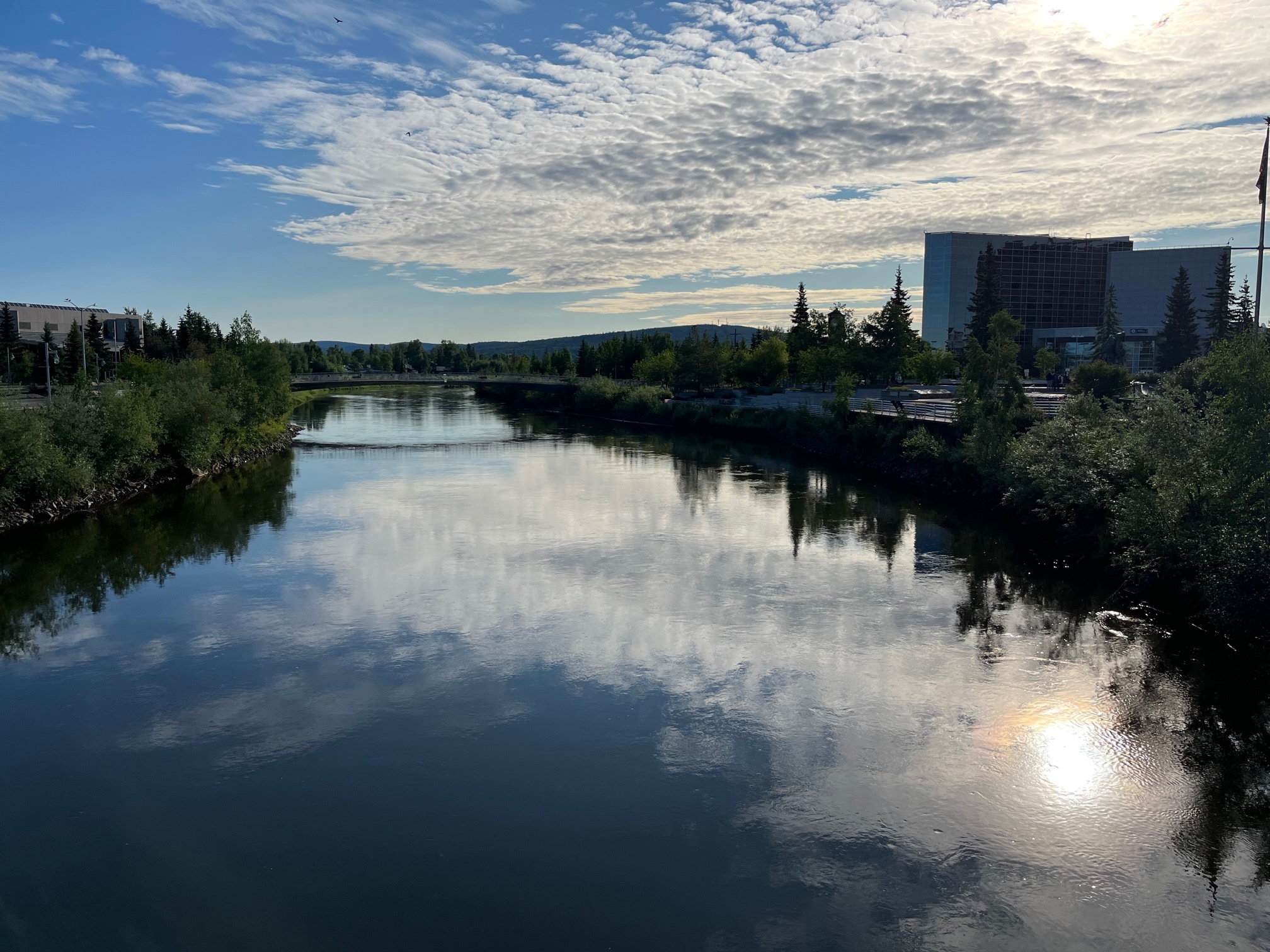
- Observe the banks of the Chena River, at the posted coordinates. Do you see any evidence of flooding?
- Do you see any evidence of erosion due to flooding?
- Do you see any erosion control methods used along the banks of the Chena River?
- Proceed to the second waypoint attached on the cache page. Estimate how high above the current river level the high water mark from the 1967 flood is. How many inches of rain fell in the 8 days leading up the flood?
- How do you think diverting floodwater from the Chena River might have affected the Tanana River? Based on your observations, do you think the flood control method chosen was effective? Why or why not?
- Upload a photo with the Chena River. You don't have to be in the photo, though it is strongly encouraged.
Sources:
- https://www.poa.usace.army.mil/Locations/Chena-River-Lakes-Flood-Control-Project/#:~:text=A%20key%20component%20of%20the,the%20natural%20flow%20of%20water.
- https://www.gi.alaska.edu/alaska-science-forum/fixing-fatal-flaw-fairbanks