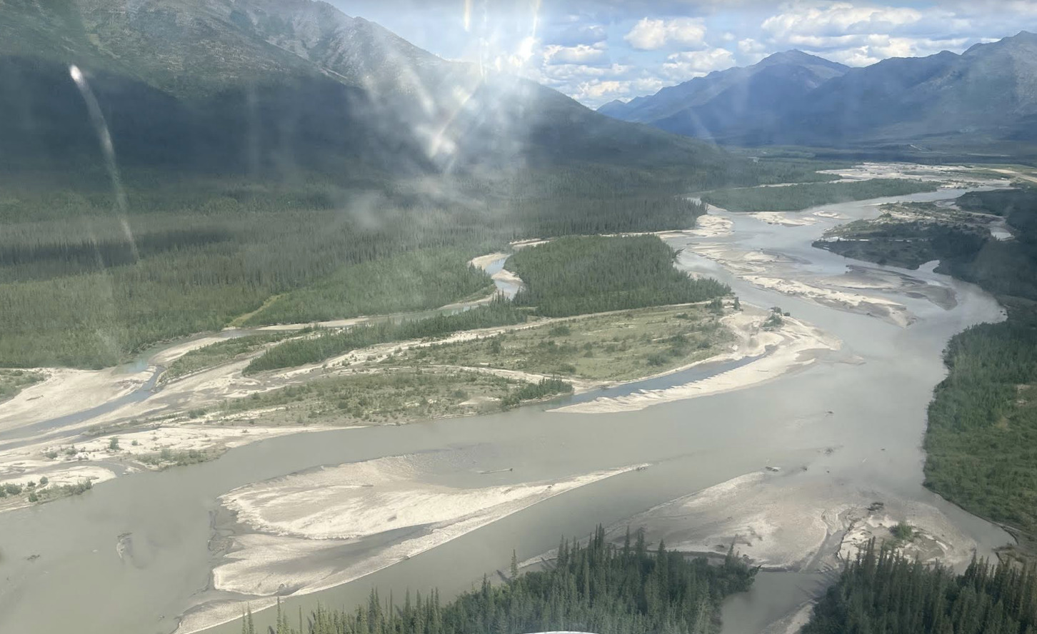
Nestled in the heart of Alaska, Coldfoot is a small community that serves as a gateway to the vast wilderness of the Gates of the Arctic National Park and Preserve. Here, where the Arctic tundra stretches as far as the eye can see, adventurers embark on remarkable journeys. The Koyukuk River winds its way through this pristine landscape, adding to the breathtaking beauty. Flowing gracefully, the river offers a lifeline for both humans and wildlife, carving a path through the rugged terrain and connecting the remote villages along its banks. Together, Coldfoot, Gates of the Arctic, and the Koyukuk River form a harmonious symphony of nature, inviting explorers to immerse themselves in the untouched splendor of the Arctic wilderness. A unique feature of the river can be observed along this stretch of the river, which can be seen in several different ways (including by boat, by land, or by air).
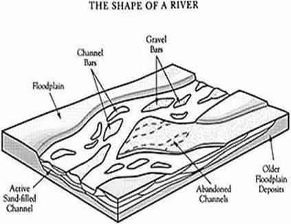
Braided rivers are a fascinating geological phenomenon characterized by a complex network of interconnected channels that continuously divide, rejoin, and shift their course. These rivers typically form in areas with high sediment loads and variable flow rates. As the river flows, it encounters obstacles such as rocks and vegetation, causing the water to split into multiple channels. The fast-moving currents then transport vast amounts of sediment, including sand, gravel, and pebbles, which are constantly deposited and eroded along the riverbed. This dynamic process creates a distinctive landscape of numerous small islands and shifting sandbars, giving braided rivers their characteristic braided pattern. These rivers often exhibit ever-changing channels, with the main flow redistributing itself over time. The unique geologic features associated with braided rivers include wide floodplains, intricate delta systems, and gravel bars that serve as important habitats for various plant and animal species. The constant interplay between erosion and deposition shapes the geology of braided rivers, making them dynamic and visually captivating natural wonders.
Logging Requirements:
- What type of sediments are located along the banks of the river?
- Do you see any "permanent" vegetation on any of the islands? Based on your observations, what does this tell us about the river?
- Only roughly this 15 mile stretch of river is braided, why do you think only this area is braided and not a larger stretch of the river? How do you think the geography of this area influenced this?
- Are you able to identify any other features that are typically found within braided rivers?
- How do you think the river will change over time? How do you think this will impact the Dalton Highway or the residents of Coldfoot?
- Upload a photo with the Koyukuk River. You don't have to be in the photo, though it is strongly encouraged.
Sources:
- https://geo.libretexts.org/Courses/University_of_California_Davis/GEL_109%3A_Sediments_and_Strata_(Sumner)/Textbook_Construction/Braided_Rivers
- https://www.nps.gov/articles/braided-stream.htm