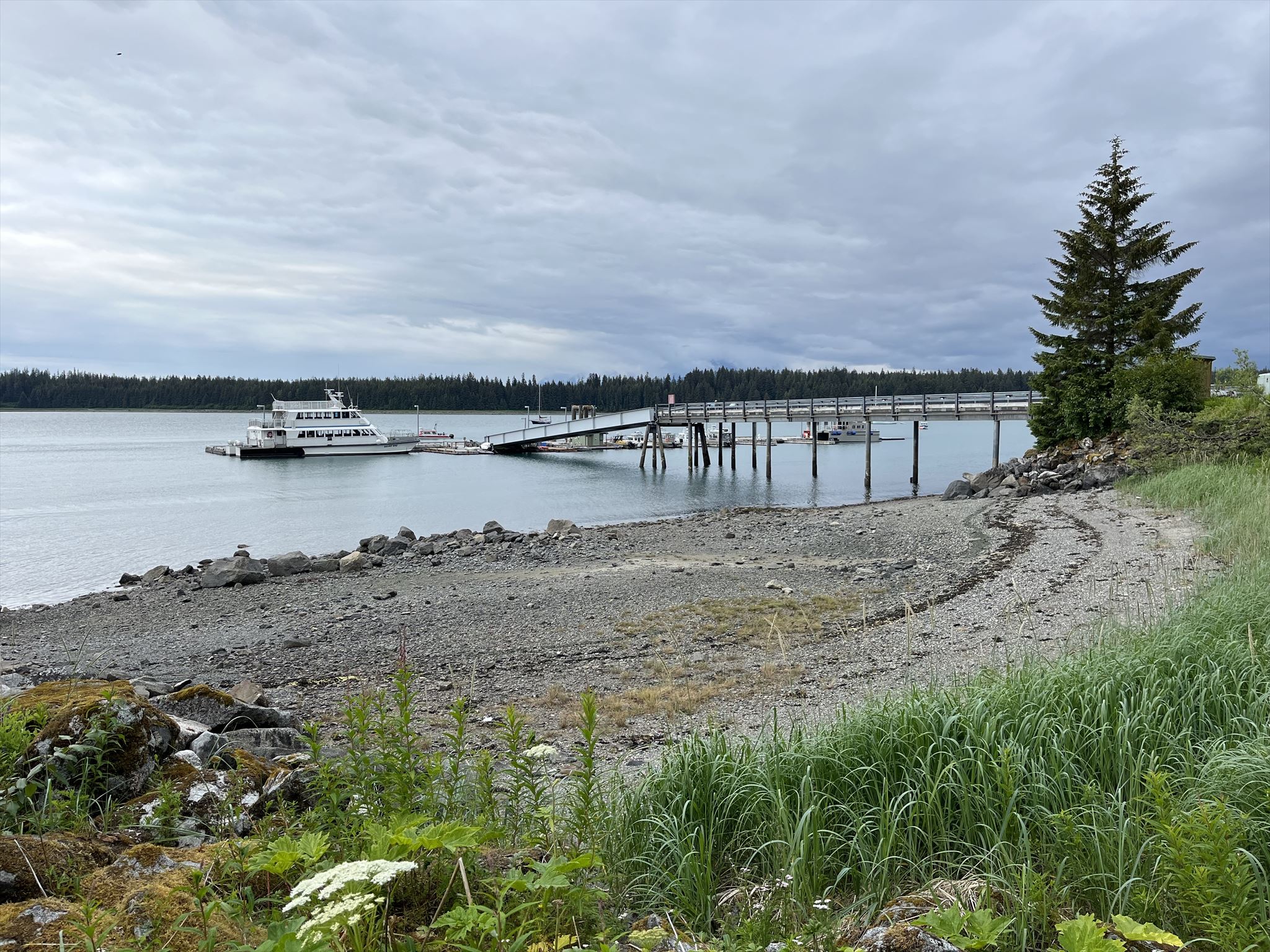
Bartlett Cove is located in Glacier Bay National Park. It is surrounded by majestic snow-capped mountains and dense forests, and offers visitors a unique opportunity to immerse themselves in the awe-inspiring beauty of nature. As the primary visitor center and hub for exploration in Glacier Bay National Park, Bartlett Cove provides access to an array of activities, including wildlife watching, hiking trails, and boat tours.
As you walk along the beach, look closely at some of the rocks. Some rocks are rounded, having been tumbled by water. Some are still angular, having been chiseled by ice. Many are travelers that arrived in Bartlett Cove on the glacier that filled the bay only a few hundred years ago. At its origin, high in snowy mountains to the north, the glacier plowed, gouged, and plucked rocks from ridges and cliffs. Flowing south, the glacier carried the rocks from cold, high elevations to warmer, lower elevations, where the ice melted and dropped the rocks in Bartlett Cove. And here they remain, each with its own story.
The Wentworth scale is a classification system used in geology to describe the sizes of sediment particles. It categorizes sedimentary materials based on their grain size, ranging from the largest boulders to the finest clay particles. The sizes on the Wentworth scale are as follows:
- Boulder: >256 mm
- Cobble: 64 - 256 mm
- Pebble: 4 - 64 mm
- Granule: 2 - 4 mm
- Sand: 1/16 - 2 mm
- Silt: 1/256 - 1/16 mm
- Clay: <1/256 mm
The scale is essential in sedimentology and helps geologists classify sediments found in various environments, such as rivers, beaches, deserts, and glacial deposits. By analyzing sediment size distributions, researchers can infer the energy of the transporting agent (such as water, wind, or ice) and interpret the geological processes that have shaped the landscape. Glaciers, as powerful agents of erosion and sediment transport, can significantly impact the size of sediments and materials. As glaciers move, they grind against the bedrock and surrounding materials, breaking them down into smaller particles. The debris generated from this process ranges from boulders to sand and fine silt. As glaciers retreat, they deposit these sediments.
Logging Requirements:
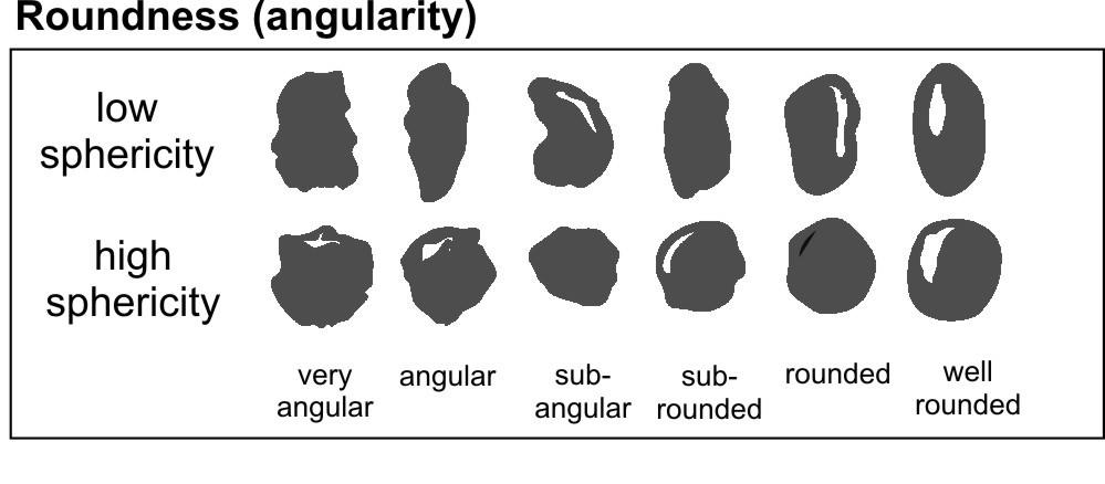
- Examine some of the sediments found along the beach. Using the chart, which shape and sphericity appears to be most dominant?
- Using the Wentworth Scale, which type of sediment appears to be most common? How does sediment size change as you move up the beach? Are there any any "outliers" visible (i.e. glacial erratics)? How do you think glaciers played a role in what you see?
- Upload a photo taken at Bartlett Cove. You don't have to be in the photo, though it is strongly encouraged.
Sources:
- Stories at your feet, NPS sign
- https://www.nps.gov/places/bartlett-cove.htm?utm_source=place&utm_medium=website&utm_campaign=experience_more&utm_content=small