PRESENTS:
Inntalblick Runde


Ausgiebige, abwechslungsreiche Runde, auf der man das gesamte vordere Paznaun kennenlernt.
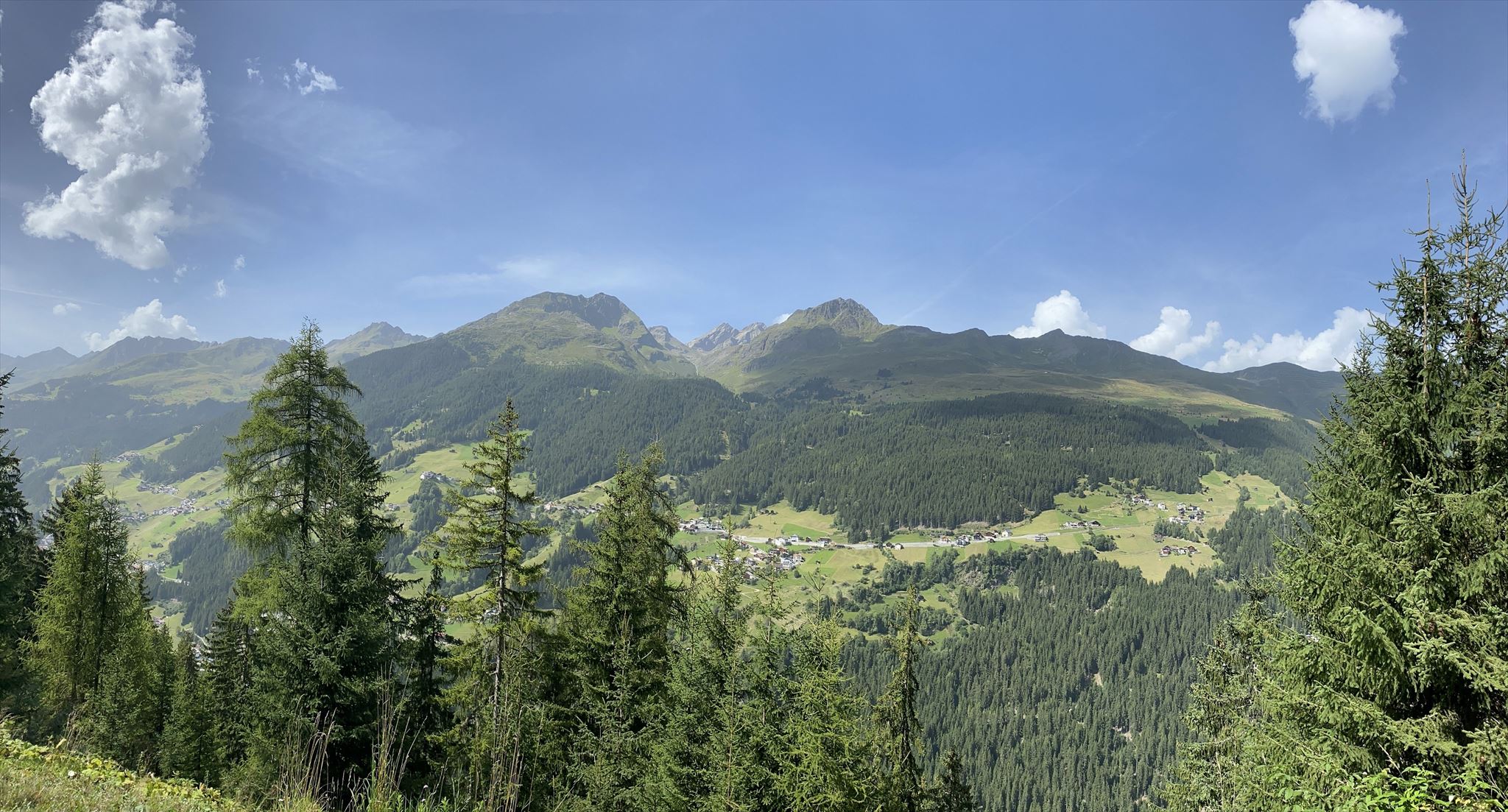
Bei Cache Nummer 19/20 geniest man eine herrliche Aussicht ins obere Inntal,
ehe man entlang der Kappler Weiler am Sonnenhang Richtung Kappl radelt.
Dort fährt man über Nebenstrassen hinunter in den Talgrund
und fährt ein paar Meter auf der Bundesstrasse Talauswärts.
Man überquert den Bach und taucht auf der südlichen Talseite in die weitläufigen Wälder ein.
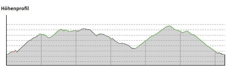
Nach etwa 400hm in mäßiger Steigung auf Forststrassen,
geht es dann Richtung See wieder Bergab zum Ausgangspunkt.


Schwierigkeit: mittel/schwer
Dauer reine Gehzeit: 8:30 h
Dauer reine Bikezeit: 4:40 h
Dauer mit cachen: ~8:30 h bzw 13:30 h
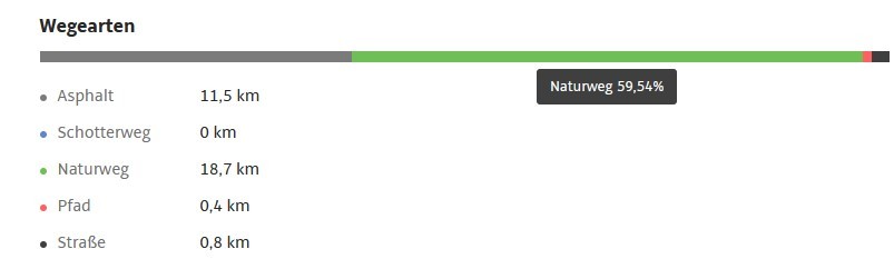
Geocaches: 112 + 1 Sidecache
--->>>SPOILERSAMMLUNG INNTALBLICK<<<---

Zu beachten:
Es gibt für jeden Cache ein recht eindeutiges Spoilerbild und einen hilfreichen Hint.
Die D/T Wertung bezieht sich auf die komplette Runde.
Bedenken sie das im Gebirge fast kein Handyempfang sein kann.
Ich empfehle dringlichst eine Offline Liste zu erstellen, und/oder die Spoiler Fotos down zu loaden.
Es ist nicht verboten volle oder nasse logbücher auszutauschen und eventuelle verschwunderne Caches zu ersetzen. Besten Dank dafür!
Bergrettung Österreich: Notruf 140
Bitte gebt bei einem Unfall die Koordinaten an, ihr habt ja ein GPS-Gerät. Hilfreich ist auch die Gratis-Notfall-App der Bergrettung Tirol für iPhone oder Android:  Im Falle eines Unfalles werden durch Drücken des Knopfes die GPS-Koordinaten an die Leitstelle Tirol GmbH übermittelt und es wird eine Verbindung zur Leitstelle aufgebaut. Diese App funktioniert nur in Tirol.

To Innvallay view round
Extensive,diverse circuit that allows you to explore the entire front Paznaun region.
At Cache number 19/20, you can enjoy a splendid view of the upper Inntal (Inn Valley),
before cycling along the Kappler hamlets on the sunny slope towards Kappl.
There, you ride down to the valley floor via side roads
and travel a few meters on the highway out of the valley.
Crossing the river, you immerse into the spacious forests on the southern side of the valley.
After about 400 meters of moderate ascent on foreat roads,
you then descend towards to See, returning downhill to the starting point.
Duration pure walking time: 9:30 h
Duration pure biking time: 4:40 h
Duration with caching: 8:30 h bzw. 13:30 h
The highest point: 1.580 hm
Geocaches: 112 + 1 Sidecache
--->>>SPOILER COLLECTION INNTALBLICK<<<---

To note:
There is a pretty clear spoiler image and a helpful hint for each cache.
The D/T rating refers to the complete round.
Consider that there can be almost
no mobile phone reception in the mountains.
I strongly recommend creating an offline list
and/or downloading the spoiler photos.
It is not forbidden to promote full or wet logbooks
and to replace eventual lost caches. Many thanks for that!!
Mountain rescue Austria:Emergency call 140
In the event of an accident, please give the coordinates, you have a GPS device. The free emergency app from Bergrettung Tirol for iPhone or Android is also helpful: in the event of an accident, pressing the button transmits the GPS coordinates to the control center Tirol GmbH and a connection to the control center is established. This app only works in Tyrol.