This broad-shouldered Munro dominates the eastern side of Loch Lomond and is one of Scotland’s most famous natural landmarks. Ben Lomond, 974 metres, is a mountain in the Scottish Highlands. It is the most southerly of the Munros. Ben Lomond lies within the Ben Lomond National Memorial Park and the Loch Lomond and The Trossachs National Park. It is one of the most popular munros, attempted by over 50,000 people a year ... and achieved by most!
The 4 miles (6km) of the main path will take you through forested ground for the first mile, before emerging onto the more open hillside for the remainder of the climb. It is well worth using the Ptarmigan Ridge route to make your walk circular. This is steeper and more difficult, particularly on the higher reaches but it runs closer to the edge of Loch Lomond and as such offers views that are second to none. The circular route is 7.5 miles (12km) in total. Most people take between 2½ and 4 hours to get to the summit, and between 4 and 6 hours for the full trip up and down, although this depends on the fitness and pace of the walker.
The reward is fantastic views: as far as Ben Nevis to the north, the Ochils and Pentlands to the east, the uplands of Galloway in the south, and Mull, Islay and Arran in the west. Make sure you choose a good day for your walk when the clouds are clear of the summit so you can enjoy these stunning panoramas - the beautiful views are the purpose of placing my virtual here.
The weather can change quickly, and on Ben Lomond (as for any venture into the hills) walkers should be fully prepared for wet and cold conditions. Winter conditions require extra caution, and the Ptarmigan route in particular should only be attempted, when under ice and snow, if you’re fully equipped and familiar with using crampons and an ice axe. Please read up on the walk before attempting if you are inexperienced in the mountains.

Logging Requirements
This is a virtual geoache and as such there is nothing hidden here and you must not search.
Instead, you must supply two photographs of yourself (or a recognisable personal item or your geocaching name) taken on the summit of Ben Lomond.
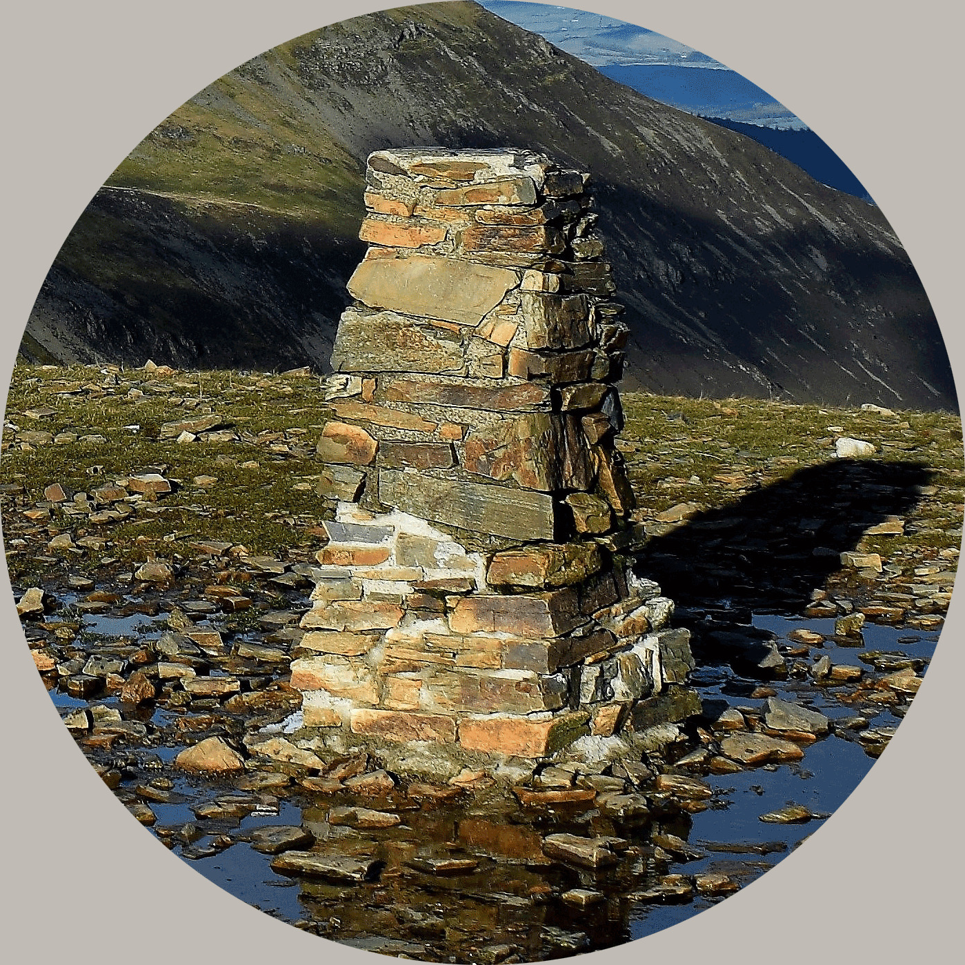
The first photograph must show you with the YOSM (trigpoint) looking northwest from the summit. It should include the side of the trigpoint with the flush bracket and the view behind, similar to the example above.
The second photograph should be taken from the edge of the summit plateau looking south with the stunning view of Loch Lomond, similar to the example below. This photo must still be included even if you are in the cloud.
I welcome other photos of your walk, and particularly additional photos with the view a little lower if the summit is within the cloud. Both photos must be attached to your log or it will be deleted.

Virtual Rewards 4.0 - 2024-2025
This Virtual Cache is part of a limited release of Virtuals created between January 17, 2024 and January 17, 2025. Only 4,000 cache owners were given the opportunity to hide a Virtual Cache. Learn more about Virtual Rewards 4.0 on the Geocaching Blog.
About Ye Ole Survey Monuments
|
 |
Ye Ole Survey Monument (YOSM) is a captivating series of caches that pays homage to the remarkable legacy of OutForTheHunt's YSM series (GC45CC).
YOSM caches are strategically positioned at or near Trig Points. These triangulation stations have played a pivotal role as surveying landmarks, contributing to the mapping of expansive territories.
Some of these points, bearing historical significance, might now be situated on private land or have vanished with time. As a result, the caches are artfully placed in close proximity, reverently acknowledging the historical importance of these survey monuments.
|
More information, bookmarks and statistics can be found at the YOSM Website
If anybody would like to expand the Ye Ole Survey Monuments Series, please do.
I would ask that you request a number for your cache first at www.yosm.org.uk
so we can keep track of the numbers and names to avoid duplication.