SAVE CACHES FOR OFFLINE USE AREAS ON THE SCENIC DRIVE HAVE WEAK OR NO CELLPHONE RECEPTION
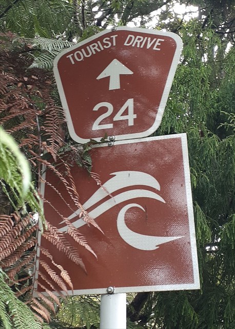
The Scenic Drive is also known as the Auckland Urban Route number 24.
The road was first constructed in the 1910s, opening in January 1914 as Exhibition Drive (named for the 1913-1914 Auckland Industrial, Agricultural and Mining Exhibition, held in the Domain on the site of the Wintergardens).
Later known as the Waitākere Scenic Drive, today its name shortened to the "Scenic Drive".
It is also part of the Twin Coast Discovery Highway.
On a fine day you are able glimpse some of the amazing views of the city and see the native trees that have grown since the roads creation.
If travelling between Titirangi to Swanson - parking is on left side of road.
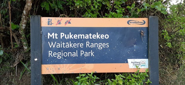
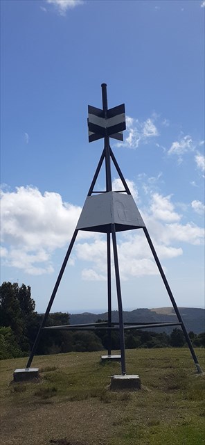
Pukematekeo (336m) means “the hill at the end of the range” and was the site of a Te Kawerau ā Maki pā.
It is also the headwaters of two river systems: the Kumeū River (flows north to the Kaipara River) and the Cassel Stream (flows eastwards to the Swanson Stream).
If you drive up this access road, and walk up the hill (1-2 minutes) to the trig - you will see (Southwest) the Waitakere Falls and dam from a distance, but also take in the 360° panorama of Auckland.
Gates closed: 9pm-6am