Termékeny talaj
FIGYELEM!
Egy mágnesre van szükséged, hogy megfejtsd ezt az EarthCache-t!
Hajós egy dél-magyarországi kisváros, amely elsősorban a borászatáról ismert. A városban mintegy 1200 borospince található. A város egy kis magaslaton, a Duna egykori medrének árterében fekszik. A Duna egykori medrében való elhelyezkedése miatt a város körül az idők folyamán értékes és termékeny folyami üledékek rakódtak le egészen a középkorig. Ezek a folyami üledékek termékeny talajt biztosítanak, amely a szőlőtermesztés számára hasznos. Az értékes homok mellett, amely a talajt vízáteresztő képességűvé teszi, a talajban egy fontos ásványi nyomelem - a vas - is jelen van.
Ez a vas a Hajós alatti talajvízben oldódik. Mivel a talajvíz nagyon közel van a felszínhez, az esős évszakokban (télen/tavasszal) a talajvíz szintje a talajszint fölé emelkedik, és a mélyben oldott ásványi anyagok a felszínre mosódnak.
Amikor nyáron ismét melegebb lesz, a földeken álló talajvíz elpárolog, a benne lévő ásványi anyagok kikristályosodnak és kiszáradnak. Ez a természetes folyamat minden évben ásványi anyagokkal gazdagítja a város környéki földeket és szőlőültetvényeket.
(Forrás: lásd www.wikipedia.org és saját kísérletek)
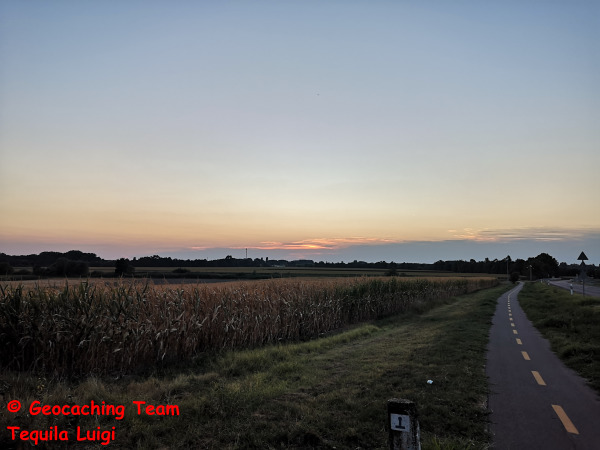
Mező Hajós határában.
Ahhoz, hogy ezt az EarthCache-t találatként naplózza, a következő feladatokat kell elvégezni.
Kérjük, küldje el nekünk a válaszokat e-mailben vagy GC üzenetben, és azonnal logoljon!
Csapatunk felveszi Önnel a kapcsolatot, ha valami nem stimmel. Kérjük, értsd meg azt is, hogy a válaszok elküldése után több mint 3 héttel készült naplóbejegyzéseket a tárolási ráfordítás miatt már nem tudjuk figyelembe venni a válaszok újbóli elküldése nélkül!
Most pedig a tényleges feladatokhoz:
Menjünk a listában megadott koordinátákhoz. Itt a Duna-csatorna Hajós menti mező szélét találjátok
1. Érzékelje a homok szemcseméretét. Inkább finom vagy durva?
2. Próbáld ki a homokot a mágneseddel. Mágneses a homok?
3. Bármi is legyen a mágnessel végzett teszt eredménye - szerinted miért van ez így?
4. Készíts legalább egy fényképet magadról és/vagy a GPS-edről az EarthCache helyszínén, hogy bizonyítsd, valóban jártál itt korábban. Ha nem akarsz magadról fényképet készíteni, akkor egy papírlapot is lefotózhatsz a geocacher neveddel és az aktuális dátummal, valami feltűnő dologgal a háttérben, és csatold a naplóbejegyzésedhez. Felhívjuk figyelmét, hogy a fénykép nélküli vagy a szabályoknak nem megfelelő képekkel ellátott naplóbejegyzések megjegyzés nélkül törlésre kerülnek!
--------------------------------------------------------------------------------------
Fertile soil
ATTENTION!
You need a magnet to solve this EarthCache!
Hajós is a small town in the south of Hungary that is primarily known for its winegrowing. There are around 1200 wine cellars in the town. The town is situated on a small elevation on the floodplain of the former Danube riverbed. Due to its location in the former riverbed of the Danube, valuable and fertile river sediments were deposited around the town over the course of time until the Middle Ages. These river sediments provide fertile soil, which is useful for winegrowing.
In addition to the valuable sand, which makes the soil permeable, there is also an important mineral trace element present in the soil - iron.
This iron is dissolved in the groundwater under Hajós. As the groundwater is very close to the surface, during the rainy seasons (winter / spring), the groundwater level rises above ground level and dissolved minerals from the depths are washed to the surface.
When it gets warmer again in summer, the groundwater standing on the fields evaporates and the minerals it contains crystallize and dry out. This natural process enriches the fields and vineyards around the city with new minerals from the soil every year.
(Source: see www.wikipedia.org & own experiments)
Field on the edge of Hajós.
To log this EarthCache as a find, the following tasks must be completed.
Please send us the answers by e-mail or via a GC message and log immediately!
Our team will contact you if something is wrong. Please also understand that log entries that are made more than 3 weeks after the answers have been sent can no longer be taken into account without resubmitting the answers due to the storage effort!
Now to the actual tasks:
Go to the coordinates given in the listing. Here you will find the edge of a field on the Duna Canal in Hajós.
1. Feel the grain size of the sand. Is it rather fine or coarse?
2. Test the sand with your magnet. Is the sand magnetic?
3. Whatever the result of the test with the magnet - why do you think that is?
4. Please take at least one photo of yourself and / or your GPS at the location of the EarthCache to prove that you were really here before. If you don't want to take a photo of yourself, you can also take a photo of a piece of paper with your geocacher name and the current date, with something prominent in the background and attach it to your log entry. Please note that log entries without photos or with pictures that do not comply with the rules will be deleted without comment!
--------------------------------------------------------------------------------------
Fruchtbarer Boden
ACHTUNG!
Ihr benötigt einen Magneten, um diesen EarthCache zu lösen!
Hajós ist eine kleine Stadt im Süden von Ungarn, die vor allem führ ihren Weinanbau bekannt ist. Im Ort gibt es rund 1200 Weinkeller. Die Stadt liegt auf einer kleinen Erhebung einer Talaue des ehemaligen Flussbettes der Donau. Durch die Lage im ehemaligen Flussbett der Donau, lagerten sich im Laufe der Zeit, bis zum Mittelalter wertvolle und fruchtbare Flusssedimente rund um den Ort ab. Diese Flusssedimente sorgen für einen fruchtbaren Boden, welcher dem Weinanbau nützlich ist.
Zusätzlich zu dem wertvollen Sand, welcher den Boden durchlässig macht, kommt noch ein wichtiges mineralisches Spurenelement, welches im Boden vorhanden ist - Eisen.
Dieses Eisen ist im Grundwasser unter Hajós gelöst. Da das Grundwasser sehr nah unter der Oberfläche steht, kommt es während der Regenzeiten (Winter / Frühling), dazu, dass der Grundwasserspiegel über das Bodenniveau ansteigt und gelöste Mineralien aus der Tiefe mit an die Oberfläche spült.
Wenn es im Sommer wieder wärmer wird, verdunstet das auf den Feldern stehende Grundwasser und die enthaltenen Mineralien kristallisieren aus und trocknen. Durch diesen natürlichen Vorgang werden die Felder und Weinanbauflächen rund um die Stadt jedes Jahr neu mit Mineralien aus dem Boden angereichert.
(Quelle: vgl. www.wikipedia.org & Eigene Experimente)
Feld am Rande von Hajós
Um diesen EarthCache als Fund zu loggen, sind die nachfolgenden Aufgaben zu erledigen.
Bitte sendet uns hierfür die Antworten per E-Mail oder über eine GC-Nachricht zu und loggt sofort!
Unser Team wird sich bei euch melden, wenn etwas nicht stimmt. Bitte habt auch Verständnis dafür, dass Logeinträge, die mehr als 3 Wochen nach der Übermittlung der Antworten erfolgen, aufgrund des Speicheraufwandes, nicht mehr berücksichtigt werden können ohne erneute Übermittlung der Antworten!
Nun zu den eigentlichen Aufgaben:
Begebt euch an die im Listing angegebenen Koordinaten. Hier befindet sich der Rand eines Feldes am Donaukanal in Hajós.
1. Fühlt die Körnung des Sandes. Ist dieser eher fein oder grob?
2. Testet den Sand mit eurem Magneten. Ist der Sand magnetisch?
3. Egal was bei dem Test mit dem Magneten herausgekommen ist - was denkt ihr, warum das so ist?
4. Macht bitte noch mindestens ein Foto von euch und / oder eurem GPS am Ort des EarthCaches um nachzuweisen, dass ihr vor wirklich hier wart. Wer kein Foto von sich machen möchte, der kann gerne auch ein Foto von einem Zettel mit seinem Geocachernamen und dem aktuellen Datum, mit etwas vor Ort markantem im Hintergrund machen und seinem Logeintrag beifügen. Bitte beachtet, dass Logeinträge ohne Fotos oder mit nicht den Regeln entsprechenden Bildern, kommentarlos gelöscht werden!
Last change november 2024
© Team Tequila Luigi