The Ontario MNRF (Ministry of Natural Resources and Forestry) created a toolset several years ago called OFAT III. This is an acronym for Ontario Flow Assessment Tools III. This was replaced recently by OWIT, the Ontario Watershed Information Tool. This geocache replaces OFAT III.
The primary purpose of OWIT is to delineate subwatersheds or catchments (where the water in an area drains to). How does it work? Imagine the province of Ontario. Then imagine the province with a grid of little square cells over top of it. These cells, or rasters, are each assigned a direction of flow (which is primarily extrapolated by slope in that cell). OFAT III can tell which rasters are connected to neighbouring rasters, and output it in a pretty little map. You do not need to understand how this tool works to find the cache.
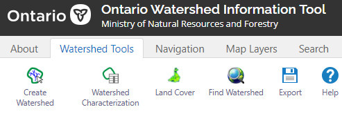
To solve this cache, you will need to find and use a tool that will allow Flow Assessment in Ontario to be calculated. Finding the tool is part of the puzzle. Once you find the tool, select the Watershed Tools tab. Enter the following names and coordinates and create two watersheds. These coordinates are for exit points of the water. If you are curious, later you can zoom in on a blue line (any watercourse in Ontario) and select create from map point to create your own watershed (create from map point is greyed out unless you are zoomed in).
McKinnons:
45.39914
75.43404
Bearbrook:
45.40150
75.40149
After creating your watersheds, click the watershed characterization button (beside create watershed). Press calculate all to calculate characterizations. Next, go to the land cover tab and press "Extract" to calculate all land covers. Repeat these calculations for your other subwatershed, then answer the below questions:
McKinnons:
Characterizations:
1. What is the length of the main channel?
2. What is the annual mean temperature?
Land Cover:
3. What percentage of this subwatershed is Agriculture (and undifferentiated)?
4. What percentage of this subwatershed is Alvar?
BearBrook:
Characterizations:
5. What is the annual precipitation?
6. What is the drainage area?
Land Cover:
7. What percentage of this subwatershed is community/infrastructure?
8. What percentage of this subwatershed is swamp?
Calculating the final:
Add your answers from 1 to 4 together. From your sum, subtract 64.678 for the North coordinates.
Add your answers from 5 to 8 together. From your sum, subtract 995.798 for the West coordinates.
Assume N 45 and W 75.
MATH CHANGED ON AUG 30 2024 TO REFLECT NEW LOCATION VERY CLOSEBY