EarthCache placed with the kind permission of South NatureScot.
A reminder about EarthCache
ATTENTION, there is no container to look for or logbook to fill in. All you have to do is go to the observation site and complete the validation conditions below.
As the aim of an EarthCache is to put a geology lesson into practice by making observations in the field, we recommend that you read the description to help you answer the questions.
Questions to validate the geological cache
- Question 0 : Take a photo of yourself or your nickname with Ben Mor in the background.
You can either send us this photo with your answers or add it to your log.
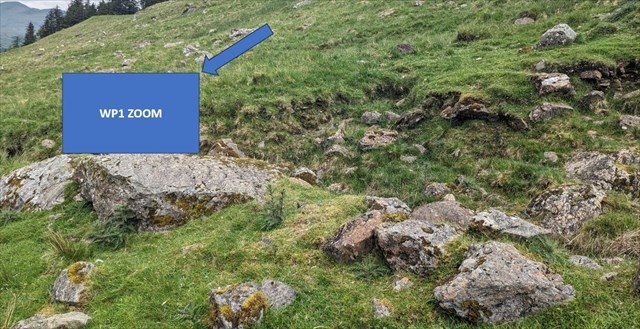
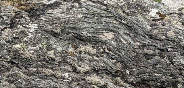
Here you are on the left-hand side of the track a few dozen metres after the barrier.
Use WP1_Large to locate the block you want to observe, then WP1_Zoom.
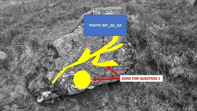
- Question 1 : What can you see under the yellow areas in photo WP1_Zoom (colour, hardness, texture)? What minerals are these areas composed of?
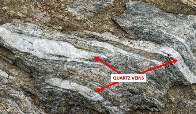
Take a closer look at the top of the block (photo WP_Q2_Q3).
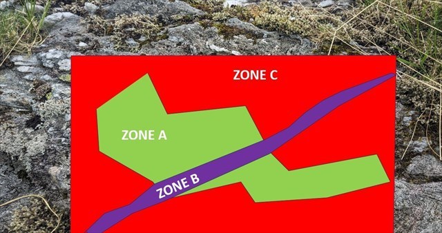
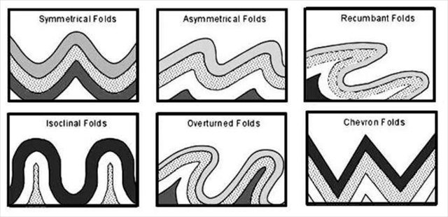
- Question 2 : Describe the fold under the green zone A and deduce its type.
- Question 3 : Using the principles of relative dating, classify the geological features in zone A (green), zone B (violet) and zone C (red) from youngest to oldest.
You can log in without waiting for our confirmation, but you must send us the answers at the same time.
by e-mail via our profile (
fafahakkai), or via the geocaching.com messaging system (Message Center).
If there are any problems with your answers, we will let you know.
Logs recorded without any response and photo will be deleted.
What does this mean in theory?
► Local geological context
Ben More (Beinn Mhòr in Gaelic) has an altitude of 1,174 m, making it the 6th highest peak in Scotland. It is a mountain at the heart of the Dalradian stratigraphic unit.
The Dalradian metamorphic rocks were formed between the Neoproterozoic (800 Ma) and the Ordovician (470 Ma).
The area around Crianlarich is part of its youngest group, the Southern Highland.
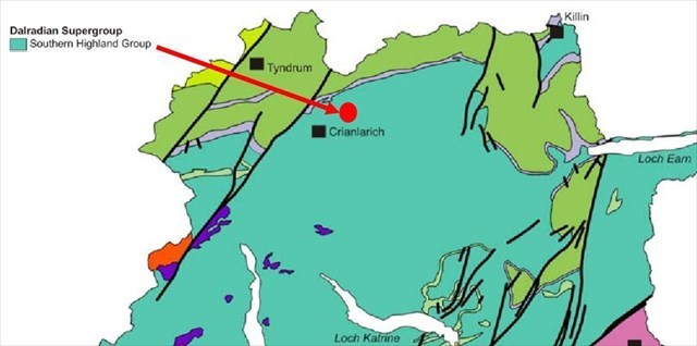
This group contains a wide variety of metamorphic formations ranging from grawacke to quartzite and pelitic schists, the latter forming the base of the Ben Mor.
► Dalradian pelites from the ‘Southern Highland’ group
A pelite is a metamorphic schist derived from a protolith which, under the action of pressure and temperature, forms a regular laminate of parallel planes, a schistosity whose plane is oblique to the direction of flattening.
In the case of this pelitic formation, the protolith is an extremely fine sedimentary rock (clay) giving a blue-grey rock texture that is invisible to the naked eye.
► Deformations and vein intrusions
During tectonic movements subsequent to its orogenesis, this ductile rock initially deformed under stress to form folds.
These folds are of different types depending on their characteristics:
- A symmetrical fold is one in which the axial plane is vertical.
- An asymmetrical fold is one in which the axial plane is inclined.
- An isoclinal fold has limbs that are essentially parallel to each other and thus approximately parallel to the axial plane.
- An overturned fold has a highly inclined axial plane such that the strata on one limb are overturned.
- A recumbent fold has an essentially horizontal axial plane.
When the stresses increase further, the rock will eventually give way and fractures will appear in the surrounding rock.
These fractures are filled with a siliceous juice that crystallises in veins of single-crystal quartz rock, an opaque, white and very hard mineral.
► Principles of relative geological dating
There are several types of relative dating for rocks and geological events.
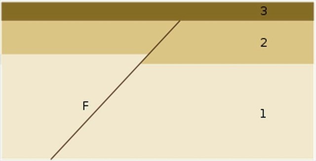
One of these is the principle of overlap: an event (magmatic intrusion, faulting, folding, unconformity, erosion) that causes a change in the geometry of the rocks is posterior to the last stratum it affects and anterior to the first unaffected stratum.
In other words, any geological event that intersects another event comes after it.
In the example below, fault/thread F is later than strata 1 and 2, but earlier than stratum 3.
► Sources bibliographiques / Bibliographical sources