Priest Lake
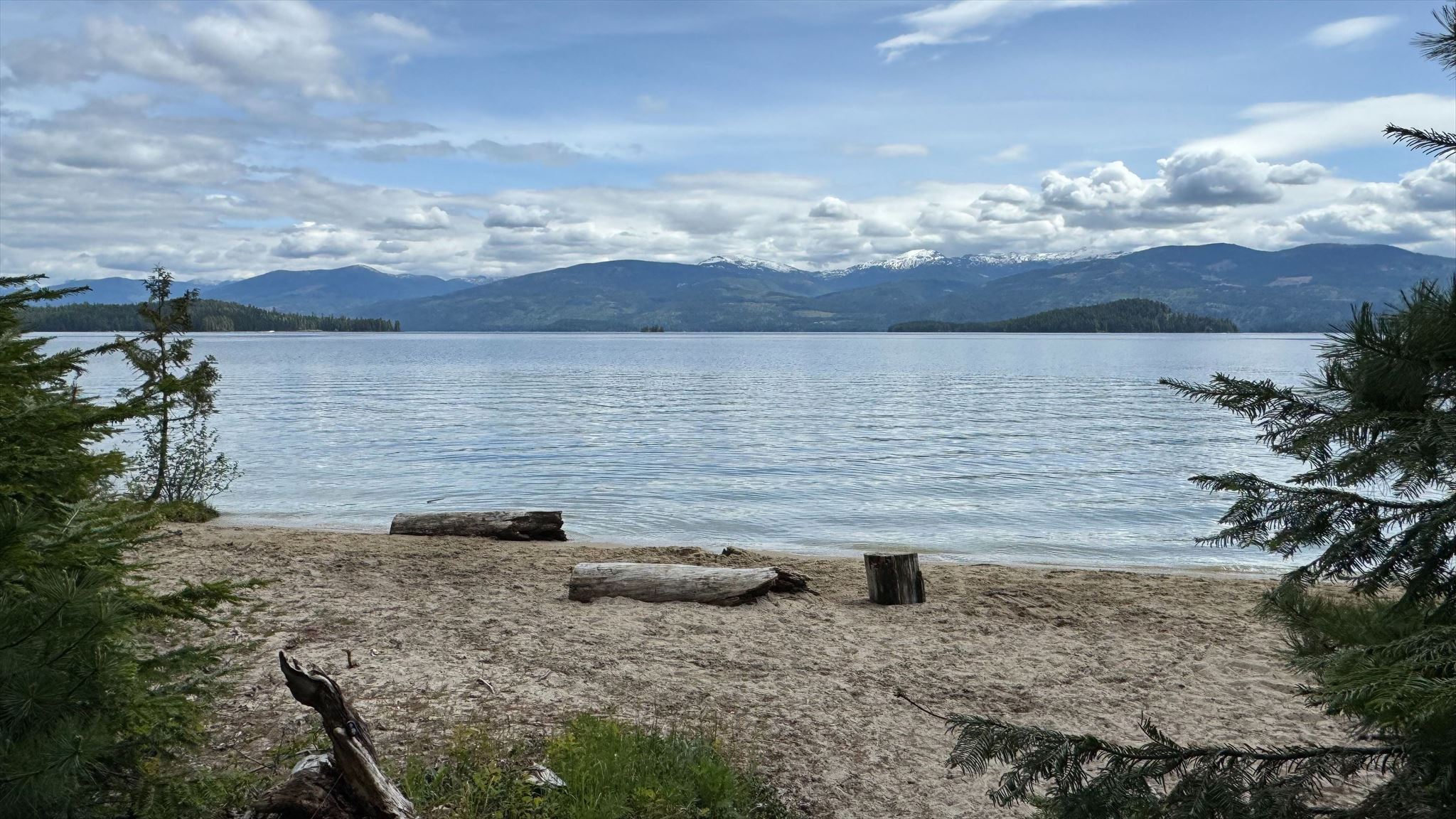
Please note that this is an Earthcache! There is no container to find; instead, you must make observations at the posted coordinates to answer the questions below and send them to the cache owner.
- If the skies are clear enough, you can see the crest of the Selkirk Mountains rising above the lake to the east. Do you think the tops of these mountains (the rugged Selkirk Crest) were carved by the continental glaciers or by alpine glaciers? Why do you think that? Based on your answer, how thick do you estimate the glacier was that carved out the Priest Lake Basin?
- How many islands are you able to make out from this vantage point? Why do you think they survived the glaciers?
- Walk out onto the beach next to this location and press your foot deep into the sand, then pull it back. Do the mounds of sand that this creates resemble any of the glacial features discussed here? What would you call the ridge created at the end of your toes?
- Take a photo of yourself in front of the lake and post it with your log. If you'd prefer not to include a photo of yourself, you may instead include a photo of a personal geocaching object.
|
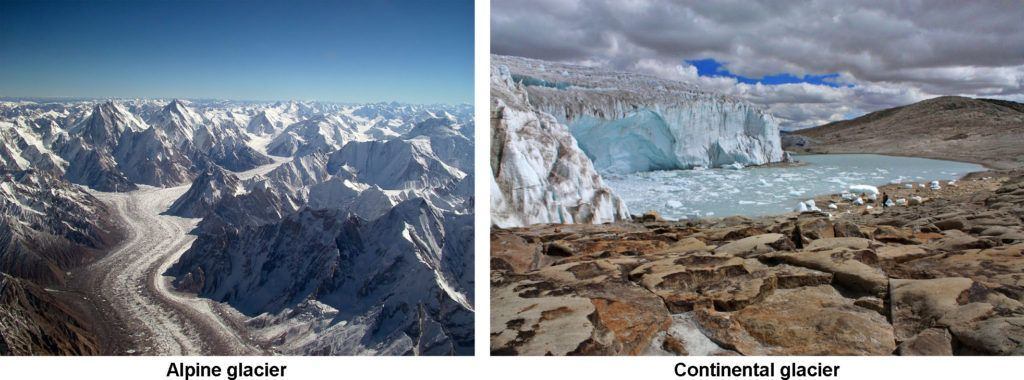
Priest Lake sits in a large basin carved out by glaciers. Glaciers are features of solid ice that move extremely slowly along the land surface. As they move, they erode and shape the underlying rocks and ground, and deposit sediments in characteristic landforms. There are two types of glaciers: alpine and continental. Alpine or valley glaciers are formed when snow collects at elevation, compacts into ice, and flows downhill through mountains along existing valleys. Continental glaciers are giant ice sheets that cover relatively flat ground and flow outward from where the greatest amount of snow and ice accumulate, usually near the poles.
| Figure 1. Alpine and Continental Glaciers |
 |
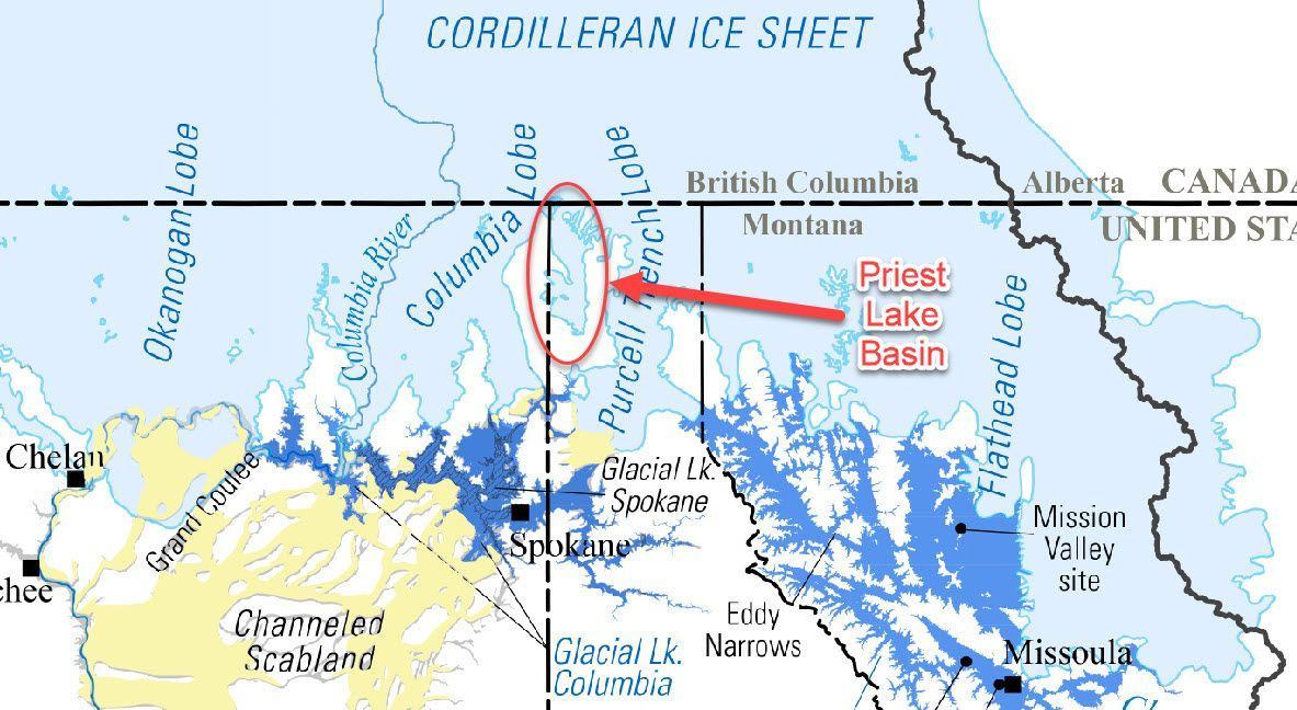
Between 10,000 and 15,000 years ago, one of the last of the great continental glaciers covered much of North Idaho. This massive glacier was called the Cordilleran ice sheet. A finger of it flowed down the valley created by the primordial Priest River and scoured the valley floor. It left striking U-shaped valleys like that seen forming the Upper Priest River Valley, and rounded and smoothed hilltops like Camels Prairie and Horton Ridge.
| Figure 2. The extent of the Cordilleran ice sheet during the Pleistocene Epoch. |
 |
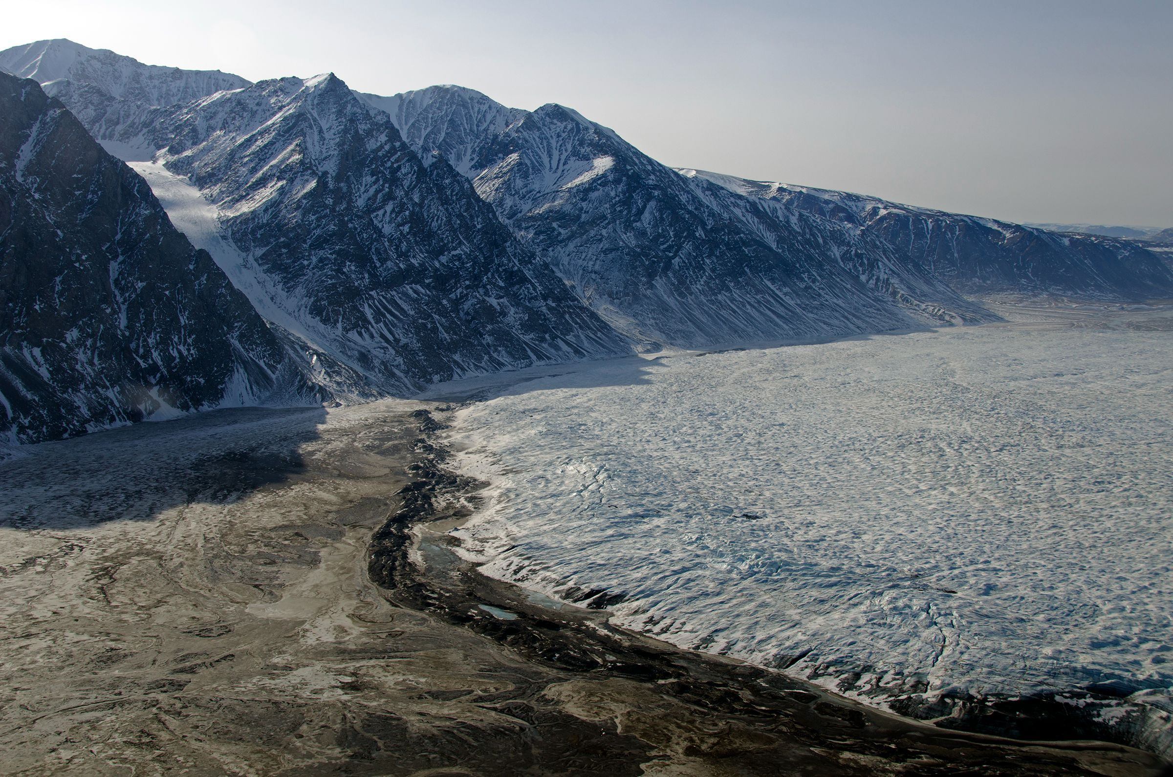
As the climate warmed and the glaciers retreated, they left behind valley floors filled with glacial till - sands, gravel, clays, and rounded boulders - and deposited large masses of gravel, rocks, and other debris at their edges. The glacial gravel deposited along the sides of the glacier is known as a lateral moraine, while that deposited at the farthest reaches of the glacier is known as a terminal moraine.
| Figure 3. Terminal moraine of Wordie Glacier, Greenland. |
 |
It is thought that the terminal moraine produced by the retreating glaciers in the Priest Lake Basin may have dammed the flow from Priest River and the melting ice. Over the millennia, the glacier disappeared, leaving a 19-mile, 369-foot deep lake of pristine water in its place.
Resources: