Please don’t climb on the bank as some erosion has already dulled the formation.
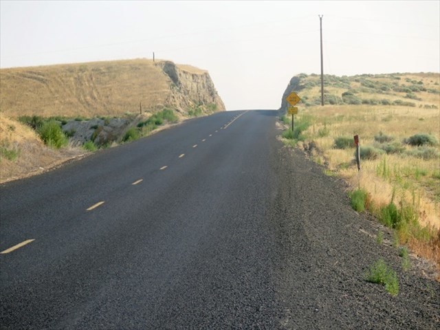
Road Cut through Clastic Dikes.
The Touchet clastic dikes are located 2.5 miles north of Touchet on Touchet River Road off of old Hwy 12. The Touchet River Road cuts through the clastic dikes.
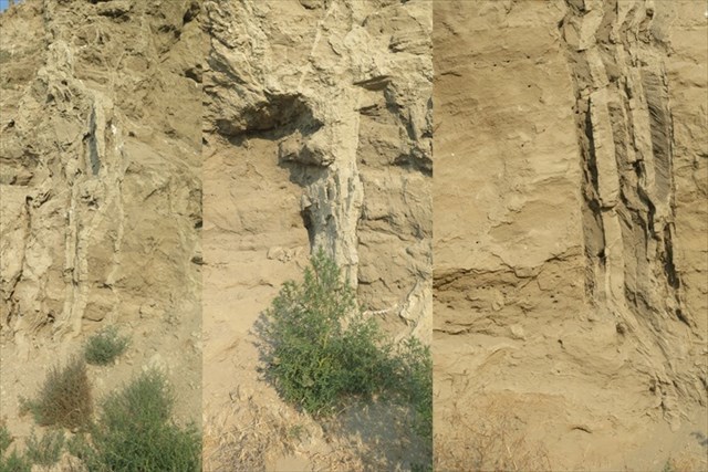
Three examples of the clastic dikes located at this formation.
The word "Clastic" means broken apart, a gap or to separate.
A "Dike" is an embankment or wall.
In terms of geology a “Clastic Dike” is a wall of sedimentary material that fills a gap that separates and cuts through a different sedimentary rock strata. Clastic dikes are crack and fill structures.
When the Touchet River Road was excavated through the hill, the road cut exposed 4 feet of top soil loess over laying 15 to 20 rhythmite layers. These Missoula flood sedimentary host material were laid down 12 to 20 thousand years ago. These unconsolidated layers are called the Touchet beds created by slack water backed up from flood waters trying to move through the Wallua gap.
Cutting through the rhythmites are the clastic dikes. These dikes are truncated vertical veins cutting through the host material of flood plain sentiments. The veins are composed of dikelets also called fill bands or sheets. Think of a book sitting on a shelf with the pages exposed and the binding towards the wall. Each dike or vein is composed of multiple vertical sheets separated by a thin silt skin layer.
The cracks themselves may have been created by ice frost wedges in the sediment during the ice age period. The ice would crack the sediment, then the ice would melt leaving a void allowing new sediment to fill the crack. This freeze and thaw would repeat and repeat making the sheets.
Another theory is hydraulic water pressure during multiple Missoula floods. This is called mega flood loading. The pressure would be so great the water itself would create the cracks and allowing sediment to be pushed into the newly formed cracks.
Some speculate the Missoula flood sediments would dry and harden over thousands of years. As time would have it, local earthquakes would split the harden beds and create a crack in the sediment. When the area was once again flooded by a different unconsolidated source material such as silt, fine and coarse sand and rubble, the material would downward fill the cracks.
To log this Earthcache; Please send a private message to me with answers to the following questions.
1. How were these clastic dikes created?
2. Compare the silt and sediment from flood deposits with the clastic dike truncated material for color, hardness, and coarseness.
3. Why does the clastic dikes not continue all the way to the top of the road cut?
4. Are there any clastic dikes on the opposite side of the road cut.
Bonus: Take the time to locate the thin horizontal white ash layer laid down by the eruption of Mount St. Helens some 13,000 years ago. Were you able to locate the layer?
Optional: You may upload a photo to the page of any local wildlife, unique vegetation or geology in the area.
Additional study and sources: