Notice: "Cache seekers assume all risks and responsibilities involved in seeking this earthcache." “Just because it is there, doesn’t mean you have to seek the cache!” Don’t let earthcaching control you, but rather you control earthcaching.
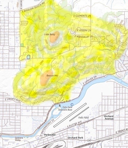
Topographical map of Newman Lake Gneiss Exposure near Spokane Courtesy of the U.S. Geological Survey, Department of the Interior/USGS (Shaded color added).
Yellow shaded area: Newman Lake Gneiss Metamorphic Rock Exposure.
Orange shaded area: Mount Spokane Granite Intrusive Rock Exposure.
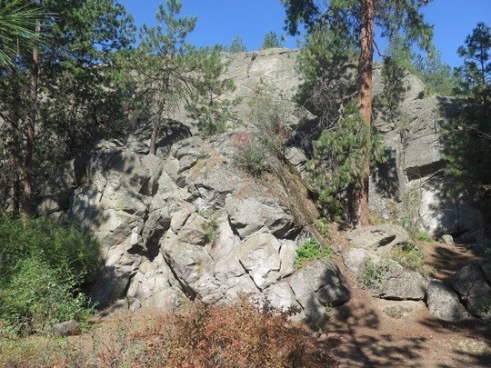
Minnehaha Climbing Rock is located at 5625 E Upriver Drive, Spokane, WA 99217, Spokane County within John H. Shields Park. The wall is a 60 to 180 million year old exposure of Newman Lake gneiss.
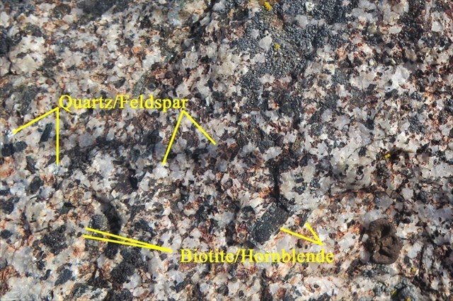
Both Granite and Gneiss (pronounced “nice”) are composed of Quartz (clear/shiny) and Feldspar (white/opaque) with Biotite and Hornblende (black bits). Gneiss differs from granite in that it has under gone extra pressure and heat creating banded layers through the stone.
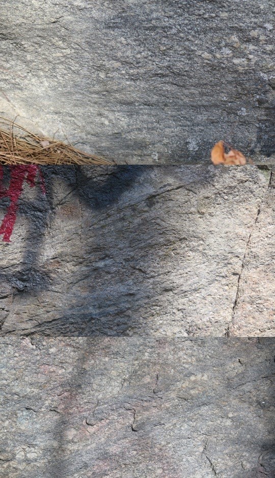
Examples of Gneiss found in this exposure.
Look closely and notice the black banding made up of Biotite and Hornblende streaking across the stone surface.
The Newman Lake Exposure is the remanence of a 60 to 18 million year old extrusion from the Precambian age belt supergroup that shifted and allow the gneiss from 20 miles below the Earth surface to erupt to the surface through dikes. The Gneiss metamorphic rock was forced to the surface and was partially covered by the Priest Rapids Wanapum Basalt lava floods. The formation was exposed near the river by the Missoula flood 12,000 years ago but not washed away. The exposed Gneiss extends form Minnehaha to Newman Lake 12 miles to the Northeast and the McKenzie Conservation Area.
To log this Earthcache; Please send me the answers to the following questions via email or the geocaching.com message center.
- How was the Gneiss created to form the Newman Lake exposure?
- At the final/ground zero, how many bands of Biotite/Hornblende is in view on the cliff face.
- Make a considered effort to search for other Gneiss exposure with banding in the area. Describe one that you have found. You have an option of attaching a photo of your discovery to your answers instead of describing the find.
Optional: You may upload a photo to the page of any local wildlife, unique vegetation or geology in the area.
Additional study and sources: