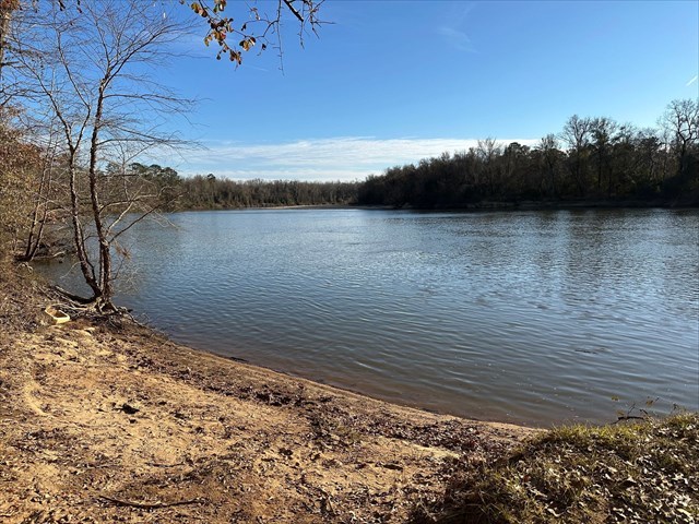
Congaree National Park is located in central South Carolina and protects the largest intact expanse of old-growth bottomland hardwood forest in the United States. This unique ecosystem thrives along the Congaree River and offers a rare glimpse into a biodiverse floodplain where towering trees form a natural canopy. Seasonal flooding replenishes the soil and supports habitats for various plant and animal species. The Bates Ferry Trail offers a glimpse into what travel was like across the 18th, 19th, and 20th centuries. Here, the Bates Ferry once carried travelers across the river, connecting the road between Camden and Charleston.
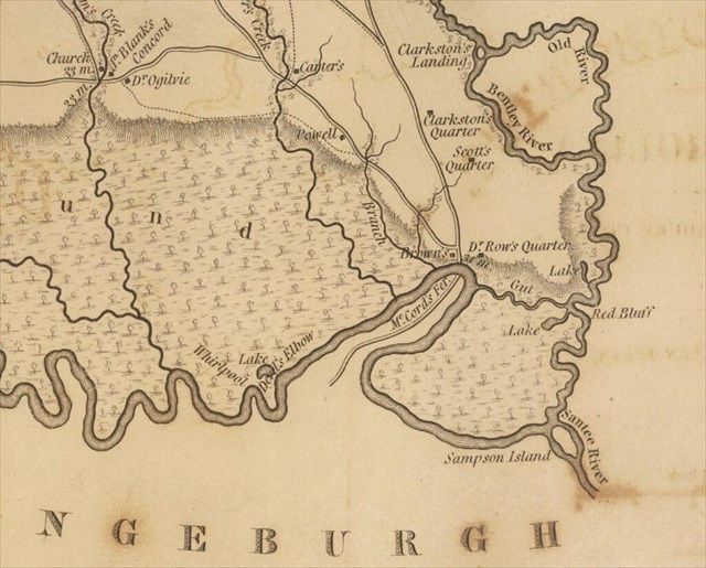
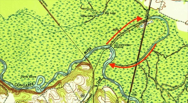
As you hike along the Bates Ferry Trail, you follow a path that runs parallel to the Bates Old River, which served as the Congaree River's main channel until 1852. The image above is from a 1943 USGS map showcasing the area. The red arrows indicate the former path of the river. At the viewpoint with the views of the Congaree River at the listed coordinates, the area in front of you and on your left would have been floodplain, and the river would have flowed towards the northeast and around a huge bend, parallel to the direction that you came from. Bates Old River was isolated from the main river during the 1852 flood. The big question you might have is how (or why) rivers change courses over time, which we will learn about shortly.
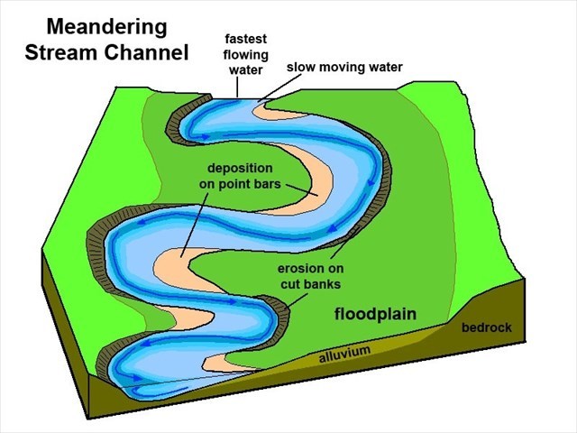
First, it is important to be familiar with point bars and cut banks, which are dynamic features (meaning they are constantly changing) that are formed by the natural processes of erosion and deposition in meandering rivers. As water flows through a curved channel, centrifugal force causes it to accelerate along the outer edge of the bend, leading to erosion of the riverbank and the formation of a cut bank. This process involves hydraulic action, where the force of flowing water removes material, and abrasion, where sediment carried by the river grinds against the bank, further deepening and widening the curve. On the inner curve of the meander, water flow slows down due to reduced velocity, allowing sediments such as sand, silt, and gravel, to settle out and accumulate. This deposition creates a point bar, which grows gradually as more material is deposited over time.
Point bars and cut banks are opposing processes, both of which play an important role in altering the course of a river through lateral migration. As erosion intensifies on the outer curves of meanders, cut banks are worn away, causing the river channel to gradually shift outward. Meanwhile, sediment deposition on the inner curves forms point bars, slowly building up the land and pushing the channel in the opposite direction. Over time, this combination of erosion and deposition causes meanders to become more pronounced, with some eventually forming tight loops. If two adjacent cut banks erode enough to meet, the river may cut through the narrow neck of land, forming a new, straighter channel and leaving the former loop as an oxbow lake. In the case of Bates Old River, a powerful flood carved through the narrow neck of land, altering the Congaree River’s course. While this change was gradually unfolding through lateral migration, the flood dramatically accelerated the process, allowing the river to breach the neck far sooner than it would have naturally.
Logging Requirements:
- As you look across the river, observe the point bar. Estimate its size. Do you notice any vegetation growing on it? How does this reinforce that this is a dynamic process?
- Over time, how do you think lateral migration might further affect the course of the Congaree River? Based on the USGS map, do you think there is a "limit" to how much the course of the river can be altered? Explain.
- Upload a photo with the Congaree River, taken near the posted coordinates. You don't have to be in the photo, though it is strongly encouraged.
Sources:
- https://www.govinfo.gov/content/pkg/GOVPUB-I29-PURL-gpo128601/pdf/GOVPUB-I29-PURL-gpo128601.pdf
- https://friendsofcongaree.org/location/bates-ferry-trail-guide/#toggle-id-4