Stara, zagubiona kapliczka / The old, lost chapel
 Wersja polska
Uroczysko Łasina - zagubiona kapliczka
"Uroczysko Łasina" to fragment lasu położony między Wzgórzem Świętej Bronisławy a Sikornikiem, na południowy zachód od Kopca Kościuszki, po południowej stronie pieszo-rowerowego odcinka Alei Waszyngtona, prowadzącego w kierunku Przełęczy Przegorzalskiej. Jest to obszar o unikalnej rzeźbie terenu, z wąwozami znanymi jako "Lisie Jamy".
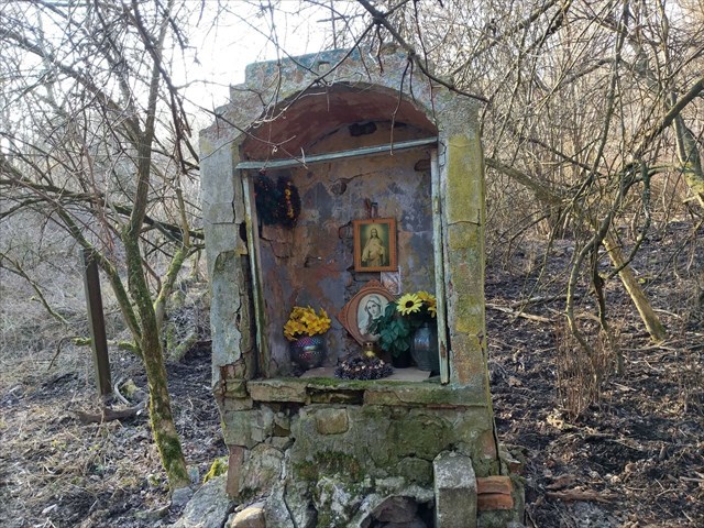
Przy dawnej granicy uroczyska, a dziś już właściwie w środku lasu, znajduje się samotna, zrujnowana i przechylona kapliczka, będąca pozostałością zabudowań, które istniały w tym miejscu jeszcze kilkadziesiąt lat temu, o czym świadczą stare zdjęcia lotnicze. W terenie pozostały także fragmenty starego ogrodzenia.
Mimo swojego stanu, kapliczka jest odwiedzana i co jakiś czas przyozdabiana przez zaznajomione z tym miejscem osoby. Ten tajemniczy świadek przeszłości skłania do zadumy nad upływającym czasem. W końcu potrzeba tylko odrobiny wyobraźni, by zobaczyć rozciągające się dawniej w tej okolicy pola uprawne, konie zaprzężone do ich orania... a może i pasące się krowy?
Źródła: Towarzystwo na Rzecz Ochrony Przyrody, Biblioteka Cyfrowa Politechniki Krakowskiej
Zdjęcia współczesne: Majki_Obbi; zdjęcia lotnicze/satelitarne: MSIP Kraków
O keszu
Pudełko o pojemności 450 ml ukryte na współrzędnych. Zawiera logbook, ołówek, certyfikaty, fanty. Zachowaj ostrożność - obiekt grozi zawaleniem.
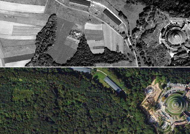
Ortofotomapa terenu z roku 1970 i 2023 / Orthophoto map of the area from 1970 and 2023
 English version
Łasina Grove - the lost chapel
"Łasina Grove" is a section of forest located between the Hill of Saint Bronisława and the Sikornik hill, to the southwest of Kościuszko Mound, on the southern side of the pedestrian-cycling section of Waszyngtona Avenue, leading toward the Pass of Przegorzały. It is an area with a unique landscape, featuring ravines known as "Fox's Dens".
At the former boundary of the grove, now almost in the middle of the forest, there stands a solitary, ruined, and tilted chapel. It is a remnant of buildings that existed here several decades ago, as evidenced by old aerial photographs. Fragments of the old fence also remain in the area.
Despite its condition, the chapel is visited and occasionally adorned by those familiar with this place. This mysterious witness of the past evokes reflection on the passage of time. After all, it only takes a little imagination to see the fields that once stretched across this area, the horses harnessed to plow them... or perhaps even the grazing cows?
Sources: Society for the Protection of Nature, Digital Library of the Kraków University of Technology
Present-day photos: Majki_Obbi; aerial/satellite photos: MSIP Kraków
About the cache
A 450 ml container hidden at the coordinates. It contains a logbook, pencil, certificates, and trinkets. Proceed with caution – the structure is at risk of collapsing.

Stara kapliczka - widok z boku / The old chapel - side view
Kopiec dawniej / The mound in the past
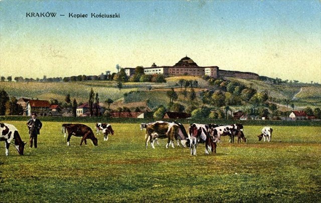
Pocztówka z początku XX wieku / A postcard from the early 20th century
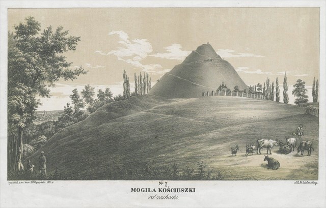
Litografia z 1851 roku / A litography from 1851 (B. Stęczyński)