Join me on the top of Warden Hill to watch the sunset on the first year of Ye Olde Survey Monuments (YOSM) series. The views over Luton to the west and the surrounding countryside are amazing on a clear day. The high terrain rating reflects the steep climb to the top, plus the descent in darkness. There is the potential for muddy and slippery chalky paths, especially after rain.
A new YOSM cache will be published during the event where all attendees can claim a group FTF. There will also be some artwork available to add to your Geocaching profile page from the YOSM website, see link below.

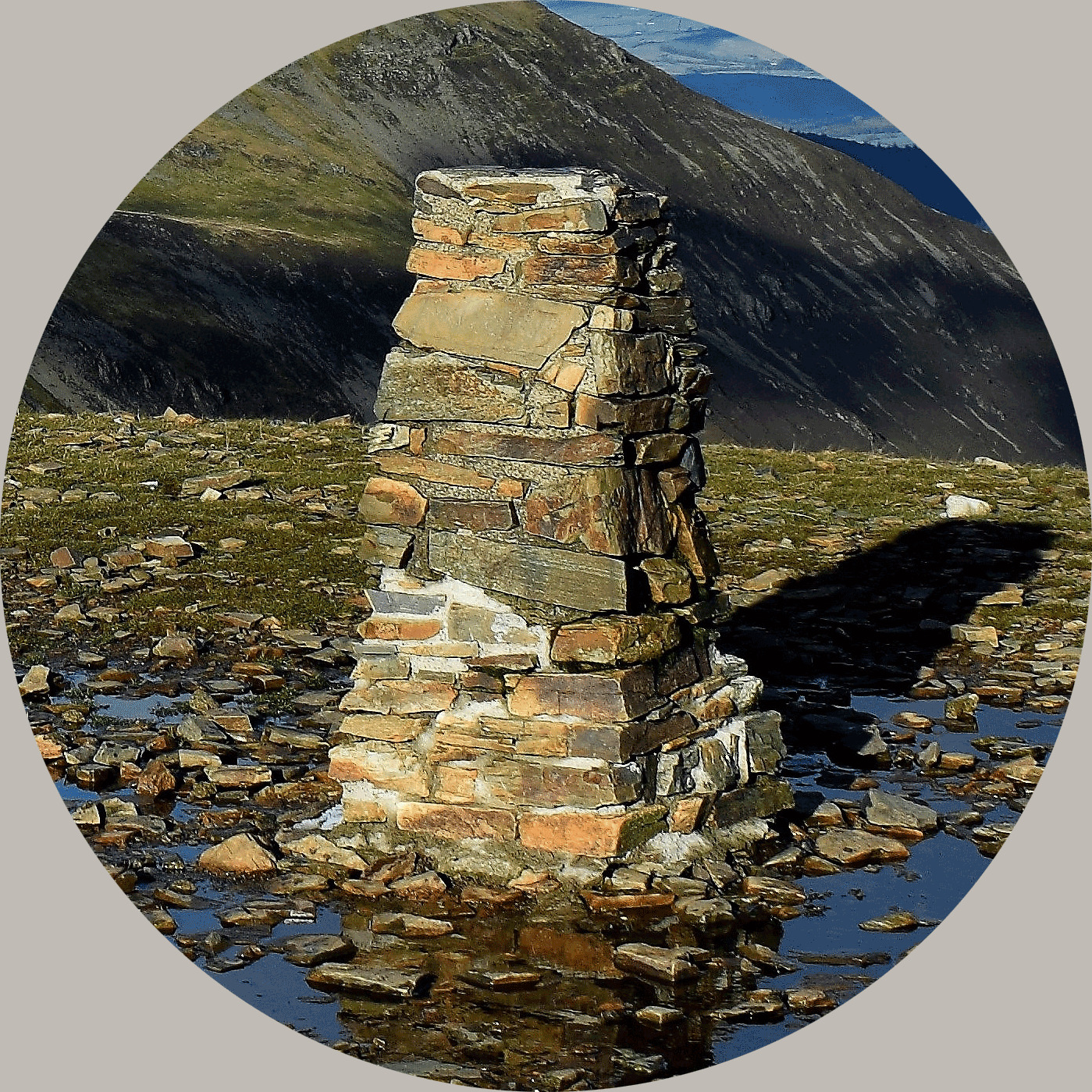
The trig point here sits proud on the top of Warden Hill at 195 metres, a short distance inside a farmer’s field with footpath access to the monument.
Warden and Galley Hills Nature Reserve was Luton’s first nature reserve. The chalk downland in this area supports a huge variety of wild flowers and these attract rare insects and over 20 species of butterflies.
“Drays ditches” run along the base of Warden Hill which were originally dug in the Bronze Age as boundaries to separate tribal groups. However, later on in the Iron Age these were built up as a way to control the traffic along the Icknield Way.
The Icknield Way is an ancient trackway in southern England that goes from Norfolk to Wiltshire. It follows the chalk escarpment that includes the Berkshire Downs and Chiltern Hills. It is generally said to be one of the oldest roads in Great Britain, being one of the few long-distance trackways to have existed before the Romans occupied the country, of which the route can still be traced.
It is thought that Warden Hill was used as a harvest hill linking with the ancient tradition, surviving until recent times in Scotland, of building harvest hills to celebrate the first fruits festival Lughnasadh in early August. Folk lore often associates neolithic tombs and stone circles with this feast day which was a major neolithic festival coming at a time when the outcome of the harvest was very uncertain.
Near the top of Galley Hill (186m) a short distance away, two Bronze Age barrows can be found. These were excavated in the 1960s and the remains of 14 burials were found in the largest barrow. In the Middle Ages a gallows was built on top of one of the barrows to be used for public executions.
About Ye Ole Survey Monuments
|
 |
Ye Ole Survey Monument (YOSM) is a captivating series of caches that pays homage to the remarkable legacy of OutForTheHunt's YSM series (GC45CC).
YOSM caches are strategically positioned at or near Trig Points. These triangulation stations have played a pivotal role as surveying landmarks, contributing to the mapping of expansive territories.
Some of these points, bearing historical significance, might now be situated on private land or have vanished with time. As a result, the caches are artfully placed in close proximity, reverently acknowledging the historical importance of these survey monuments.
|
More information, bookmarks and statistics can be found at the YOSM Website
If anybody would like to expand the Ye Ole Survey Monuments Series, please do.
I would ask that you request a number for your cache first at www.yosm.org.uk
so we can keep track of the numbers and names to avoid duplication.