Skip to content

Playa de Rodas EarthCache

Hidden : 4/28/2026
Difficulty:
2 out of 5
Terrain:
2.5 out of 5

Size: Size:   other (other)

Join now to view geocache location details. It's free!

Watch

How Geocaching Works

Please note Use of geocaching.com services is subject to the terms and conditions in our disclaimer.

Geocache Description:


Preguntas que hay que responder - questions to answer

Para reclamar este EarthCache, debes enviarme, a través de mi perfil y antes de cualquier registro de hallazgo, las respuestas a las siguientes preguntas. Si hay algún error, me pondré en contacto contigo. No es necesario esperar a recibir ninguna autorización. Por favor, NO ENVÍES fotos. Estas son más útiles en el registro.

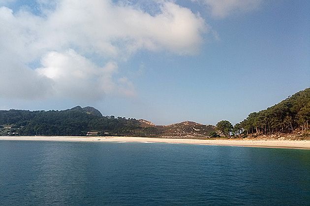
En las coordenadas del EarthCache te encuentras en la arena de la Praia de Rodas...

1 - Mide la pendiente de la playa.

2 - Teniendo en cuenta el resultado anterior, ¿qué tipo de playa es la Praia de Rodas? a) disipativa; b) reflectante; c) intermedia.


Obligatorio:

Se debe subir una foto por cada registro. La foto debe mostrar claramente el punto de referencia (en el centro de la playa) con los árboles de fondo o, si se prefiere, una foto en la arena con el código gc de este EC escrito en la arena y acompañado de un pie (el tuyo y de nadie más). Gracias por visitarnos.

To claim this EarthCache one should send me, through my profile and before any found log, the answers to the following questions. If something is incorrect I'll contact you. There is no need to wait for any authorization. Please DO NOT SEND photos. These are more useful on the log.

At the EarthCache coordinates you are on the sand of Praia de Rodas.

1 - Measure the beach’s slope.

2 - Based on the previous result, what type of beach is Praia de Rodas? a) dissipative; b) reflective; c) intermediate.


Mandatory:

One photo uploaded for each log. Either clearly identified at ground zero (in the middle of the beach) with the trees as background, or, if desired, a photo on the sand with the gccode for this EC written in the sand and accompanied by a foot (yours and from no one else). Thank you for visiting.


Tipos de playas:


La pendiente de la playa, también conocida como pendiente del frente de playa o pendiente de la zona intermareal, se refiere al ángulo con el que el frente de playa se inclina desde la línea de costa hacia el interior. Se trata de una característica dinámica que varía en función de las condiciones del oleaje y la composición de los sedimentos. Por lo general, las pendientes de playa van desde suaves (disipativas) hasta pronunciadas (reflectivas), con pendientes intermedias entre ambas.

Playas disipativas:

Tienen pendientes suaves (normalmente inferiores a 0,05 o 3 grados). Suelen encontrarse en zonas con gran energía de las olas, donde la suave pendiente permite que estas disipen su energía gradualmente.

Playas reflexivas:

Estas tienen pendientes pronunciadas (normalmente superiores a 0,1 o 6 grados). Son habituales en zonas con poca energía de las olas, donde estas se reflejan de vuelta hacia el mar en lugar de romper en la playa.

Playas de nivel intermedio:

Estas playas presentan pendientes moderadas (entre 0,05 y 0,1 o de 3 a 6 grados) y muestran características tanto de playas disipativas como de playas reflectantes.


Factores que influyen en la pendiente de la playa:

Energía de las olas:

Una mayor energía de las olas suele dar lugar a pendientes más suaves (disipativas), mientras que una menor energía de las olas da lugar a pendientes más pronunciadas (reflectivas).

Tamaño de grano de los sedimentos:

Las playas con sedimentos de mayor tamaño (como guijarros o cantos rodados) suelen tener pendientes más pronunciadas que aquellas con arena más fina. Esto se debe a que los sedimentos de mayor tamaño son más permeables, lo que permite que el agua se drene más fácilmente y reduce la fuerza erosiva del reflujo.

Composición de los sedimentos:

Los cambios en la composición de los sedimentos, como la erosión o la sedimentación, también pueden afectar a la pendiente de la playa. Por ejemplo, las condiciones de tormenta pueden aplanar la pendiente de la playa debido a la erosión, mientras que las condiciones más tranquilas pueden provocar una pendiente más pronunciada a medida que se deposita el material.

Amplitud de marea:

El rango de marea también puede influir en la pendiente de la playa, ya que unos rangos de marea más amplios pueden dar lugar a un perfil de playa más ancho y a una pendiente general más suave.


Medición de la pendiente de la playa:

La pendiente de la playa se mide normalmente como el ángulo (en grados) entre la superficie de la playa y un plano horizontal.

Se puede utilizar un transportador o un clinómetro para medir el ángulo directamente. Aquí puedes aprender a fabricar uno tú mismo.

Como alternativa, la pendiente se puede calcular utilizando la relación entre la altura y la longitud (distancia vertical dividida por la distancia horizontal).
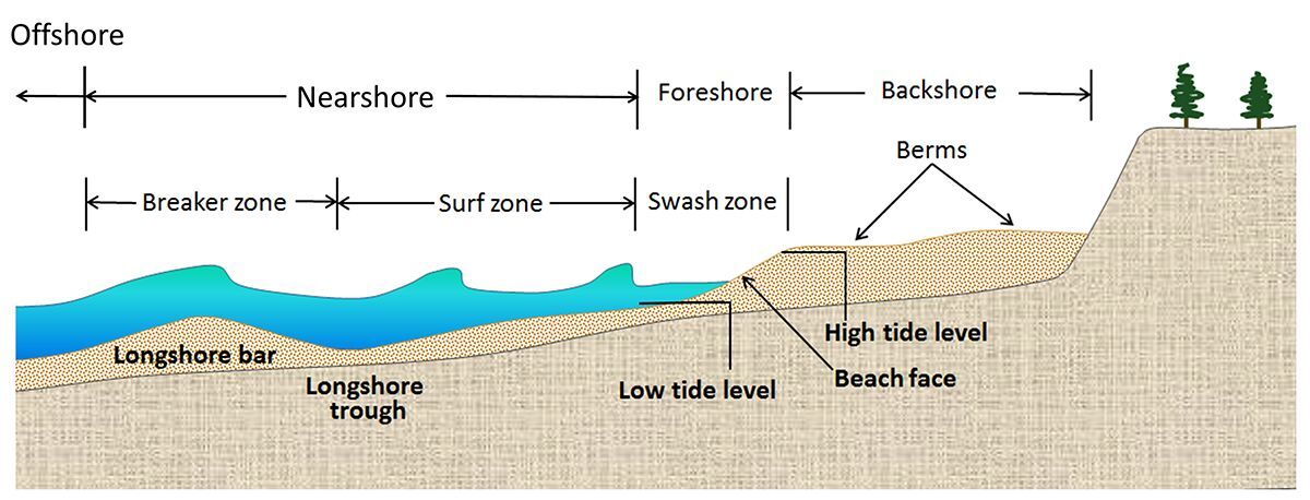
 

Plan de la playa

ref: wikipedia, https://www.nps.gov/articles/effects-of-grain-size-and-slope.htm , https://www.internetgeography.net/topics/landforms-of-coastal-deposition/ , https://www.numberanalytics.com/blog/beach-slope-essentials , https://www.researchgate.net/publication/358979403_A_punctuated_equilibrium_model_for_storm_response_of_geologically_controlled_beaches_Application_to_western_Portuguese_beaches


Beach types:


Beach slope, also known as beach face slope or foreshore slope, refers to the angle at which the beach face inclines from the shoreline towards the land. It's a dynamic feature that changes based on wave conditions and sediment composition. Typically, beach slopes range from gentle (dissipative) to steep (reflective), with intermediate slopes in between.

Dissipative Beaches:

These have gentle slopes (typically less than 0.05 or 3 degrees). They are often found in areas with high wave energy, where the gentle slope allows waves to dissipate their energy gradually.

Reflective Beaches:

These have steep slopes (typically greater than 0.1 or 6 degrees). They are common in areas with low wave energy, where waves reflect back into the ocean rather than breaking on the beach.

Intermediate Beaches:

These have moderate slopes (between 0.05 and 0.1 or 3 to 6 degrees) and exhibit characteristics of both dissipative and reflective beaches.


Factors affecting beach slope:

Wave Energy:

Higher wave energy generally leads to gentler slopes (dissipative), while lower wave energy results in steeper slopes (reflective).

Sediment Grain Size:

Beaches with larger sediment (like pebbles or cobbles) tend to have steeper slopes than those with finer sand. This is because larger sediments are more permeable, allowing water to drain more easily and reducing the erosive force of the backwash.

Sediment Composition:

Changes in sediment composition, such as erosion or deposition, can also affect the beach slope. For example, storm conditions can flatten the beach slope due to erosion, while calmer conditions can lead to a steeper slope as material is deposited.

Tidal Range:

The tidal range can also influence beach slope, with higher tidal ranges potentially leading to a wider beach profile and a gentler overall slope.


Measuring Beach Slope:

Beach slope is typically measured as the angle (in degrees) between the beach face and a horizontal plane.

A protractor or clinometer can be used to measure the angle directly. Here you can learn how to make one yourself.

Alternatively, the slope can be calculated using the rise over run (vertical distance over horizontal distance).


Beach scheme

ref: wikipedia, https://www.nps.gov/articles/effects-of-grain-size-and-slope.htm , https://www.internetgeography.net/topics/landforms-of-coastal-deposition/ , https://www.numberanalytics.com/blog/beach-slope-essentials , https://www.researchgate.net/publication/358979403_A_punctuated_equilibrium_model_for_storm_response_of_geologically_controlled_beaches_Application_to_western_Portuguese_beaches


El acceso a las Islas Cíes está regulado. El mejor sitio para obtener información es este. Hay diferentes ofertas con distintos horarios; algunas de ellas se pueden consultar aquí. Aquí puedes consultar la tabla de mareas y también las previsiones meteorológicas. Puede resultarte útil.


Access to the Cíes Islands is controlled. The best place to get information is here. There are different offers with different schedules, some of them can be seen here. Here you can check the tide chart and also the weather predictions. It might be helpful.


Por favor, no compartas las respuestas. Para garantizar la perdurabilidad de los EarthCaches, añade a tu registro una foto del momento en el que llegaste al lugar. Esto ayuda a acabar con las visitas fantasma que parecen sacadas de una película de Walter Mitty.

Please do not share the answers. To make sure that EarthCaches endure append to your log a photo of the day at ground zero. It helps to end ghost visits that resemble Walter Mitty.


Additional Hints (No hints available.)

Advertising with Us