The Fort Augustus granite gneiss is a member of the West Highland granite gneiss suite in Scotland. It is a metamorphic rock formed from a granite that underwent partial melting of Neoproterozoic metasediments of the Moine Supergroup. The granitic protolith (the original granite) was intruded approximately 870 million years ago. The gneiss is also known for its association with the early to mid-Ordovician Grampian Orogeny and its role in understanding the Great Glen Fault, within which you are standing.
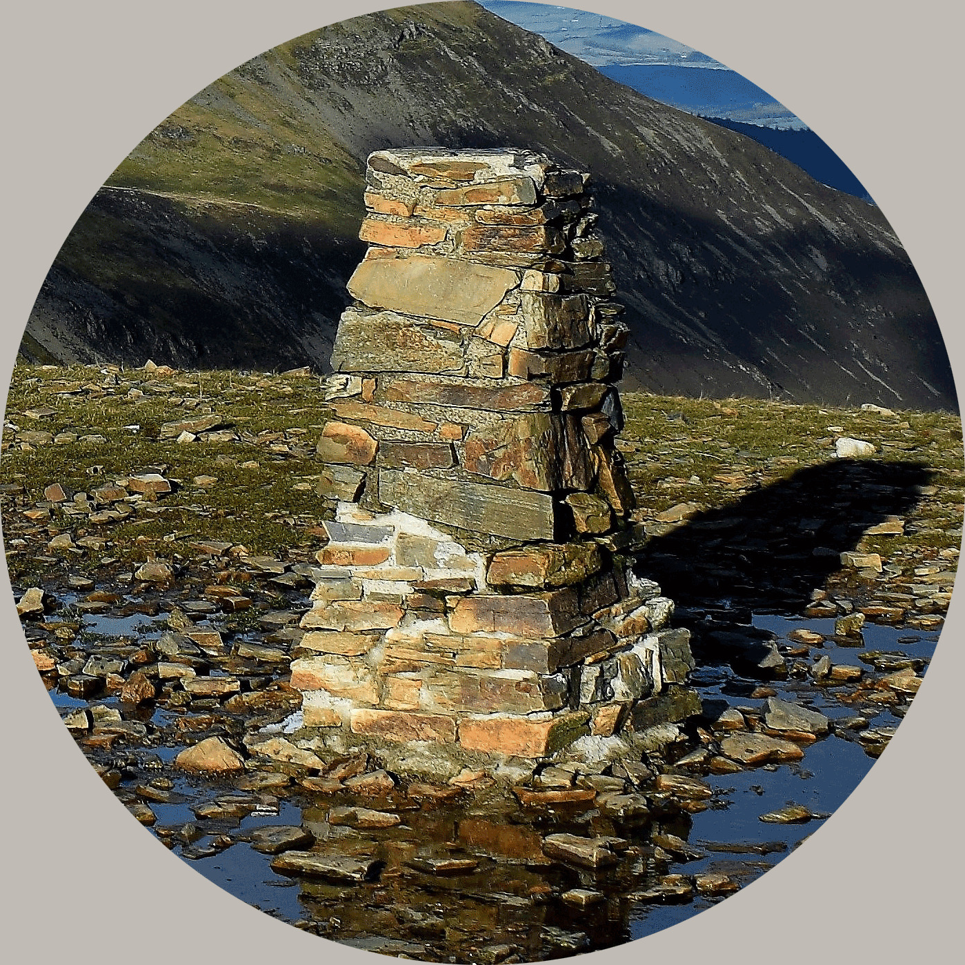
The trigpoint here, which is situated within an area of felled forestry, is in reality positioned on the top of a rocky crag giving the opportunity to have a closer look at the rock you find here and answer a couple of simple questions, whilst hopefully gaining a little understanding of one of the most important rocks found in this area.
You need to look at the large, exposed boulder close to the trigpoint. The tasks you need to complete to log a find are as follows:
1) Take a photo of yourself (or a personal item) with the trigpoint and view as proof of your visit to the YOSM
2) Look closely at the rock next to the trigpoint. There is a distinct mineral in the rock that is rectangular and a very different colour to the rest of the rock. Please tell me what mineral you believe it to be - does it protrude from the rock - if so, what does this tell you about the hardness of the mineral?
3) Finally, look at the main rock. What is the noticeable feature on the surface of the rock. Describe what you can see, and speculate on what might have caused it. You don't need to research beyond the information given in the listing below.
About the Great Glen trigpoint project
The Great Glen trigpoint project itself was a geological study of the crustal movement across the Great Glen Fault. This is where two crustal plates meet, with one plate slowly sliding north, while the other slides south. The area experiences numerous earthquakes each year, but as they are small and frequent, they are seldom felt. The Kessock Bridge, which spans the north end of the fault, was designed to cope with these tremors.
The project, designed to measure this movement, ran from 12 June 1972 until 3 July 1979. Fifteen pillars were planned, but only fourteen, comprising a mix of Hotine and Vanessa type trigpoints, seem to have been built. Most of the pillars have flush brackets, with the exception of Stations P and Q, but only one appears on OS maps, it being Station J, situated about 1.5k south of Fort Augustus.
Due to the geological link to these specific trigpoints, it is fitting to publish an EarthCache here at one of them, although for the purposes of this one, we will look at the local rock rather than the fault, however, we want to highlight the geological project within the listing - this is why the trigpoints are much closer together than usual and cross both sides of the valley, and indeed, both sides of the Great Glen Fault.
Background Geology
Granite gneiss is a type of metamorphic rock formed from granite that has been subjected to intense heat and pressure, resulting in a banded or foliated structure. It shares the same mineral composition as granite (quartz, feldspar, and mica) but has distinct banding and can be significantly stronger than granite.
-
Metamorphism
Gneiss is a metamorphic rock, meaning it was formed from pre-existing rocks (like granite) that have been transformed by heat, pressure, and/or chemical reactions.
-
Banding:
The most noticeable feature of gneiss is its banding, which is a layering of light and dark minerals that can appear as bands or streaks. This banding is a result of the mineral grains aligning under pressure.
-
Granite Composition:
Gneiss, like granite, is primarily composed of quartz, feldspar, and mica.
-
Strength:
Gneiss can be stronger than granite due to the reorganisation of minerals during metamorphism, leading to increased interlocking and resistance to stress.
-
Formation:
Gneiss can form from granite as it has here, but it can also form from other types of rocks, such as schist or volcanic rocks, under the right metamorphic conditions.
Quartz, feldspar, and mica are three common minerals found in many rocks, particularly granite and pegmatite. They are often described as key constituents of granitic rocks, forming an interlocking matrix. A typical granite composition includes 20-60% quartz, 10-65% feldspar, and 5-15% mica. Other minerals like amphiboles and trace amounts of various minerals are also present. Below is a more detailed look at each of the main minerals.
-
Quartz:
This mineral is a hard, glassy-looking mineral that often appears clear or white. It's a major component of granite and other rocks, and it's known for its hardness (7 on the Mohs scale).
-
Feldspar:
Feldspar is another common mineral in igneous rocks like granite. It can be a variety of colors, including pink, red, and white. It's also known for its hardness (6 on the Mohs scale).
-
Mica:
Mica minerals, such as biotite and muscovite, are known for their sheet-like structure and ability to split into thin layers. They often appear dark brown or black.
The trigpoint lies within an area of felled forestry. There is actually quite a good track now that leads up from somewhere near the bridge below to the trigpoint, once on it the going is fairly easy and with the forest now felled once again, the views from the trigpoint are quite good.
About Ye Ole Survey Monuments
|
 |
Ye Ole Survey Monument (YOSM) is a captivating series of caches that pays homage to the remarkable legacy of OutForTheHunt's YSM series (GC45CC).
YOSM caches are strategically positioned at or near Trig Points. These triangulation stations have played a pivotal role as surveying landmarks, contributing to the mapping of expansive territories.
Some of these points, bearing historical significance, might now be situated on private land or have vanished with time. As a result, the caches are artfully placed in close proximity, reverently acknowledging the historical importance of these survey monuments.
|
More information, bookmarks and statistics can be found at the YOSM Website
If anybody would like to expand the Ye Ole Survey Monuments Series, please do.
I would ask that you request a number for your cache first at www.yosm.org.uk
so we can keep track of the numbers and names to avoid duplication.