
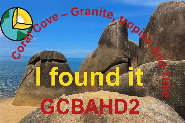
🇬🇧 EarthCache: Coral Cove – Granite, Tropics & Time
Location: Coral Cove Beach, Ko Samui, Thailand
🧭 Introduction
Welcome to Coral Cove Beach – where ancient granite, tropical weather, and coastal forces meet. In this EarthCache, you'll learn how granite forms, how it weathers, and how erosion shapes the coastline.
🪨 How is Granite Formed?
Granite is an intrusive igneous rock (pluton), formed when magma slowly cools deep underground. Its minerals include:
- Quartz (gray, translucent)
- Feldspar (white to pink)
- Mica (black or silvery)
On Ko Samui, tectonic uplift exposed this granite, which has been weathered over millions of years.
🌧️ Weathering
Weathering is the breakdown of rock in place:
- Chemical: Water + CO₂ → breaks down feldspar into kaolinite
- Physical: Temperature changes, salt crystals, root growth → cracks and breaks the rock
🌊 Coastal Erosion
Waves, tides, and wind constantly shape the granite. Typical features:
- Rounded, smoothed surfaces
- Undercut bases
- Salt weathering from sea spray
📋 Tasks
- What colors and minerals can you observe in the granite?
- How does the surface feel? Smooth? Rough? Rounded?
- Do you see any cracks or fractures? In which direction do they run?
- Find at least 2 examples of weathering or erosion. Classify them as chemical / physical / coastal erosion.
📸 Logging Requirement
Take a photo of yourself or a personal object and your cacher name (e.g. GPS, sign, backpack) in front of the granite rocks. Avoid spoilers or showing other people.
Your geocaching username must be clearly visible in the photo. It must not be digitally added afterward. Logs that do not meet both conditions will be deleted.

🇹🇭 EarthCache: Coral Cove – หินแกรนิต เขตเมืองร้อน และกาลเวลา
สถานที่: หาด Coral Cove เกาะสมุย ประเทศไทย
🧭 แนะนำสถานที่
ยินดีต้อนรับสู่ หาด Coral Cove จุดที่ หินแกรนิตโบราณ สภาพอากาศแบบเขตร้อน และแรงกัดเซาะตามธรรมชาติมาบรรจบกัน ใน EarthCache นี้คุณจะได้เรียนรู้เกี่ยวกับ การเกิดของหินแกรนิต การ ผุพัง และ การกัดเซาะชายฝั่ง
🪨 หินแกรนิตเกิดขึ้นอย่างไร?
หินแกรนิตเป็น หินอัคนีแทรกซอน (Pluton) ที่เกิดจาก ลาวาที่เย็นตัวช้าใต้ดิน ประกอบด้วยแร่:
- ควอตซ์ (เทา โปร่งแสง)
- เฟลด์สปาร์ (ขาวถึงชมพู)
- ไมกา (ดำหรือเงิน)
บนเกาะสมุย หินแกรนิตนี้ถูกยกตัวขึ้นมาจากชั้นหินลึกโดยแรงเทคโทนิก และผุพังตามกาลเวลา
🌧️ การผุพัง
การผุพัง คือกระบวนการที่หินสลายตัวในที่เดิม:
- เคมี: น้ำ + CO₂ → ทำให้เฟลด์สปาร์เปลี่ยนเป็นเคโอลิไนต์
- กายภาพ: อุณหภูมิเปลี่ยนแปลง เกลือ รากไม้ → ทำให้เกิดรอยแตก
🌊 การกัดเซาะชายฝั่ง
คลื่น ลม และน้ำทะเล สร้างรูปร่างใหม่ให้กับหินแกรนิต ลักษณะเด่น:
- พื้นผิวเรียบมน
- ฐานถูกกัดเซาะ
- การกัดเซาะด้วยเกลือจากไอน้ำทะเล
📋 คำถามภาคสนาม
- คุณเห็นสีและแร่ใดบ้างในหินแกรนิต?
- พื้นผิวของหินเป็นอย่างไร? เรียบ? ขรุขระ? มน?
- คุณเห็นรอยแตกหรือรอยแยกไหม? ทิศทางใด?
- ยกตัวอย่างการผุพังหรือการกัดเซาะอย่างน้อย 2 กรณี พร้อมจำแนกประเภท (เคมี / กายภาพ / ชายฝั่ง)
📸 เงื่อนไขในการลงบันทึก
ถ่ายภาพ คุณเองหรือสิ่งของส่วนตัวที่มีชื่อผู้เล่น (เช่น GPS ป้าย กระเป๋า) โดยมีหินแกรนิตอยู่ด้านหลัง หลีกเลี่ยงการแสดงเนื้อหาที่เป็นสปอยล์หรือบุคคลอื่น
ชื่อผู้เล่น Geocaching ของคุณต้องมองเห็นได้ชัดเจนในภาพถ่าย และต้องไม่ถูกเพิ่มเข้ามาทีหลังด้วยวิธีดิจิทัล หากไม่ปฏิบัติตามทั้งสองเงื่อนไข Log จะถูกลบโดยไม่มีข้อยกเว้น

🇩🇪 EarthCache: Coral Cove – Granit, Tropen & Zeit
Ort: Coral Cove Beach, Ko Samui, Thailand
🧭 Einleitung
Willkommen am Coral Cove Beach auf Ko Samui. Hier treffen Jahrmillionen alte Granitfelsen, tropisches Klima und die Kraft des Meeres aufeinander. In diesem EarthCache lernst du, wie Granit entsteht, wie er verwittert und wie Küstenerosion das Gestein verändert.
🪨 Wie entsteht Granit?
Granit ist ein magmatisches Tiefengestein (Plutonit), das entsteht, wenn Magma tief in der Erdkruste langsam abkühlt. Dabei kristallisieren Mineralien wie:
- Quarz (grau, durchsichtig)
- Feldspat (weiß bis rosa)
- Glimmer (schwarz oder silbrig)
Auf Ko Samui wurde der Granit durch tektonische Hebung an die Oberfläche gebracht und im Laufe von Jahrmillionen durch Verwitterung freigelegt.
🌧️ Verwitterung
Verwitterung ist der Zerfall von Gestein am Ort:
- Chemisch: Wasser + CO₂ → zersetzt z.B. Feldspat zu Kaolinit
- Physikalisch: Temperaturwechsel, Salzsprengung, Wurzeln → mechanischer Zerfall
🌊 Küstenerosion
Wellen, Wind und Gezeiten schleifen die Granitfelsen ab. Typische Zeichen:
- Glattpolierte, runde Oberflächen
- Unterspülte Sockel
- Salzsprengung durch Meeresluft
📋 Aufgaben
- Welche Farben und Minerale erkennst du im Granit?
- Wie fühlt sich die Oberfläche an? Glatt? Rau? Abgerundet?
- Siehst du Klüfte oder Risse? In welche Richtung verlaufen sie?
- Finde mindestens 2 Beispiele für Verwitterung oder Erosion. Ordne sie chemisch / physikalisch / Küstenerosion zu.
📸 Logging-Bedingung
Mache ein Foto von dir oder einem persönlichen Gegenstand und deinem Cacher-Namen (z. B. GPS, Zettel, Rucksack) vor einem der markanten Felsen. Achte darauf, dass keine Spoiler oder fremde Personen im Bild sind.
Dein Cachername muss lesbar zu sehen sein. Nicht nachträglich ins Bild eingefügt. Logs die, die beiden Bedingungen nicht erfüllen werden gelöscht.
Banner:
Für die Bannerfans von euch gibt es hier noch ein Banner das ihr gerne in eurem Profil einfügen könnt.
For the banner fans of yours, there is another banner that you can add to your profile.
<a href="http://coord.info/GCBAHD2"><img src="https://s3.amazonaws.com/gs-geo-images/4de28658-f2e8-4ea1-b47f-f631b815afc5_l.jpg" alt="GCBAHD2" width="307" height="197" /> </a>
