Steventon GeoCache Series
After our recently placed GeoCache Series at Great Western Park (GWP) (cache #1-11, 14, 17-19, 30-32, 35, 38, 60-61, 80-81, 84, 104-106), Didcot (cache #12-13, 15-16, 20-25, 29, 33-34, 41-42, 44-45, 47-48, 53, 59, 62-63, 66-67, 69-79, 82-83, 90-103, 107-112, 117-119, 121-129, 137-141, 146, 163-164), Harwell (cache #26, 36-37, 43, 46, 54-55, 58, 68), Chilton (cache #27-28, 85), Sutton Courtenay (cache #39, 64-65), Milton (cache #40, 49-52, 56-57, 151-153), Upton (cache #86-87), Long Wittenham (cache #88-89), Hagbournes (cache #114-116, 179), Kingsgrove (cache #120, 130-132), Compton (cache #133-134), Appleford (cache #135-136), Newbury (cache #142-145, 147-150, 159-161, 165-177), Drayton (cache #154-158), Richmond (cache #162), and Steventon (cache #178, 180), we decide to place a few more caches in other parts of Didcot and surrounding villages, in order to honour local heros, and to reflect our rich local history, stories and heritage. We hope you will enjoy these new caches and may also learn something new when you are caching, thank you!
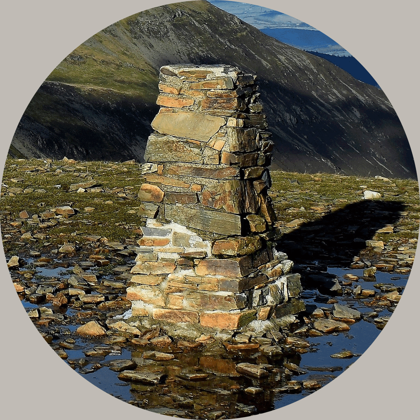
Steventon #181 - Steventon Hill Trig Point (Officially Known as YOSM #1338 Steventon Hill)

The Steventon Hill Trig Point (designated TP6176) is a concrete surveying pillar located in the village of Steventon, Oxfordshire. It sits at an elevation of approximately 99 metres above sea level and offers panoramic views across the Vale of White Horse toward the Cotswolds.
Key Details
About this Wherigo-cache
This Wherigo cache is placed near the Steventon Hill Trig Point to celebrate the 2nd Anniversary of the revived Ye Ole Survey Monuments (YOSM) Series launched on 18th April 2024.
Why 18 April?
This date holds historical significance - it was on 18 April 1936 that a group of surveyors began the retriangulation of Great Britain, an ambitious project that led to the creation of the trig points we know and love today. Since YOSM caches are placed at these historic monuments, this is the perfect day to celebrate geocaching, mapping, and adventure!
This cache is located using the Reverse Wherigo cartridge developed by -Waldmeister-.
To find the cache you will need to download this Wherigo cartridge to a compatible device.
At the published coordinates, you will be standing in front of the trig point. Please find a Flush Bracket (or Plate) with a 4 digit number preceded with the letter S on this trig point. Let these numbers be ABCD.
And then please look at the brass fitting mounted on the top of the trig point, which has three radiating arms. This served as the mounting point for a theodolite (a precision surveying instrument), which is also known as the "Spider". On this "Spider", someone carved some letters and digits. The digits carved here are EF, and the total number of letters carved to the left of the digits is G.
To find this Wherigo cache you will need to use the above collected information to complete the following three 6-digit codes to use in the Reverse Whereigo cartridge:
A ( A - G ) G ( A - C ) ( C + E ) ( A - E )
C ( B - C ) ( D - B ) ( G - C ) ( A / G ) ( A - G )
( B - F ) ( A / E ) E ( C - E ) ( B - E ) ( D - A - C )
Please also note:
This is our first Wherigo cache, so any comments and suggestions are welcome.
Please bring your own pen, and open & close the cache lid carefully so the cache and log book can survive longer. You might need a tweezer to help retrieve the log paper.
Please also replace exactly as found due to obvious reason, and please be careful with the possible thorns, stinging nettles, and overhead tree branches! Long sleeves, trousers, and gloves are recommended.
Thank you and enjoy GeoCaching!
FTF: Congratulations to George & The Dragons for their FTF on 21 April 2026!

About Ye Ole Survey Monuments
|
 |
Ye Ole Survey Monument (YOSM) is a captivating series of caches that pays homage to the remarkable legacy of OutForTheHunt's YSM series (GC45CC).
YOSM caches are strategically positioned at or near Trig Points. These triangulation stations have played a pivotal role as surveying landmarks, contributing to the mapping of expansive territories.
Some of these points, bearing historical significance, might now be situated on private land or have vanished with time. As a result, the caches are artfully placed in close proximity, reverently acknowledging the historical importance of these survey monuments.
|
More information, bookmarks and statistics can be found at the YOSM Website
If anybody would like to expand the Ye Ole Survey Monuments Series, please do.
I would ask that you request a number for your cache first at www.yosm.org.uk
so we can keep track of the numbers and names to avoid duplication.