Le rocher de l'Hermitage
Curiosité géologique
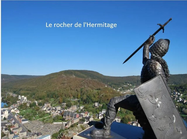
Le rocher de l’Hermitage, situé sur la rive gauche de la Meuse face aux roches des quatre fils Aymon, est constitué par un massif rocheux, abrupt et très découpé. Il surplombe la Meuse et l’on peut découvrir une très belle vue sur la vallée en aval en direction de Laval-Dieu et de l’embouchure de la Semoy.
L’étendue des roches constituant à proprement parler le site de l’Hermitage est assez restreinte bien qu’en fait, toute la crête constituant ce que l’on appelle la boucle de Monthermé soit remarquablement pittoresque. La zone comprise notamment entre les deux ponts, celui de Bogny-sur-Meuse et le pont du chemin de fer situé au nord à 1300 mètres environ en aval du premier, offre cette particularité de surplomber la Meuse de presque à pic et d’être parmi les plus élevées de la région.
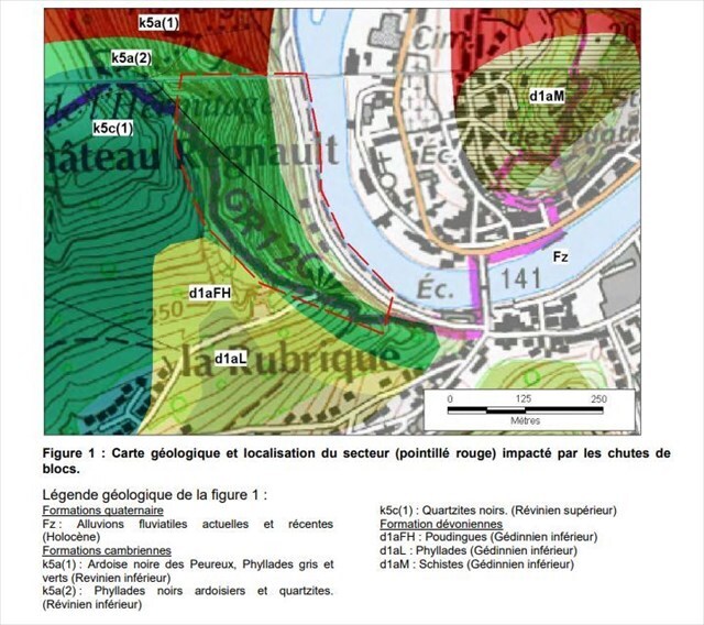
Géologiquement, la roche est une curiosité géologique constituée de poudingue du plateau de Rocroi
Ce site est entouré d’une légende : Maugis, cousin des quatre frères Aymon et enchanteur de son état, vint y faire pénitence. Il vécut quelques années sur ce rocher, contemplant sûrement les restes du célèbre Montessor (château qui appartenait aux quatre frères et qui avait été pris par Charlemagne) puis il mourut, laissant au rocher le nom de l’Hermitage.
The Hermitage Rock, located on the left bank of the Meuse facing the rocks of the Four Sons of Aymon, is made up of a steep and highly rugged rocky massif. It overlooks the Meuse, offering a magnificent view of the valley downstream toward Laval-Dieu and the mouth of the Semoy River.
The rocky area that strictly constitutes the Hermitage site is relatively limited, although the entire ridge forming what is known as the Monthermé loop is remarkably picturesque. The area located between the two bridges — the one at Bogny-sur-Meuse and the railway bridge situated about 1,300 meters downstream to the north — has the particular feature of overlooking the Meuse almost vertically and being among the highest points in the region.
Geologically, the rock is a geological curiosity linked to the Rocroi plateau.
This site is surrounded by a legend: Maugis, cousin of the Four Sons of Aymon and a magician by trade, came there to do penance. He lived for several years on this rock, surely contemplating the remains of the famous Montessor (a castle that belonged to the Four Brothers and had been taken by Charlemagne). He eventually died there, leaving the rock with the name “Hermitage.
.
Le poudingue
Qu’est-ce que c’est ?
Le poudingue est une roche sédimentaire composée de galets arrondis, collés par un ciment naturel de sable et d’argile.
Son âge
Le poudingue de l’Hermitage date du Dévonien inférieur, il y a environ 400 à 435 millions d’années.
Il repose sur des roches plus anciennes du Cambrien âgées de plus de 500 millions d’années.
Sa formation
Le poudingue se forme en plusieurs étapes sur une très longue durée, souvent plusieurs millions d’années.
1. L’érosion
La pluie, les rivières et le vent cassent les roches des montagnes.
Cela produit : des cailloux ; des galets ; du sable ; de l’argile.
2. Le transport
L’eau transporte ces matériaux.
Pendant le transport, les pierres se frottent entre elles, elles deviennent arrondies , elles forment des galets.
3. Le dépôt
Quand le courant ralentit, les galets, le sable et la boue se déposent au fond d’une rivière, d’un delta ou près d’une mer.
Des couches de sédiments s'accumulent peu à peu.
4. Le ciment naturel
Des minéraux dissous dans l’eau circulent entre les galets. Ils forment un « ciment » naturel qui colle les éléments ensemble.
What is it?
Puddingstone is a sedimentary rock made of rounded pebbles cemented together by a natural mixture of sand and clay.
Its age
The Hermitage puddingstone dates from the Lower Devonian period, about 400 to 435 million years ago.
It lies on older Cambrian rocks that are more than 500 million years old.
How it forms?
Puddingstone forms in several stages over a very long period of time, often millions of years.
1. Erosion
Rain, rivers, and wind break down mountain rocks.
This produces: stones; pebbles; sand; clay.
2. Transport
Water carries these materials away. During transport, the stones rub against each other, they become rounded ,they form pebbles.
3. Deposition
When the current slows down, the pebbles, sand, and mud settle at the bottom of a river, a delta, or near the sea.
Layers of sediment gradually accumulate.
4. Natural cement
Minerals dissolved in water circulate between the pebbles. They form a natural “cement” that binds the elements together.
Rappel concernant les « Earthcaches »: Il n'y a pas de conteneur à rechercher ni de logbook à renseigner. Il suffit de se rendre sur les lieux et de répondre aux questions posées.
Loguez cette cache "Found it" et envoyez-moi vos réponses soit via mon profil, soit via la messagerie, je vous contacterai en cas de problème.
Reminder concerning "Earthcaches": There is no container to search or logbook to complete. All you have to do is go to the scene and answer the questions asked.
Log this "Found it" cache and send me your answers either via my profile or via messaging, I will contact you in case of problem.
Questions
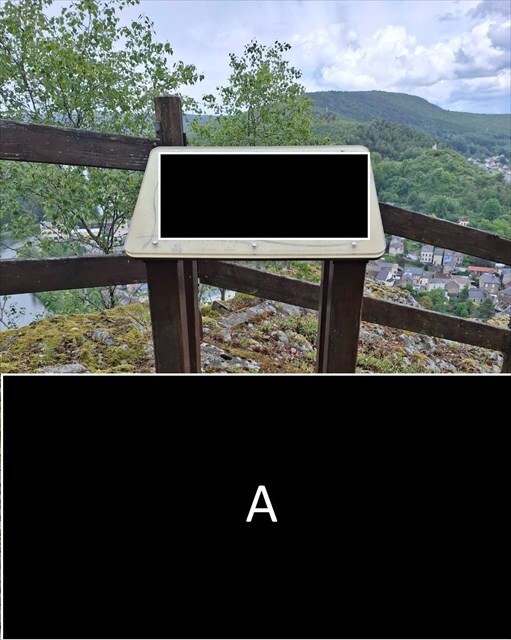
1) Sur la photo spoiler en A :
- Que voit-on dans la roche sous le panneau ?
- Les morceaux de roche sont-ils tous de la même taille ?
- Les galets sont-ils arrondis ou pointus ?
- Comment les galets sont-ils assemblés ?
- Comment ces galets ont-ils pu arriver ici ?
2) Prenez une photo devant Dardennor de vous, de votre GPS, ou de tout objet attestant de votre passage.
Questions
1) On the annotated photo A:
- What can we see in the rock beneath the sign?
- Are all the rock fragments the same size?
- Are the pebbles rounded or sharp?
- How are the pebbles held together?
- How could these pebbles have arrived here?
2) Take a photo in front of Dardennor showing yourself, your GPS device, or any object that can serve as proof that you visited the site.