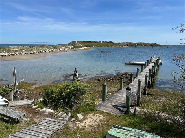
Cuttyhunk Island is part of the Elizabeth Islands chain near the entrance to Buzzards Bay and is known for its quiet, undeveloped character and strong connection to fishing and boating. The island has a very small year-round population, which increases slightly during the summer months when visitors arrive by ferry or private boat. Unlike more developed tourist destinations, Cuttyhunk has no major hotels, chain stores, or busy commercial areas; instead, it consists mostly of simple cottages, natural landscapes, and a small working harbor that serves as the center of activity.
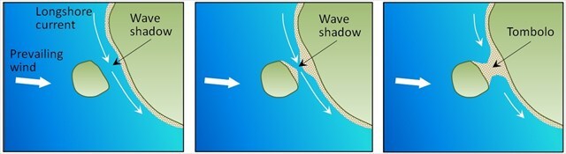
A tombolo is defined as a narrow strip of sand, gravel, or shingle that connects an island to the mainland (or to another island). It is formed when waves and currents deposit sediment in the calmer water behind an island.
As waves approach an offshore island, the island blocks some of their energy. This creates a wave shadow on the side of the island facing away from the incoming waves. Because the water in this sheltered area is calmer, sand, gravel, and other sediment carried by longshore currents begin to accumulate there. Over time, the deposits grow into a ridge that eventually connects the island to the mainland (or another island), forming a tombolo.
The type of sediment found in a tombolo can also reveal information about how it formed and the coastal forces that shape it. Coarse sediments, such as gravel and pebbles, typically indicate a high-energy environment with strong waves and currents capable of transporting larger particles. In contrast, fine sediments like sand or silt suggest lower-energy conditions. The degree of sorting can also provide clues, since well-sorted sediments indicate that waves and currents have repeatedly reworked the material over time, while poorly sorted sediments may point to a combination of processes, such as storms and normal wave action. Also shape of the sediment is also important since rounded particles suggest they have been transported and worn down by wave action, whereas angular particles often indicate a nearby source.
Logging Requirements:
- Compare and contrast the sediment particles found on either side of the tombolo. Why do you think such a noticeable difference exists?
- Based on the location of the tombolo, from which direction is the prevailing current most likely transporting sediment?
- Upload a photo with either yourself or a personal object taken at GZ. If caching in a group, the photo must prove each person visited the site.
Sources:
- https://www.worldatlas.com/articles/coastal-landforms-what-is-a-tombolo.html
- https://en.wikipedia.org/wiki/Tombolo