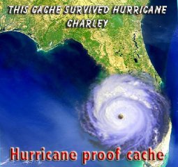
FEMA developed this Park for the many people that lost their
homes in Charlotte County During Hurricane Charley. The difficulty
of this cache isn't in finding this cache, it is in finding it
without getting caught by the many watchers that watch 24 hours a
day 7 days a week. Can you avoid the eyes in the skies? This park
is an awesome thing to witness but sad that so many lost their
homes. It brings to the fore front what a hurricane can
do.
Hurricane Ivan was the ninth named
storm, the sixth hurricane, and the fourth major hurricane of the
2004 Atlantic hurricane season. It formed on September 2 as a
tropical depression, became a tropical storm on September 3, and a
hurricane on September 5. It was a Cape Verde-type hurricane that
reached Category 5 strength on the Saffir-Simpson Hurricane Scale,
the highest possible category. Ivan also gained unprecedented
intensity at low latitudes—Category 4 at only 10.6° N—after having
existed for only a few days. Its minimum recorded pressure of 910
mb made it the sixth most intense Atlantic hurricane on record. It
caused an estimated $13 billion dollars worth of damage in the
United States, making it the third costliest hurricane to ever
strike the U.S.
Ivan struck Grenada directly on mid-day
September 7 at Category 3 intensity, causing at least 39 deaths and
damage to over 85% of the structures on the island. It continued
across the Caribbean Sea, reaching Category 5 intensity before
passing close to the Jamaican coast and Grand Cayman and crossing
the western tip of Cuba. Twenty deaths were reported in Jamaica,
and damage to over 80% of the buildings was reported on Grand
Cayman.


Storm history
On September 2, 2004, Tropical Depression Nine formed about 555
miles (890 km) southwest of the Cape Verde Islands. The depression
strengthened gradually to tropical storm status about 610 miles
(980 km) southwest of the Cape Verde Islands, moving
west-northwesterly at around 16 mph (25 km/h), and was given the
name Ivan on September 3.
Early September 5, Tropical Storm Ivan's winds strengthened to
hurricane status 1210 miles (1950 km) east-southeast of the Lesser
Antilles. By 5 PM EDT, Ivan had rapidly strengthened to a strong
category three hurricane (nearly a category four) on the
Saffir-Simpson Hurricane Scale with winds of 125 mph (200 km/h).
The National Weather Service noted such rapid strengthening was
unprecedented at such low latitudes in the Atlantic basin.
Caribbean
As Ivan traveled west, it weakened to a Category 2 hurricane. But
on September 7, shortly after passing over Grenada on its way into
the Caribbean Sea, it retained Category 4 intensity with winds of
135 mph (215 km/h). Saint Lucia, St. Vincent, and Barbados were
scaved by the hurricane with Grenada suffering a significant direct
battering for several hours.
As Ivan was passing just north of the Windward Netherlands
Antilles and Aruba on September 9, sustained wind speed increased
to 160 mph (260 km/h) thus classifying Ivan as a Category 5
hurricane. Following this milestone, Ivan fluctuated between
category 4 and 5 status, which is typical of intense
hurricanes.
Ivan continued west-northwest, heading straight for Jamaica. As
Ivan approached the island late on September 10, it began a
westward jog which kept the eye and the strongest winds to the
south and west. However, because it still came very close to the
Jamaican coast, and its winds were strongest on the north side,
Jamaica still was battered with hurricane-force winds for hours.
After clearing Jamaica, it resumed its more northerly track, and
retained Category 5 intensity with sustained wind speeds of 165 mph
(270 km/h). With minimum recorded central pressure at 910
millibars, Ivan is ranked as the sixth most intense Atlantic
hurricane on record.
Ivan spent most of September 11 traveling west at Category 4
strength, staying just off the southern coast of Jamaica. Ivan's
intensity continued fluctuating, with the storm temporarily
retaining Category 5 strength before passing within 30 miles (45
km) of Grand Cayman, bringing 180 mph winds onto the island.
After passing the Cayman Islands, Ivan brushed the western tip
of Cuba late on September 13, with its eyewall coming on shore.
With most of its central circulation staying offshore, Ivan was
able to pass through the Yucatan Channel with no loss of strength.
Once over the Gulf of Mexico, Ivan lost some strength, dropping
back to a 140 mph (225 km/h) Category 4 hurricane, but maintained
that intensity as it traveled north to the coast of the United
States.
United States
Around 2 AM CDT September 16 (0700 UTC), Ivan struck the U.S.
mainland near Gulf Shores, Alabama. At the time, Ivan's maximum
sustained winds had dropped to 130 mph (210 km/h). This drop in
strength was accompanied by a disruption of Ivan's eyewall. Both
NEXRAD operators and Hurricane Hunters reported that the
southwestern portion of the eyewall had all but disappeared in the
hours before landfall. As Ivan approached landfall, Florida Lt.
Governor Toni Jennings described it as "the size of Frances but
[with] the impact of Charley".
Ivan continued inland, maintaining hurricane strength until it
was over central Alabama. The city of Demopolis, over 100 miles
inland in west-central Alabama, endured wind gusts estimated at 90
mph, while Montgomery saw wind gusts in the 60–70 mph range at the
height of the storm. [3] Late on the 16th, Ivan weakened to a
tropical depression over northeastern Alabama. On September 18,
remnants of Ivan drifted off the U.S. mid-Atlantic coast into the
Atlantic Ocean, and the low pressure disturbance continued to dump
rain on the east coast of the United States.
Ivan lost tropical characteristics on September 18 while
crossing Virginia. The remnant low crossed the coast of New Jersey
later that day and advisories were discontinued. Nevertheless, on
the morning of September 21, some of its remnants combined with a
low-pressure system to pelt Cape Breton Island of Nova Scotia,
Canada, with hurricane-force winds, flooding some roads, felling
trees, and leaving thousands without power.
Ivan's "return"
An interesting development occurred on September 20 as a small
surface low, caused by the southern remnants of Ivan, moved across
the Florida peninsula. As it continued west across the northern
Gulf of Mexico, the system organized and took on tropical
characteristics. On September 22 the National Weather Service,
"after considerable and sometimes animated in-house discussion
[regarding] the demise of Ivan," determined that the low was in
fact a result of the remnants of Ivan and thus named it
accordingly.
On the evening of September 23, the revived Ivan made landfall
near Cameron, Louisiana, as a weak tropical storm. Ivan weakened
quickly as it traveled overland into southeast Texas.
Preparations
In the Caribbean, 500,000 Jamaicans were told to evacuate from
coastal areas, but only 5,000 were reported to have moved to
shelters. 12,000 residents and tourists were evacuated from Isla
Mujeres off Yucatan.
In Louisiana, mandatory evacuations of vulnerable areas in
Jefferson, Lafourche, Plaquemines, St. Charles, St. James, St. John
the Baptist and Tangipahoa parishes took place, with voluntary
evacuations in 6 other parishes ordered. More than one-third of the
population of Greater New Orleans voluntarily evacuated. At the
height of the evacuation, intense traffic congestion on local
highways caused delays of up to 12 hours.
In Mississippi, evacuation of mobile homes and vulnerable areas
took place in Hancock, Jackson and Harrison counties. In Alabama,
evacuation in the areas of Mobile and Baldwin counties south of
Interstate 10 was ordered, including a third of the incorporated
territory of the City of Mobile, as well as suburbs such as Daphne,
Fairhope, Gulf Shores, Orange Beach, Robertsdale, Foley, Fort
Morgan, Bayou La Batre, Dauphin Island, Point Clear, Belle
Fontaine, Coden, Grand Bay, Mon Luis and Hollinger's Island.
In Florida, a full evacuation of the Florida Keys began at 7:00
AM EDT September 10, but was lifted at 5:00 AM EDT September 13 as
Ivan tracked further west than originally predicted. Voluntary
evacuations were declared in ten counties along the Florida
Panhandle, with strong emphasis in the immediate western counties
of Escambia, Santa Rosa, and Okaloosa
Aftermath and recovery
Ivan killed 64 people in the Caribbean—mainly in Grenada and
Jamaica—three in Venezuela, and 25 in the United States, including
fourteen in Florida. Thirty-two more deaths in the United States
were indirectly attributed to Ivan. Tornadoes spawned by Ivan
struck communities along concentric arcs on the leading edge of the
storm. Blountstown, Florida, and Panama City Beach suffered two of
the most devastating tornadoes. A Panama City Beach news station
was nearly hit by an F2 tornado during the storm. Ivan also caused
over $13 billion in damages in the United States and $3 billion in
the Caribbean.
Hurricane Ivan

Track of Hurricane Ivan
Duration: Sep. 4 - Sep. 24, 2004
Highest winds: 165 mph (270 km/h)
Total damages (in USD): $16-18 billion
Total fatalities: 92 direct, 32 indirect
Areas affected: The Windward Islands, especially Grenada; Jamaica;
Grand Cayman; Cuba; Alabama, Florida, and much of the eastern
United States; After rebirth, Texas and Louisiana

 <<a href="http://www.nefga.com">
This cache was placed by a member of the
Northeast Florida Geocachers
Association