EARTHCACHE REQUIREMENTS
Each cacher must send his/her own answers BEFORE logging a find. Enjoy the journey (learning adventure) as well as the destination (smiley earned). Remember to take only pictures and leave only footprints. To get credit for this Earthcache, complete the following tasks:
NOTE: Answers via message -and- two log signature pictures are required to post a find for this cache.
The posted coordinates bring you to a place along the East Branch of the Tunungwant Creek. My dad and I enjoyed sitting on the rock amidst the running water with our four-legged friends lying contentedly by our side.
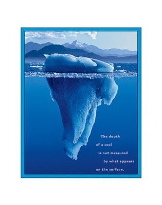
Find a special place to sit and reflect on the beauty and wonder of the water flowing within and around you. I always enjoy the peaceful splendor of sitting by running water. This earthcache added another dimension as I observed and pondered what lay beneath the surface causing the ripples and ….
1. MESSAGE …. a. What is the estimated width and depth of the TUNA at the posted coordinates? ... b. Describe (or post a picture) a minimum of two water features you observe at the posted coordinates. ... c. Explain what obstacles / creek bed features / etc. are responsible for what you observe.
2. MESSAGE …. a. Choose one more place anywhere along the TUNA. Post the coordinates. ... b. What is the estimated width and depth of the TUNA at your chosen coordinates? ... c. Describe (or post a picture) a minimum of two water features you observe at your chosen coordinates. ... d. Explain what obstacles / creek bed features / etc. are responsible for what you observe.
4. LOG …. Post a picture of you or your signature item at the two sites. These pictures are your log signature. No spoiler pics.
OPTIONAL - Please respect the time and effort involved in finding and creating this earthcache by adding A B C to your log.
A. Discover another body of water in/around the ANF, Give coordinates. Identify (river, stream, etc.). If found at a geocache/earthcache site, post picture with name of the cache and GC number instead of cooordinates.
B. JOURNEY OF THE MIND ... Science explains what we observe. Relate (in your own words) something you found interesting in the reading. This adds to your learning adventure and your log.
C. JOURNEY OF THE HEART ... Art shares our personal experience of what we see. Share something special you found on site, and why it is special to you ... prose / story / poem / picture. This is a memorable addition to your log and will make other hearts smile.
Journeys of Heart and Mind ...
Stories to Touch the Heart and Puzzles to Challenge the Mind / Rainbow Tree Story
THANK YOU LN for travelling and hiking with RT to complete this Earthcache Trail.
AN OBSTACLE IN OUR PATH
Author Unknown
starlightwalker.com/images/obstacles2.jpg

In ancient times, a King had a boulder placed on a roadway. Then he hid himself and watched to see if anyone would remove the huge rock.
Some of the king's wealthiest merchants and courtiers came by and simply walked around it. Many loudly blamed the king for not keeping the roads clear, but none did anything about getting the stone out of the way. Then a peasant came along carrying a load of vegetables. Upon approaching the boulder, the peasant laid down his burden and tried to move the stone to the side of the road. After much pushing and straining, he finally succeeded.
After the peasant picked up his load of vegetables, he noticed a purse laying in the road where the boulder had been. The purse contained many gold coins and a note from the king indicating that the gold was for the person who removed the boulder from the roadway.
The peasant learned what many of us never understand. Every obstacle presents an opportunity to improve our condition.
OBSTRUCTIONS
BOULDER - A boulder or ledge in the middle of a river or near the side can obstruct the flow of the river, and can also create a "cushion"; a "drop" (over the boulder).
SIEVE - Narrow empty space that water flows through between two obstructions, usually rocks. Water is forced through the sieve, resulting in higher pressures which forces water up and creates turbulence.
STRAINER - Formed when an object blocks the passage of larger objects but allows the flow of water to continue. The force of the water will pin an object or body against the strainer and then pile up, pushing it down under water.
SWEEPER - Trees fallen or heavily leaning over the river, still rooted on the shore and not fully submerged. Its trunk and branches may form an obstruction in the river like strainers. Since it is an obstruction from above, it often does not contribute to whitewater features but may create turbulence.
UNDERCUT ROCKS - Rocks that have been worn down underneath the surface by the river. They can be extremely dangerous features of a rapid because a person can get trapped underneath them, under water. This is espcially true of rocks that are undercut on the upstream side. Undercuts sometimes have pillows, but other times the water just flows smoothly under them, which can indicate that the rock is undercut. Undercuts are most common in rivers where the riverbed cuts through sedimentary rocks like limestone rather than igneous rock like granite. In a steep canyon, the side walls of the canyon can also be undercut.
FEATURES
CASCADE - a type of waterfall or a series of waterfalls.
EDDY - the swirling of a fluid and the reverse current created when the fluid flows past an obstacle. The moving fluid creates a space devoid of downstream-flowing fluid on the downstream side of the object. Fluid behind the obstacle flows into the void creating a swirl of fluid on each edge of the obstacle, followed by a short reverse flow of fluid behind the obstacle flowing upstream, toward the back of the obstacle. This phenomenon is most visible behind large emergent rocks in swift-flowing rivers.
FLATWATER - Lake water or slow-moving river current with no rapids. Water that is not moving, such as a lake or a pond.
HOLE - Also known as "stoppers" or "souse-holes", are formed when water pours over the top of a submerged object, causing the surface water to flow back upstream toward the object. Names because their foamy, aerated water provides less buoyancy and can feel like an actual hole in the river surface.
PILLOW - Formed when a large flow of water runs into a large obstruction, causing water to "pile up" or "boil" against the face of the obstruction. Pillows are also known as "pressure waves".
RAPID - A section of a river where the river bed has a relatively steep gradient causing an increase in water velocity and turbulence. A rapid is a hydrological feature between a run and a cascade. A rapid is characterised by the river becoming shallower and having some rocks exposed above the flow surface. As flowing water splashes over and around the rocks, air bubbles become mixed in with it and portions of the surface acquire a white colour, forming what is called "whitewater". Rapids occur where the bed material is highly resistant to the erosive power of the stream in comparison with the bed downstream of the rapids. Very young streams flowing across solid rock may be rapids for much of their length.
RIFFLE - Also known as a swift, is a shallow stretch of a river or stream where the current is below the average stream velocity and where the water forms small rippled waves as a result. It often consists of a rocky bed of gravels or other small stones. This portion of a stream is often an important habitat for small aquatic invertebrates and juvenile fishes.
RIPPLE - A small wave.
RUN - A smoothly flowing part of a stream.
WATERFALL - Usually a body of water flowing over an erosion-resistant rock formation that forms a nickpoint, or sudden break in elevation.
Wave - Noted by the large smooth face on the water rushing down. Sometimes a particularly large wave will also be followed by a "wave train", a long series of waves. These standing waves can be smooth or, particularly the larger ones, can be breaking waves (also called "whitecaps" or "haystacks"). Because of the rough and random pattern of a riverbed, waves are often not perpendicular to the river's current.
WHIRLPOOL - A swirling body of water usually produced by ocean tides. Smaller whirlpools also appear at the base of many waterfalls. In the case of powerful waterfalls, like Niagara Falls, these whirlpools can be quite strong. The most powerful whirlpools are created in narrow shallow straits with fast flowing water.
WHITEWATER - Formed in a rapid, when a river's gradient drops enough to disturb its laminar flow and create turbulence, i.e. form a bubbly, or aerated and unstable current; the frothy water appears white. The term "whitewater" also has a broader meaning, applying to any river or creek itself that has a significant number of rapids. On any given rapid there can be a multitude of different features which arise from the interplay between the shape of the riverbed and the velocity of the water in the stream.
TUNUNGWANT CREEK
A stream (also known as a brook, beck, burn, creek, crick, kill, lick, rill, river, syke, bayou, rivulet, or run) is a flowing body of water with a current, confined within a bed and stream banks, and is less than 60 feet (18 metres) wide. When two first-order streams (does not have any other stream feeding into it) come together, they form a second-order stream. When two second-order streams come together, they form a third-order stream. Typically, streams are said to have a particular profile, beginning with steep gradients, no flood plain, and little shifting of channels, eventually evolving into streams with low gradients, wide flood plains, and extensive meanders. Based on water flow, streams are classified as perennial (flow year-round), intermittent (flow part of the year), and ephemeral (flow only during and immediately after precipitation).
The posted coordinates take you to a place along the bank of the East Branch of the Tunungwant Creek. This spot is within 2+ miles of the source, which is the width and depth of a small brook that you can easily step over. Two first-order streams, Pigeon Run and Railroad Run, as well as numerous smaller springs, enter the Creek changing it to a second-order stream with increased width and depth. At the posted coordinates, you are observing a young, perennial, second-order stream.
The bedrock in McKean County is predominantly sandstone and shale. The relatively shallow depth at the posted coordinates give you a good view of the creek bed. Here you can easily observe the broken sheets of shale along the bottom of the creek, edges rounded due to the action of running water.
The Tunungwant Creek is divided into two second-order streams (East Branch and West Branch) which join together and flow into a third-order stream (Allegheny River). The Tunungwant Creek is part of the Allegheny River watershed.
WATER CACHES
All the water caches are a THANK YOU
to Earth Mother for her life-sustaining waters.
The depth of a soul is not measured by what appears on the surface.