EARTHCACHE REQUIREMENTS
Each cacher must send his/her own answers BEFORE logging a find. Enjoy the journey (learning adventure) as well as the destination (smiley earned). Remember to take only pictures and leave only footprints. To get credit for this Earthcache, complete the following tasks:
1. MESSAGE …. At the posted coordinates, there is a river of rocks. Although it is part of the boulder field, it is both the same and different. Give two ways this "river" compares to the boulder field?
2. MESSAGE …. Is what you are seeing considered alluvium or colluvium? Explain.
3. LOG …. Post a picture at or near the coordinates. This picture is your log signature.
OPTIONAL - Please respect the time and effort involved in creating this earthcache by adding A and B to your log.
A. JOURNEY OF THE MIND ... Science explains what we observe. Relate (in your own words) something you found interesting in the reading. This adds to your learning adventure and your log.
B. JOURNEY OF THE HEART ... Art shares our personal experience of what we see. Share something special you found on site, and why it is special to you. This is a memorable addition to your log and will make other hearts smile.
Journeys of Heart and Mind ...
Stories to Touch the Heart and Puzzles to Challenge the Mind / Rainbow Tree Story
THANK YOU Richard Carroll at Geological Survey of Alabama for your help.

ALLUVIUM vs COLLUVIUM
Both terms are used to denote the accumulation of debris. Alluvium involves sorted deposits as a result of water. Colluvium involves unsorted deposits as a result of a rockfall down a slope. Alluvium generally has smaller sediment sizes. Colluvium generally has larger sediment sizes.
BOULDER FIELD
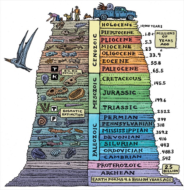
As you travel AL Route 281 (relatively close to the posted coordinates), you will see a continuous boulder field for more than a quarter of a mile along the road. The boulders extend both up and down the hill. The rock formation that holds up the ridge (and thus, the boulders) is called the Cheaha Quartzite member of the Lay Dam Formation. It makes up part of the Talladega Group. The geologic age of the Cheaha is Silurian or Devonian. According to a local geologist, age is not firm because there are very few identifiable fossils in it.
RESOURCES
https://mrdata.usgs.gov/geology/state/sgmc-unit.php?unit=ALtldc%3B7
file:///C:/Users/rainb/Downloads/miller.pdf
https://mavdisk.mnsu.edu/larsop2/geog101/MassWasting/LarsonMassWastOutline.html
Geologic Time Scale - multiple sites