At the given coordinates you should be standing at an informational sign near the parking area. This is a somewhat unique location. As you look around you will see areas that have been affected by glaciers, and other area which have not been affected.
During the most recent glaciation of the area (Wisconsinan - appox. 16,000 years ago) this was the location where the glaciers began to retreat. Glaciers carry large amounts of soil and rock within them. As the glociers retreat the soil and rock is released from the ice forming hills called moraines. The moraine in this area is a called a terminal morraine since it is at the furthest advance of the glacier. A common formation on terminal moraines is called a hummock. This is a small rounded mound up to around 15' high, but often smaller. Hummocks are prominent in the mowed area below this sign. The picture below shows an example of some of the hummocks in this area.
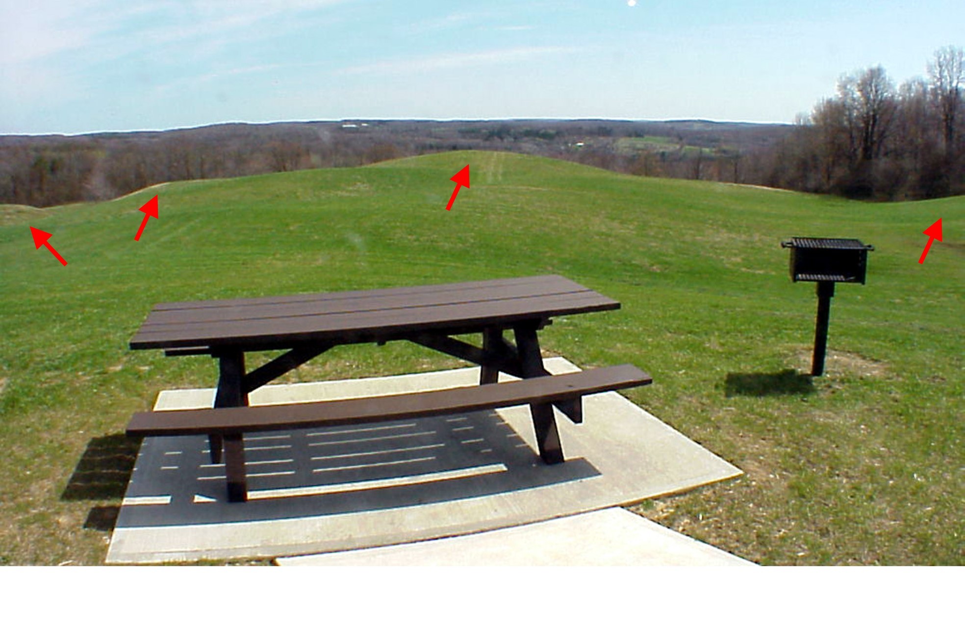
Glaciers, due to their immense weight cause a lot of erosion in areas that they pass over. Characteristics of a past glaciated area include broad valleys and rounded hilltops. Areas beyond the terminal moraine which have not been affected by the glacier tend to have valleys that are not as wide with more of a v-shape. Hills tend to be steeper and slightly higher than the hills that were affected by the glacier.
EARTHCACHE REQUIREMENTS:
(Questions Based on the Informational Sign)
- What is the name for the terminal moraine at this location?
- Besides the terminal moraine at this location, the sign mentions another type of moraine that is also present in Chautauqua county. What is the name of that type of moraine?
- The sign specifically mentions two examples of this other moraine type. What are the names for those two moraines, and what major impact did they have on the county?
(Questions Based on Observations at the Site)
- Look to the north. At the bottom of the moraine there is a valley and then a line of hills.
- Is the valley wide and generally flat or is it more 'V" shaped?
- Are the hills relatively tall and jagged or are they relatively short and smoothed out?
- Look behind you (south and/or east). Notice the large number of hummocks in the area. Select one of them and walk to the top of it.
- Take a GPS coordinate reading. Send this information with your answers.
- Also, estimate the size of the hummock that you selected.
|
IMPORTANT INFORMATION
|
| The park gates are open from mid-May to November from 8:30 AM to Dusk. NO NIGHT CACHING!!! If you are there during the day between November and mid-May you will find the gate closed. There is a space large enough for 3-4 vehicles near the gate. DO NOT BLOCK THE GATE!!! Starting from that location the terrain will increase 2-3 levels depending on the route you take to the site. |
| If you are there during the day between November and mid-May you will likely notice that the informational signs are not in place. If they are missing just answer the questions based on the onsite observations. |