Skip to content

[QVL] Rocca di Maiolo [Needs Unarchived] Traditional Cache

Hidden : 10/27/2019
Difficulty:
2.5 out of 5
Terrain:
5 out of 5

Size: Size:   regular (regular)

Join now to view geocache location details. It's free!

Watch

How Geocaching Works

Please note Use of geocaching.com services is subject to the terms and conditions in our disclaimer.

Geocache Description:


Rocca di Maiolo

Fortress of Maiolo
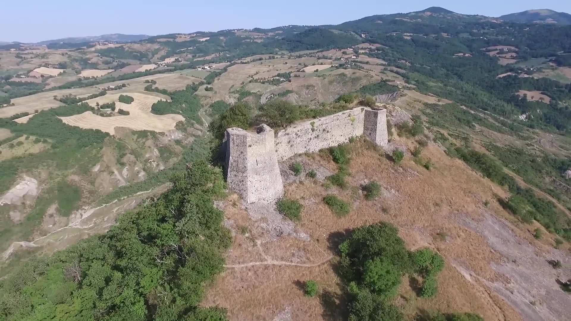

Foto aerea della rocca.

(Aerial photo of the fortress).
Consigli:

  • I sentieri che portano alla rocca sono pericolosi, sconsiglio la visita in solitaria, consiglio di andare almeno in due.
  • Sconsiglio la ricerca durante la notte, entrambi i percorsi sono ripidi e presentano degli strapiombi che li rendono molto pericolosi al buio.
  • Per affrontare i sentieri che conducono alla rocca, sono richieste: agilità, un minimo di preparazione fisica e assenza di forti vertigini.
  • Indossare calzature da trekking idonee.
  • Portare uno zainetto con acqua e alcuni viveri.

Advices:

  • The paths that lead to the fortress are dangerous, I advise you not to visit it alone, I recommend going at least in two.
  • I do not recommend the search during the night, both paths are steep and have overhangs that make them very dangerous in the dark.
  • To face the paths that lead to the fortress, the following are required: agility, a minimum of physical preparation and absence of strong vertigo.
  • Wear suitable trekking shoes.
  • Bring a backpack with water and some provisions.

Storia:

Maiolo era durante il medioevo, un importante insediamento a ridosso d'una rupe, sovrastato da una rocca considerata da tutti inespugnabile. La sua posizione strategica fu motivo di dure lotte tra le signorie dei Montefeltro e dei Malatesta, difatti il possesso di Maiolo rappresentava la chiave d'accesso alla vicina San Leo. Il borgo e la rocca seguirono le vicende storiche del Ducato di Urbino fino alla devoluzione di quest'ultimo allo Stato Pontificio nel 1631.

Non le guerre distrussero questo borgo e la sua rocca ma la natura. Il 28 maggio del 1700 si abbattè sul paese un diluvio che durò quaranta ore ininterrotte. Racconta una cronaca manoscritta del 1737, conservata nella Biblioteca Civica Gambalunga, che la notte seguente «staccossi dal monte il terreno ove era posta questa nostra terra, e rovinò tutto sottosopra, restando solo quattro piccole case verso tramontana, restando sotto le rovine della medesima morti gran parte degli abitanti». Una rovinosa frana spazzò via l'intero paese provocando una sciagura conosciuta in tutto il Montefeltro.

Come succedeva in questi casi, si pensò ad una punizione divina. Nacque così la leggenda che nella rocca si praticasse il "Ballo Angelico", profanando la quaresima, periodo di penitenza, castità e digiuno. Questa pratica si consumava di notte fra canti e risa, conducendo i partecipanti ad uno stato di semincoscienza e culminante con orge collettive.

Secondo la leggenda in una notte di luna piena, durante una di queste feste erotiche, ai convenuti apparve un angelo che annunciò una terribile punizione se si fossero ripetuti altri balli. Ma vinse la tentazione, suscitando fra tuoni e pioggia il castigo dell'ira divina. Si narra che un fulmine in particolare fu così potente da spaccare il monte di Maiolo, distruggendo case e palazzi e uccidendo uomini e animali, ma in realtà tale diceria risulta infondata poichè è una travisazione del fatto documentato che un fulmine nel 1647 (ovvero 53 anni prima della sciagura) mandò per aria la polveriera distruggendo parte della muraglia posta sulla strada che conduceva al forte.

History:

Maiolo was during the Middle Ages, an important settlement close of a cliff, topped by a fortress widely considered to be impregnable. Its strategic position was the cause of hard struggles between the lords of the Montefeltro and the Malatesta, in fact, the possession of Maiolo was the key to the nearby San Leo. The village and the fortress followed the historical events of the Duchy of Urbino until the latter's devolution to the Papal States in 1631.

Not the wars destroyed this village and its fortress but nature. On May 28, 1700, a downpour broke out over the town that lasted forty uninterrupted hours. It tells a manuscript chronicle of 1737, preserved in the Gambalunga Civic Library, that the following night «the ground where this land of ours was, detached from the mountain, and ruined everything upside down, leaving only four small houses towards the north, remaining under the ruins of the same, great part of the inhabitants». A disastrous landslide swept away the entire town causing a disaster known throughout the Montefeltro.

As it happened in these cases, it was thought of divine punishment. Thus was born the legend that the "Angelic Dance" was practised in the fortress, profaning Lent, a period of penance, chastity and fasting. This practice was consumed at night between songs and laughter, leading the participants to a state of semi-consciousness and culminating in collective orgies.

According to legend, on a full moon night, during one of these erotic parties, an angel appeared to the participants, he announced a terrible punishment if other dances were repeated. But temptation overcame, stirring up the punishment of divine wrath between thunder and rain. It is said that a lightning, in particular, was so powerful that it broke the mountain of Maiolo, destroying houses and buildings and killing men and animals, but in reality this rumour is unfounded as it is a misrepresentation of the documented fact that a lightning in 1647 (ie 53 years before the disaster) sent the gunpowder warehouse into the air, destroying part of the wall on the road that led to the fort.


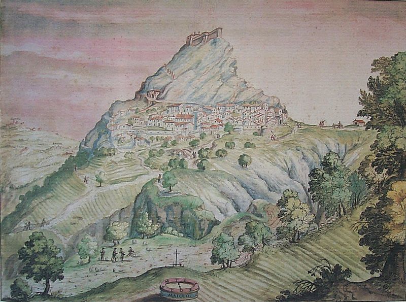
Dipinto di Maiolo dall'opera cartografica "Stati, domini, città, terre e castella dei Serenissimi Duchi e Prencipi della Rovere tratti al naturale" di Francesco Mingucci del 1626.

(Painting of Maiolo from the cartographic work "Stati, domini, città, terre e castella dei Serenissimi Duchi e Prencipi della Rovere tratti al naturale" by Francesco Mingucci of 1626).


Dipinto anonimo di Maiolo.

(Anonymous painting of Maiolo).


Sentieri / Paths:
Sentiero Nord:

Consigliato ai più avventurosi

Partendo dalla chiesa di Maioletto (Parcheggio Nord) si prosegue a piedi sulla strada fino a trovarsi di fronte ad un cancello, qui si prende la strada campestre che si trova sulla destra. Questa strada presenta un lieve dislivello e ci porta fino ad una zona in cui è presente un tabellone informativo su Maiolo, un tavolo da picnic, ed una vista sui macigni franati dal colle nel 1700.

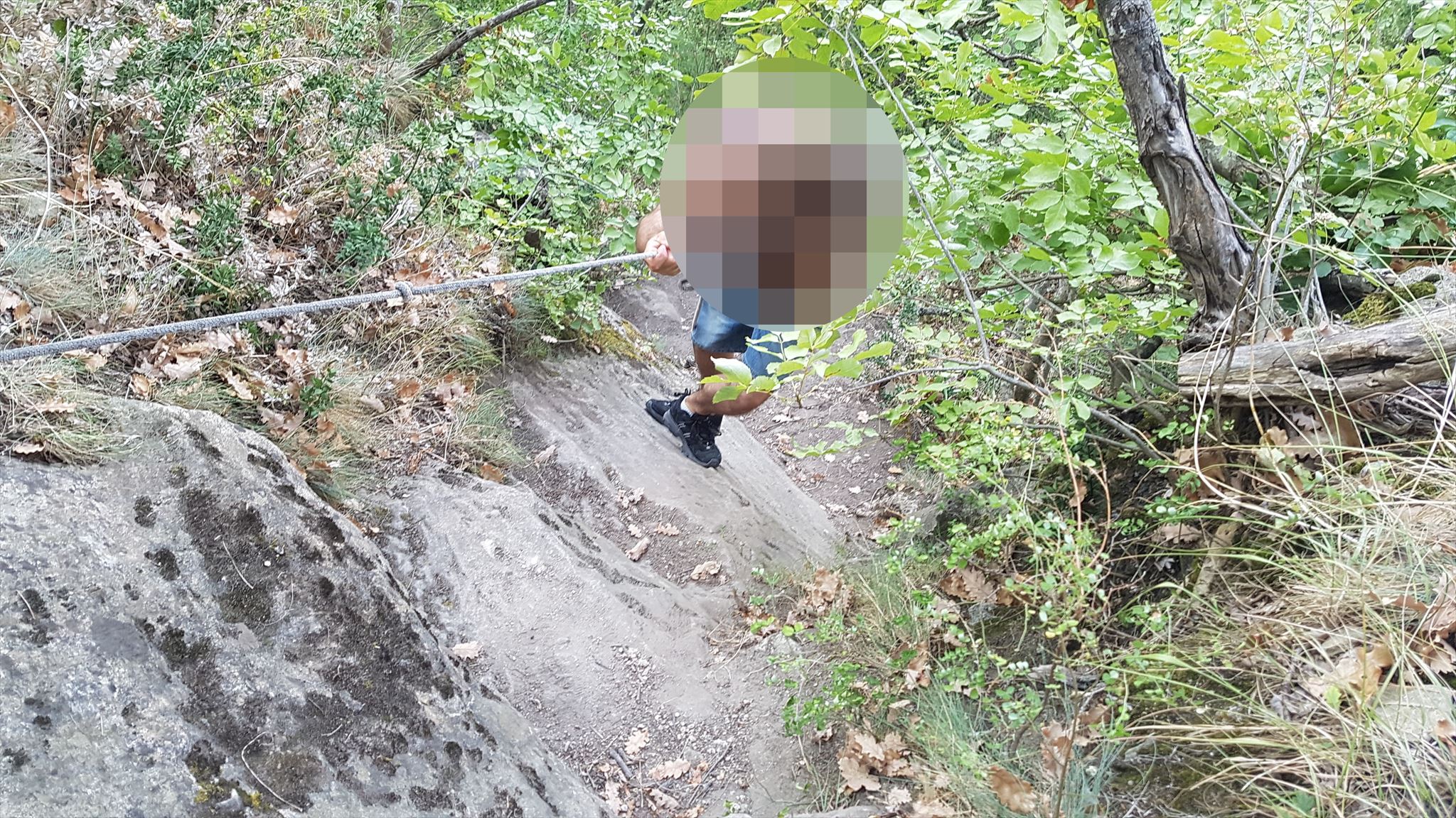
Venendo dalla chiesa, sulla sinistra, poco prima del tabellone informativo inizia il vero e proprio sentiero. Questo attraversa il bosco con pendenza sempre più elevata man mano che si prosegue, ed alcuni tratti son provvisti di corde per aiutarsi nella salita. Esso compie diversi tornanti ed in alcuni punti son presenti alberi caduti che intralciano il passaggio, facilmente superabili accovacciandosi sotto di essi o salendoci a cavallo per valicarli.

Nel tratto finale si dovrà scalare una parete di roccia tramite l'ausilio di un paio di corde già predisposte in loco legate a degli alberi.

Una volta superata la parte più impegnativa ed emozionante del sentiero esso continua per poche altre decine di metri fino al raggiungimento del torrione nord e della sua porta che permette l' entrata in una stanza con una scala che permette la salita in cima alla rocca.

Northern Path:

Recommended for the more adventurous

Starting from the church of Maioletto (North Parking Area) continue on foot on the road until you find yourself in front of a gate, here you take the country road on the right. This road has a slight gradient and takes us to an area where there is an information board on Maiolo, a picnic table, and a view of the boulders that collapsed from the hill in 1700.

Coming from the church, on the left, just before the information board, the real path begins. This crosses the wood with an increasingly higher gradient as you continue, and some sections are provided with ropes to help you climb. It makes several hairpin bends and in some places, there are fallen trees that hinder the passage, easily overcome by crouching beneath them or riding up to cross them.

In the final stretch, you will have to climb a rock face with the aid of a pair of already prepared ropes tied to trees.

Once past the most challenging and exciting part of the path, it continues for a few more tens of meters until it reaches the north tower and its door that allows entry into a room with a staircase that allows the climb to the top of the fortress.


Parete di roccia da scalare nel tratto finale del sentiero nord.

(Rock wall to climb in the final section of the northern path).
Sentiero Sud:

Consigliato ai deboli di cuore

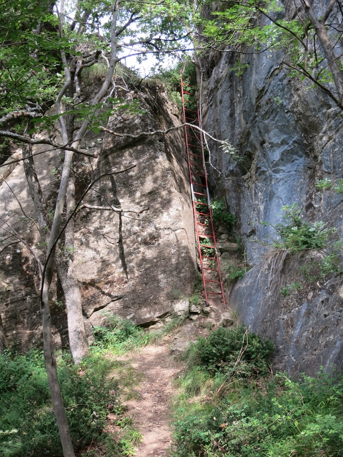
Questo percorso comincia alla chiesa di San Rocco (unica struttura rimasta interamente in piedi dopo la grande frana che coinvolse questo monte) e presenta alcuni tratti in forte pendenza ed altri con fango che potrebbero risultare scivolosi. Dalla chiesa il sentiero prosegue tagliando a mezzacosta un ripido pendio boschivo fino ad una radura dove una scala a pioli di metallo alta circa 8 metri permette di superare una parete di roccia.

Superata la scala si continua su sentiero a tratti esposto (sotto il quale è presente una parete di roccia ed i resti dell' evidente frana che sconvolse questo versante) che va poi a salire alcune placche di roccia (un cordone di canapa aiuta a superare queste erte rampe). Si continua su evidente traccia fino ai margini del bosco dove si trova un bivio. Qui si prosegue a destra salendo una ripida rampa in salita con l' aiuto di un altro cordone. Si esce di nuovo su pendio aperto, si salgono le ultime placche rocciose, a volte nascoste dall' erba, fino ai resti della rocca. Si segue la traccia fino al muro dove una porta permette l' entrata in una stanza con una scala che permette la salita in cima alla rocca.

Southern Path EN:

Recommended for the faint of heart

This route begins at the church of San Rocco (the only structure left entirely standing after the great landslide that involved this mountain) and has some steep slopes and others with mud that could be slippery. From the church, the path continues cutting a steep wooded slope to a clearing, where a metal ladder about 8 meters high allows you to climb a rock wall.

Once past the ladder, continue along the exposed path (under which there are a rock wall and the remains of the obvious landslide that upset this side) which then goes up some rock slabs (a hemp cord helps overcome these steep ramps). Continue on the obvious track to the edge of the forest where there is a fork in the road. Here you continue to the right going up a steep uphill ramp with the help of another cord. You go out again on an open slope, climb the last rocky plaques, sometimes hidden by the grass, up to the remains of the fortress. Follow the track to the wall where a door allows entry into a room with a staircase that allows the climb to the top of the fortress.


Scala a pioli nel sentiero sud.

(Ladder on the southern path).


Cache Banner:

PER RICEVERE QUESTO BANNER, ALLEGA AL TUO LOG UNA FOTO DI TE STESSO IN CIMA ALLA ROCCA, CON IN MANO IL TUO GPS E/O IL LOGBOOK.

(TO GET THIS BANNER, ATTACH TO YOUR LOG A PHOTO OF YOURSELF AT THE TOP OF THE FORTRESS, HOLDING YOUR GPS AND / OR THE LOGBOOK).


Ripresa video con drone / Video shooting with a drone:

Clicca sull' immagine per vedere il video completo.

(Click on the image to see the complete video).


Podio / Podium:

🥇 FTF - the_bau_team

🥈 STF - UpmTeam

🥉 TTF - asiappolo


Visitatori / Visitors:

Flag Counter


old cache


needs unarchived


Additional Hints ()

[IT]: Fnyv yn fpnyrggn nyy'vagreab qryyn gbeer, yn pnpur fv gebin ary fhb cvnab fpbcregb. [EN]: Pyvzo gur ynqqre vafvqr gur gbjre, gur pnpur vf va vgf bcra sybbe.

Decryption Key

A|B|C|D|E|F|G|H|I|J|K|L|M
-------------------------
N|O|P|Q|R|S|T|U|V|W|X|Y|Z

(letter above equals below, and vice versa)

Advertising with Us