Welcome to Sugar Creek Conservation Area. This Earthcache will take you on a very scenic walk to a very unique geological feature, requiring a round trip walk/hike of about a mile. The parking coordinates for this EC are provided as a waypoint and will get you to where you need to start. The majority of the hike back to the posted coordinates is relatively easy with a prairie land beginning and a relatively flat dirt trail section once you enter the woods. The terrain changes and becomes a bit more challenging once you reach the waterfalls (waypoint provided). I provided a trailhead waypoint to help you get to the starting point. DO NOT attempt to take the road that splits off to the left by the mailbox (shortly after you leave the parking area) to attempt to shorten your walk. You would be trespassing on private property. The trailhead marked will allow you to avoid any trespassing issues. HUNTING IS ALLOWED ON PROPERTY SO PLEASE TAKE PROPER PRECAUTIONS DURING ALL HUNTING SEASONS. If you have any questions, please refer to the pictures in the gallery, courtesy of IDNR, that list all hunting dates from 2020-2021. Finally, you will need some way to measure width and depth to be able to provide the answers needed to log a find. High water may prevent you from answering some of the questions, which would prevent you from logging a find so I suggest you attempt this EC during times of low water. If you have the time and are willing to make multiple trips, high water makes the waterfalls so much better, while making this EC unlikley to be completed.
We usually define a canyon as a deep cleft between escarpments (steep slopes) or cliffs created primarily by erosion from a source of water. The source of water is typically a river that manages to carve/erode its way through the various strata of rock as it travels downstream on its way to its end destination, or mouth/delta. Geologists use bigger words to define a canyon but at its essence, it's defined the same way. "A long, deep, narrow, very steep-sided valley cut primarily in bedrock with high and precipitous walls in an area of high local relief (e.g., mountain or high plateau terrain), often with a perennial stream at the bottom; similar to but larger than a gorge." https://en.wikipedia.org/wiki/Canyon, https://directives.sc.egov.usda.gov/OpenNonWebContent.aspx?content=41992.wba
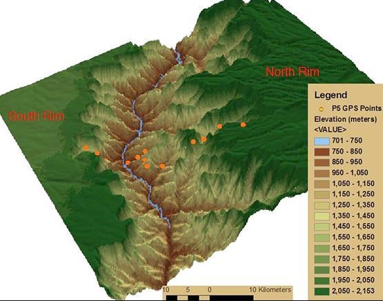
There are three primary types of canyons - a box canyon, a plateau canyon (also occasionally called a mountain-type canyon or river canyon), and a slot canyon. There is also a submarine canyon, located under large bodies of water, but we're looking at terrestrial canyons for this particular Earthcache.
Box Canyon
A box canyon is a steep walled canyon that normally has one access point that opens up into a somewhat circular "hole" that gives the person at the base of the walls the impression that one is "boxed" in and the only way out is also the only way in. Box canyons were sometimes used by settlers as a natural corral for animal control.
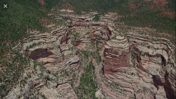
Plateau Canyon
The second, and most common type of canyon, is the plateau canyon. These canyons are the ones we generally think of when we hear the word canyon. The Grand Canyon is the most famous canyon that falls into this category.
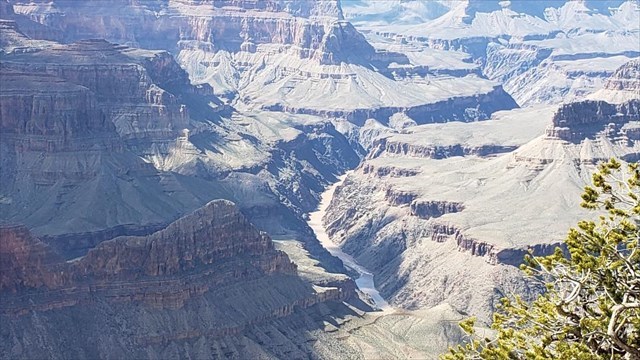
They have been created over time by the flow of water as it carves its way through softer rock, looking for the easiest path to flow downstream. They are occasionally aided in their development by other forms of erosion but the main erosion factor is the perennial flow of water, meaning that there is always water flowing along the river bed. They are typically wide and deep and the Grand Canyon is a good example of this. It has an average depth of one mile and an average width of 10 miles, its widest point being 18 miles across and its narrowest point being just 600 feet wide. Plateau canyons, by and large, are very hard to miss.
Slot Canyon
A slot canyon, on the other hand, can be very easy to miss. Slot canyons are defined as long, narrow, deep and tortuous channels or drainageways with sheer rock walls eroded into sandstone or other sedimentary rocks, especially in the semiarid western United States (e.g., Colorado Plateau); subject to flash flood events; depth to width ratios exceed 10:1 over most of its length and can approach 100:1. https://directives.sc.egov.usda.gov/OpenNonWebContent.aspx?content=41992.wba
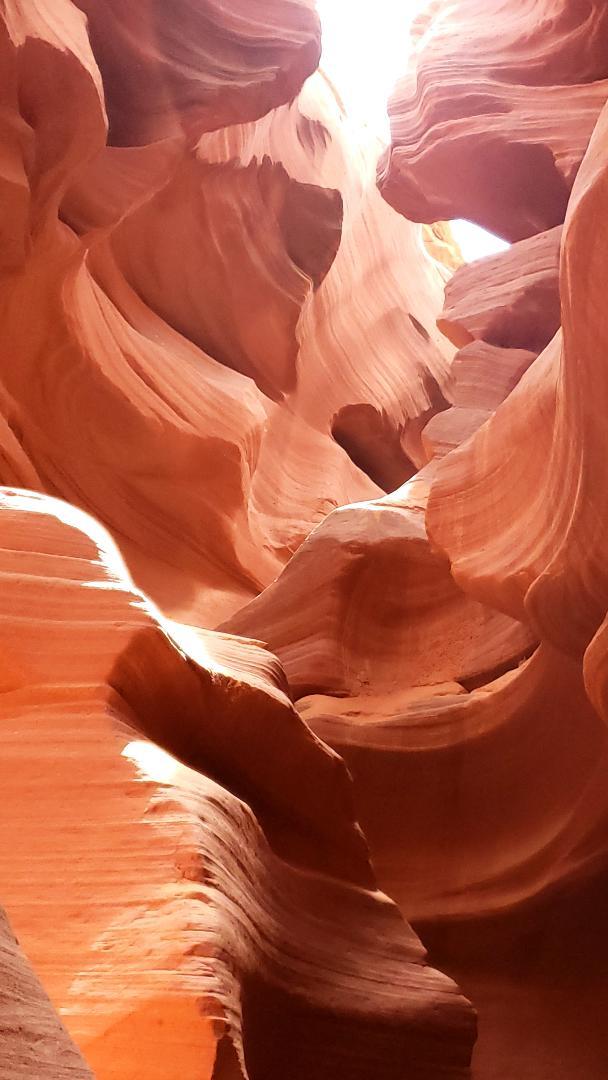
Unlike plateau canyons, slot canyons normally appear as slashes or narrow crevices in the stone and do not open to the sky in the manner in which a plateau canyon does. Although they are also created by the flow of water and the erosion of the rock that lines its walls, the water flow is NOT regular and is instead intermittent. Due to this intermittent flow of water, the water tends to follow a very narrow pathway of flow and erodes the rock in a much more dramatic downward way rather than via a more traditional V or U-shaped manner that predominates most forms of water erosion in water bodies with current that flow in a singular direction. http://www.scienceclarified.com/landforms/Basins-to-Dunes/Canyon.html#ixzz6EbjctrFv
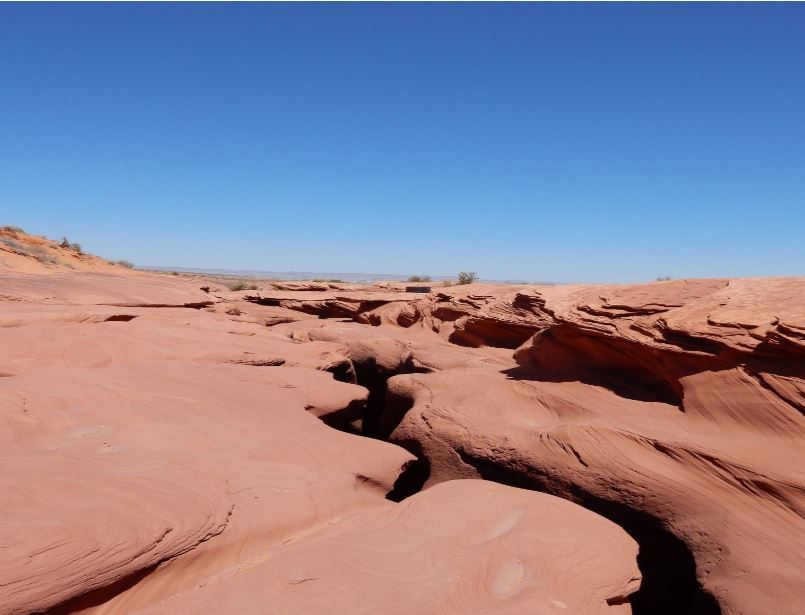
Slot canyons may not appear to be much from the surface but if one can access the areas of erosion in a slot canyon (or even see down into them), then something completely different is seen. Antelope Canyon in northern Arizona is probably the most photographed slot canyon in the world and when you see it below, you'll understand why. The rush of water that flows through a slot canyon is fast, immense, and erodes the walls quickly, creating stone carvings on the walls unseen almost anywhere else.
To Log This EarthCache
To demonstrate the educational value of your visit, please send me the answers to the following questions: use this link here (coachstahly) or use the link at the top of the cache page to reach my profile, where you will see a link to Send message or Send email). Reminder that you'll need some way to measure width and depth in order to answer these questions.
1. This will be the easiest question you'll need to answer! Which of the 3 types of canyons do you find yourself at? What similarities do you see between your answer and the canyon descriptions provided above? Despite my efforts to provide accurate coordinates, there was some bounce so you'll need to proceed downstream, noting where each noticeable drop off occurs as that marks the end of one section and the beginning of the next section. I suggest you stay on the left side as it's much easier to traverse.
2. For this set of questions we're going to examine the section of the canyon from the posted coordinates to virtual stage 4. How wide is the main channel that has been eroded? Just past that channel is your first depth measurement. How deep is it from the top to the bottom of the stream/canyon? What characteristics, if any, appear in this section that are similar in nature to the canyon you decided this is? What characteristics, if any, appear in this section that aren't similar in nature to the canyon you decided this is?
3. For this set of questions we're going to examine the section of the canyon from virtual stage 4 to virtual stage 5. How wide is the main channel that has been eroded? How deep is it from the top to the bottom of the stream/canyon? What characteristics, if any, appear in this section that are similar in nature to the canyon you decided this is? What characteristics, if any, appear in this section that aren't similar in nature to the canyon you decided this is?
4. For this set of questions we're going to examine the section of the canyon from virtual stage 5 to virtual stage 6 (the end of the canyon). How wide is the main channel that has been eroded? There's currently a log wedged across most of this channel. How deep is it from the top to the bottom of the stream/canyon? You'll see a logjam (the log in the channel is part of it) and your measurement needs to be taken to the right side of that logjam, just past the two large erosion potholes on the left side (as you look downstream). What characteristics, if any, appear in this section that are similar in nature to the canyon you decided this is? What characteristics, if any, appear in this section that aren't similar in nature to the canyon you decided this is?
5. For this set of questions we're going to examine the end of the canyon from the top. How wide is the channel between the left and right walls of the canyon here at the end of the canyon? How deep is it from the top to the bottom of the stream/canyon? This last measurement almost provides the total drop from the starting point. Look at where you're standing and then look upstream to where this canyon starts (posted coordinates). Are you slightly higher or slightly lower? Approximate the difference and you'll arrive at the total drop in elevation in this canyon due to water erosion. Approximately how far down did the water erode this canyon here at the end (add the depth measurement to your estimated difference between where you are and where you started).
6. OPTIONAL. Feel free to post pictures of yourself at or near GZ, any of the virtual stages, or any from the reference point. Please refrain from posting any pictures that might allow others to answer any of the measurement questions. Finally, feel free to offer me feedback about the coordinates for each of the virtual stages, including the posted coordinates. As stated earlier, there was enough bounce in my multiple trips out that made things a bit less accurate than I had hoped.