Narodni prirodni rezervace Prielom Hornadu je jednim z nejdelsich kanonu na Slovensku.
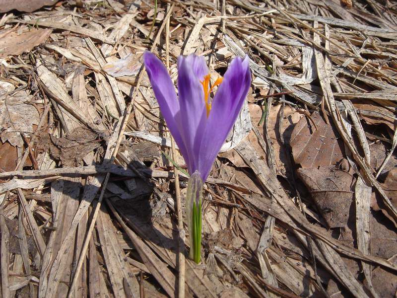
Reka Hornad rozdeluje tuto rezervaci na severni a jizni cast, s mnozstvim vzacnych druhu rostlin, na ktere se vaze velmi bohata fauna. Pozoruhodny je vyskyt teplomilnych druhu rostlin, ktere v davnych dobach pronikali dolinou Hornadu. Kanon je pristupny celorocne. Muzete do neho vstoupit z Podleska nebo od Cingova. Na rozdil od soutezek Slovenskeho Raje je pruchod mozny v obou smerech.
Pozveme Vas na navstevu unikatniho uzemi, ktere vytvorila reka Hornad.
Ve ????? vyhloubila kanon dlouhy 11,7km. Charakter hornin,clenitost terenu,mikroklima a pritomnost vody podminuji velkou pestrost rostlin,zivocichu a jejich biotopu.Atraktivnost uzemi zvysuje i vyskyt zajimavych skalnich utvaru, jako je Tomasovsky vyhled, Jehla a Kazatelna, ruznych jeskyn, dir a propasti.
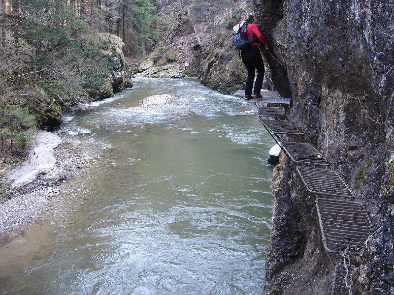
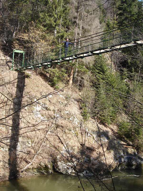
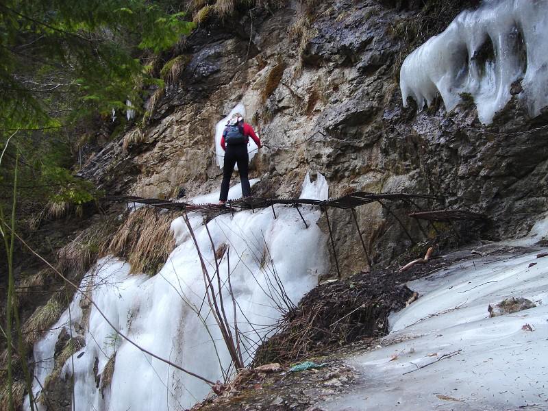
Prvni znamy prechod kanonu Hornadu po jeho zamrzle hladine se uskutecnil v unoru 1906 a v cervenci tohoto roku byl poprve splaveny na voru. Je jednim z nejatraktivnejsich kanonovych recist na Slovensku. Od Hrdla Hornadu az po Skalni vrata pri usti Bieleho potoka byl do roku 1974 postupne spristupnovany "Chodnikem Horske sluzby". Nejexponovanejsi casti je mozne prejit jen za pomoci kovovych stupacek,zebriku,lavek a retezu. Jeho vychodni casti prochazi Naucny chodnik Prielom Hornadu. Tento chodnik prochazi Narodni prirodni rezervaci s patym, tedy nejprisnejsim stupnem ochrany prirody. Aby se zachovala vysoka prirodni hodnota a jedinecnost tohoto uzemi je potrebna ochrana zejmena ze strany navstevniku.
Pohyb je mozny jen po znacenych turistickych chodnicich.
Nejnissi bod: Hornad pod Tomasovskym Vyhledem - 511m
Nejvyssi bod: soutok Hornadu a Velkej Bielej vody - 528m
Prevyseni: 17m na delce 9km
Vymera: 290,5 ha
Prumerny cas prechodu: 3,5 hod.
Pri prechodu vyuzijete 7 kovovych mostu a lavek, 140 stoupacek, priblizne 333m retezu a 70m drevennych lavek.
Upozorneni:
Kanon je v exponovanych mistech zabezpeceny technickymi pomuckami, ktere Vam pomuzou s prekonanim nepruchodnych mist.
Prechod si vyzaduje vhodnou turistickou vystroj, zejmena pevnou obuv a v neposledni rade take trochu odvahy.
Dodrzujte prosim pokyny Navstevniho radu NP Slovensky raj a Horske zachrane sluzby.
[EN]
We would like to invite you to visit a truly unique area formed by the Hornad River,which has cut trough ??? bedrock,to create the 11,7km long canyon.
The ccarecter of the rocks,diversity of the terrain,its microclimate and presence of water provide excellent conditions for a great variety of plants,animals and their habitats.The attraktiveness of the area is enhanced by occurrence of interesting rock formations,such,as Tomasovsky vyhlad (The Tomasovsky Viewpoint), Ihla (The Needle) and Kazatelnica (The Pulpit), as well as various gorges, caves, sinkholes and cliffts.
Due to its exceptionally high natural value,the canyon area is protected at the highest level of protection, as the Hornad Canyon National Nature Reserve, which has a total area of 290,5 ha.
This area is also proposed to become a part of the European network of protected areas, Natura 2000. This highlighst its importance as well at the European level.
The educational trail will enable you to get the best out of your visit to the Hornad Canyon and discover all its hidden wonders.
It was established within the framework of the EC LIFE project "Conservation of habitat diversity in Slovensky raj National Park".
Hornad Canyon Educational Trail
The canyon is accessible all year round. You can enter it from the villages of Podlesok and Cingov. Unlike the other gorges of Slovensky raj National Park, it is possible to pass trough it in both directions. Therefore,it is necessary to be both considerate and tolerant when visiting it.
In order to maintain high natural value and uniqueness of this territory, it is necessary that visitors behave respectfully.
The first known passage trought the Prielom Hornadu (Hornad River Canyion) on its frozen river surface occured in February 1906 and in July of the same year the river was floated on the wooden raft. Hornad River Canyion is one of the most attractive canyons of Slovakia. It has been gradually opened to public access until 1974 from Hrdlo Hornadu (Neck of Hornad River) to Skalne vrata (Rocky Gate) near mouth of Biely potok (White Brook). You can pass the most axtreme sites of the Hornad River Canyon only by using of metal footsteps and chains. In the eastern part of this trail there is also an Educational trail that crosses trought National Nature Reserve with the same name - "Prielom Hornadu". There is valid the 5th level - the strictes level of the nature protection. In order to protect this fragile and beatiful area, hikong is allowed only inside the tourist marked trail.
Lowest point: Hornad River unter Tomasovsky vyhlad (Tomasovky View) mouth of Biely potok (White Brook) - 511m ASL
Highest point: confluence of Hornad River and Velka Bieala Voda (Big White Water) - 528m ASL
Vertical overtop: 17m per 9km
Climbing aids include: 17 metal bridges and footbridges, 140 rungs, 333m of chains and 70 wooden footbridges
Warning
The canyon on its extreme sites is provided by technical aids (ladders,bridges,footbridges,footsteps,chains).
Passage along the Hornad River Canyon is two-way and requires appropriate equipmentincluding sturdy hiking boots.
Estimated travel time of hiking is about 3,5 hours.
Please,keep to the instructions of Visiting rules of Slovensky Raj NP,Rangers and Mountain rescue service.